
Watching for increased storminess to spread south along the West Coast later this week
1 minute ago
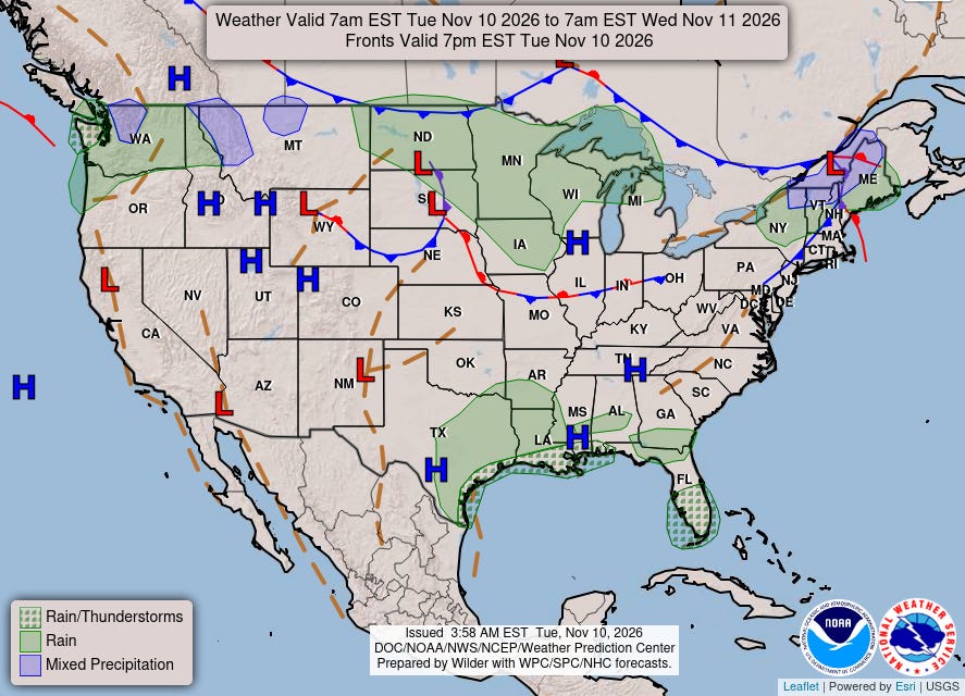
The weather today is about as quiet as one could expect at this time of year, and I have been writing about a lot of weather issues in recent days — so I am going to take advantage of the relative calm to stick with a short newsletter today.
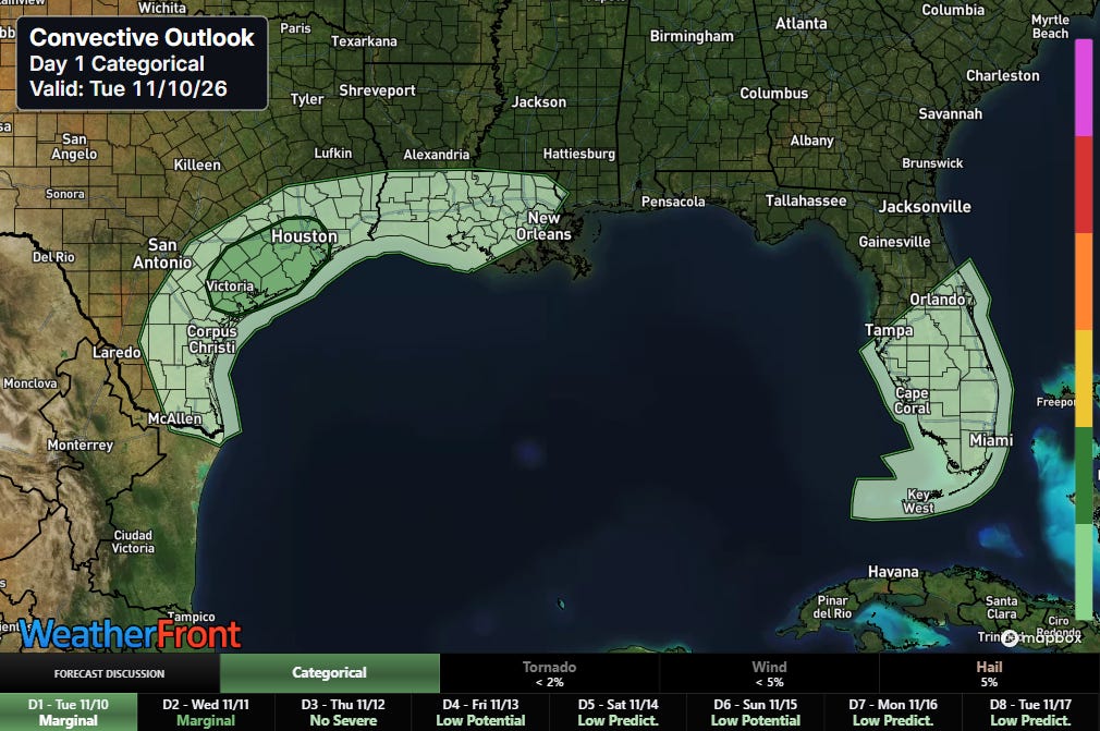
There is a marginal (level 1 of 5) risk for a few severe thunderstorms today along the southeast Texas coast — hail is expected to be the primary risk with these storms.
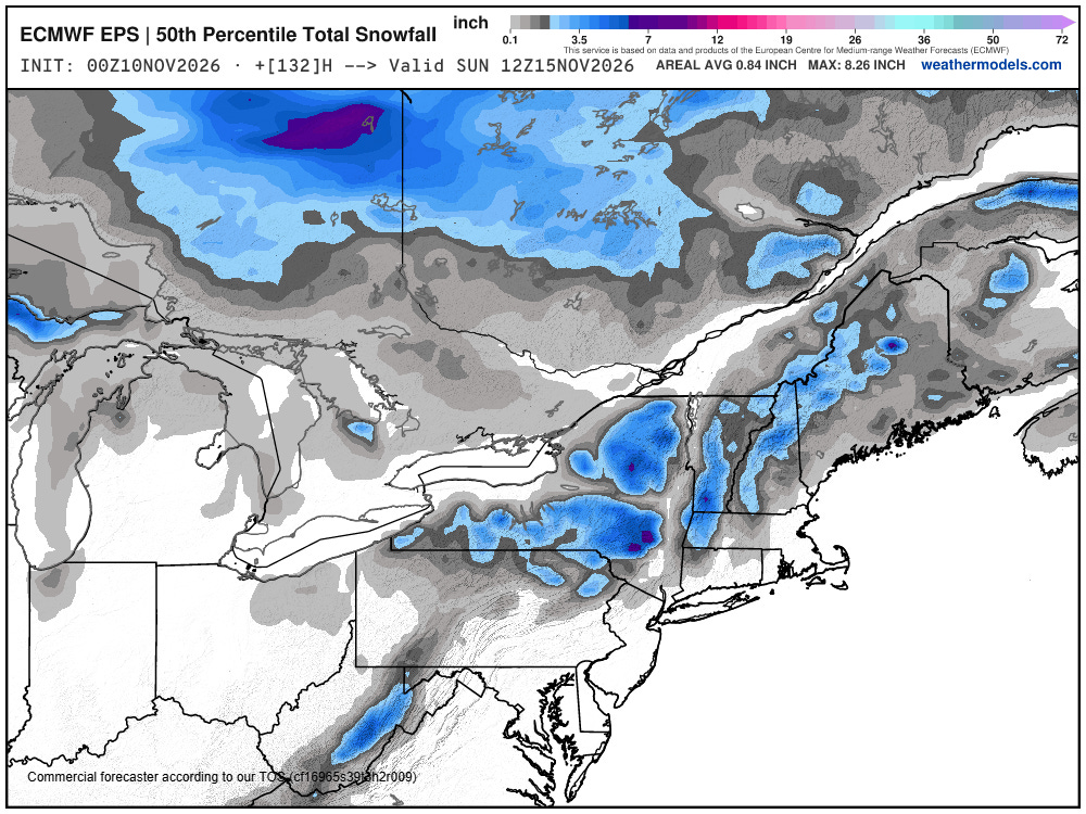
A storm system is still anticipated to impact the northeast quarter of later this week, but it still look as if accumulating snow will be relatively light and mainly at higher elevations and in lake effect regions.
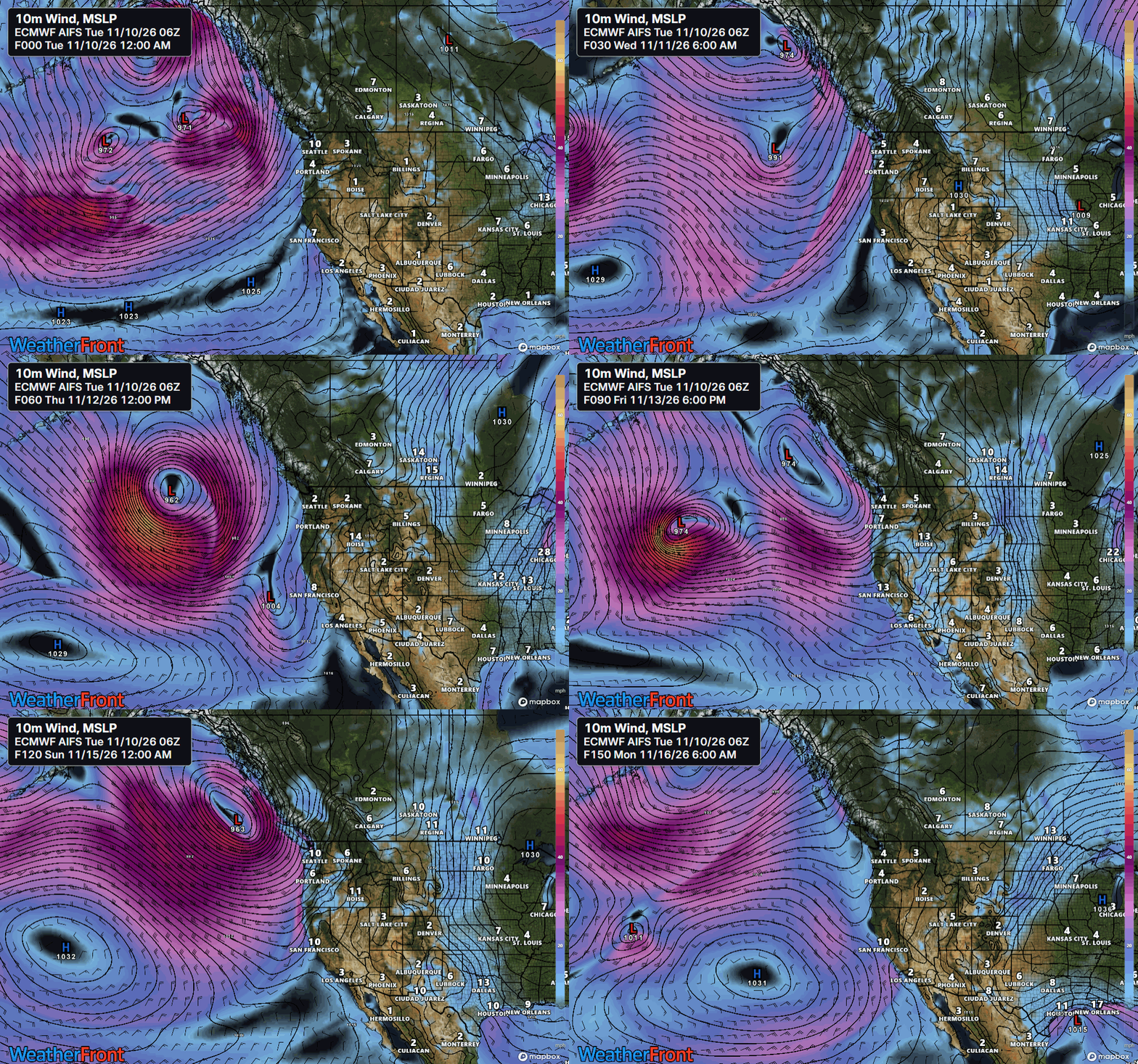
The next significant impact weather for the CONUS looks to come later this week as the active storm track which has been bringing strong winds and heavy precipitation to southeast Alaska, British Columbia and parts of the Pacific Northwest shifts south and begins to bring heavier precipitation, strong winds, and high waves farther south along the West Coast.
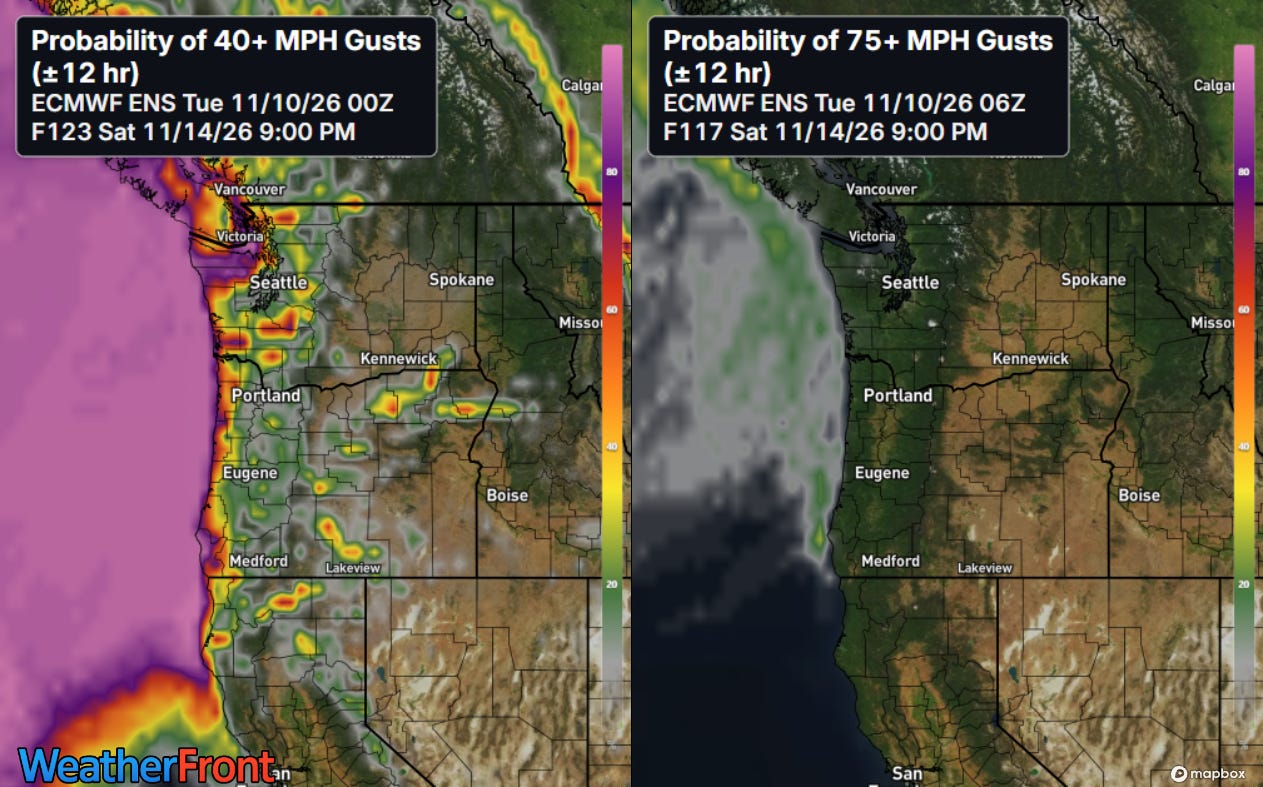
The storm system that impact tshould he coast on Saturday looks as it if will be the most intense as far as wind and wave potential. Depending on the exact intensity and track of the system — which still has a fair amount of uncertainty — large waves and coastal flooding could be an issue, particularly given the unusually high water levels due to anomalously warm waters along the West Coast. San Francisco Chronicle meteorologist Anthony Edwards has an excellent overview of this potential here (gift article).


Leave a Reply