
Risks of severe weather and flash flooding today in Philly/NYC
4 minutes ago
There has been a lot of media coverage across the Northern Hemisphere in recent weeks about a potential breakdown in the hemispheric polar vortex. Today marks a key day in that process as data shows that the vortex has “officially” broken down.
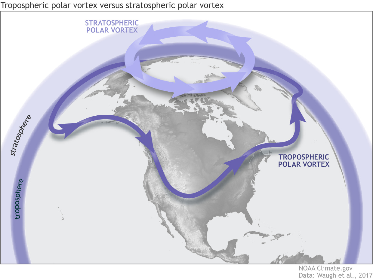
The term “polar vortex” has gotten an increasing amount of media use in recent years. Unfortunately, there is a polar vortex in both the troposphere — the lower part of the atmosphere up to about 10 km AGL — and the stratosphere — the next layer of the atmosphere from about 10 km AGL to 50 km AGL. While there is some interplay between these two polar vortices, they are not the same and it is not always made clear which one is being discussed in stories about the polar vortex.
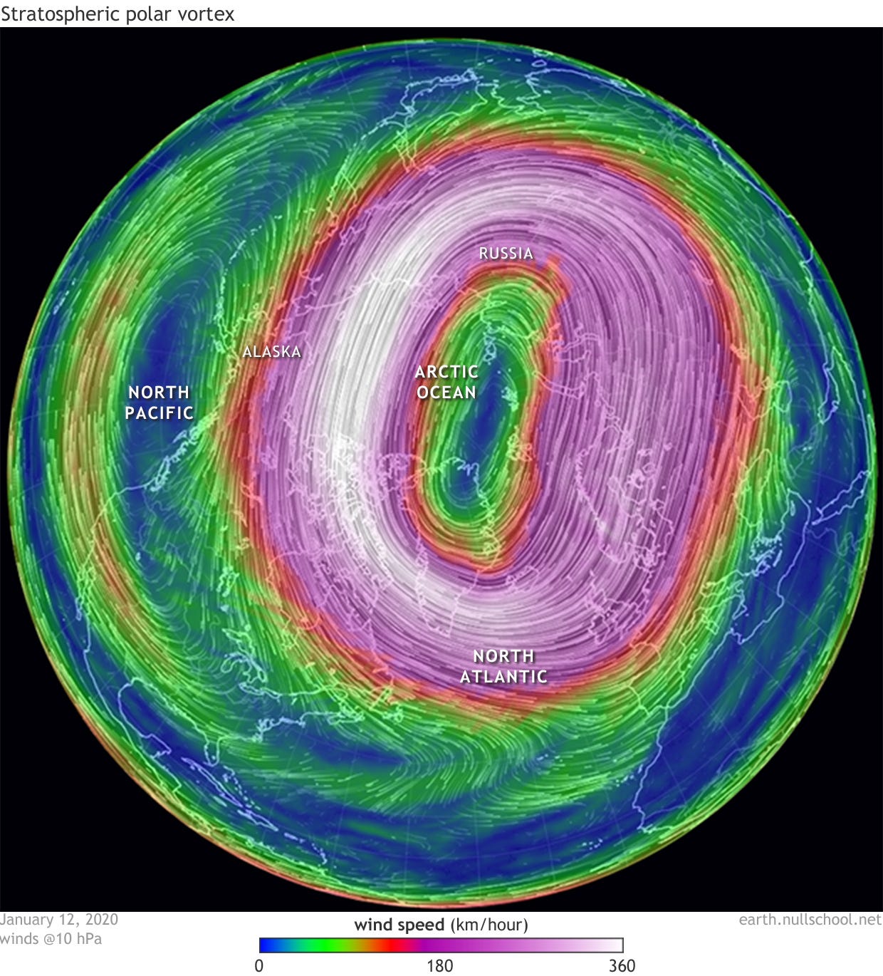
When meteorologists talk about a polar vortex breakdown or collapse, they are typically talking about the stratospheric polar vortex. This vortex is analyzed by looking at a 10 millibar (about 100,000 ft AGL) weather chart. Most of the time this chart shows a very strong cyclone centered over the North Pole with strong winds rotating counter-clockwise around it, i.e., the polar vortex.
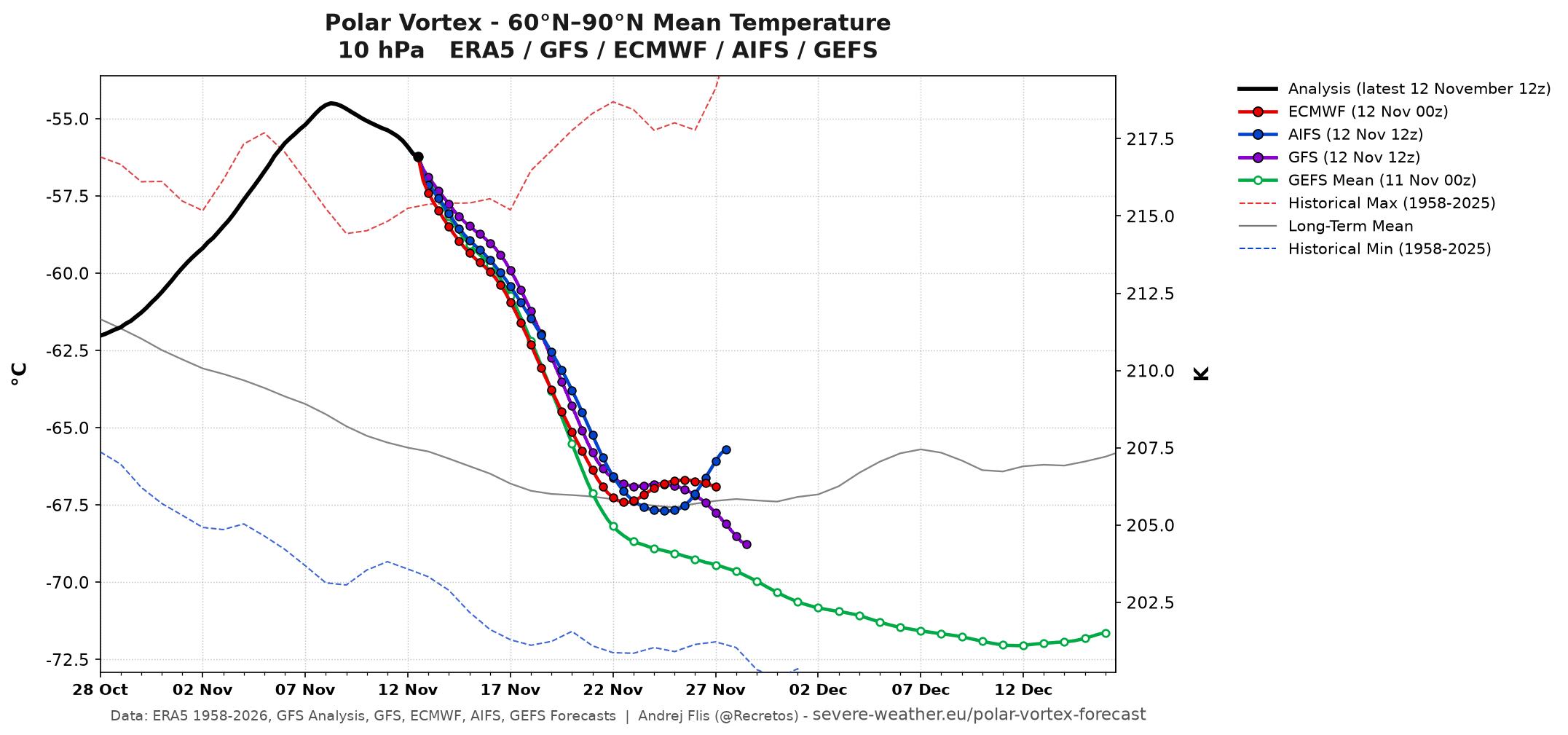
Occasionally, though, the incredibly cold air at the center of this cyclone can be disrupted by what is known as a sudden stratospheric warming (SSW) event. When this happens, the buildup of warmer air causes a disruption or split in the vortex in which the intense cyclone is no longer centered over the North Pole. Over the last two weeks, 10 mb data over the pole shows that a significant warming has taken place, with temperatures peaking about 8C warmer — and, notably, at the highest level ever observed for this time of year.
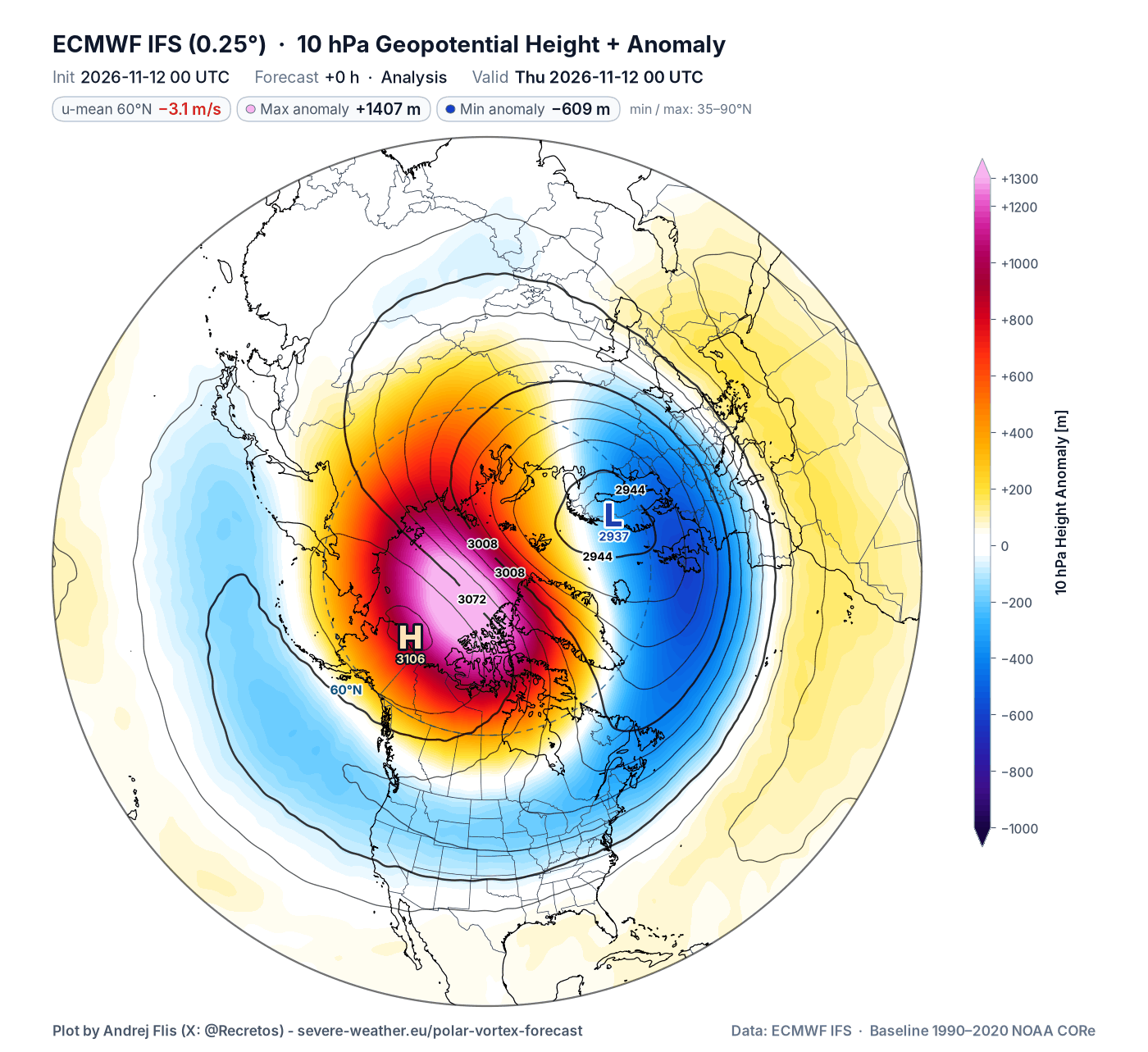
This SSW event has forced a weakened vortex off the pole, pushed toward northern Europe.
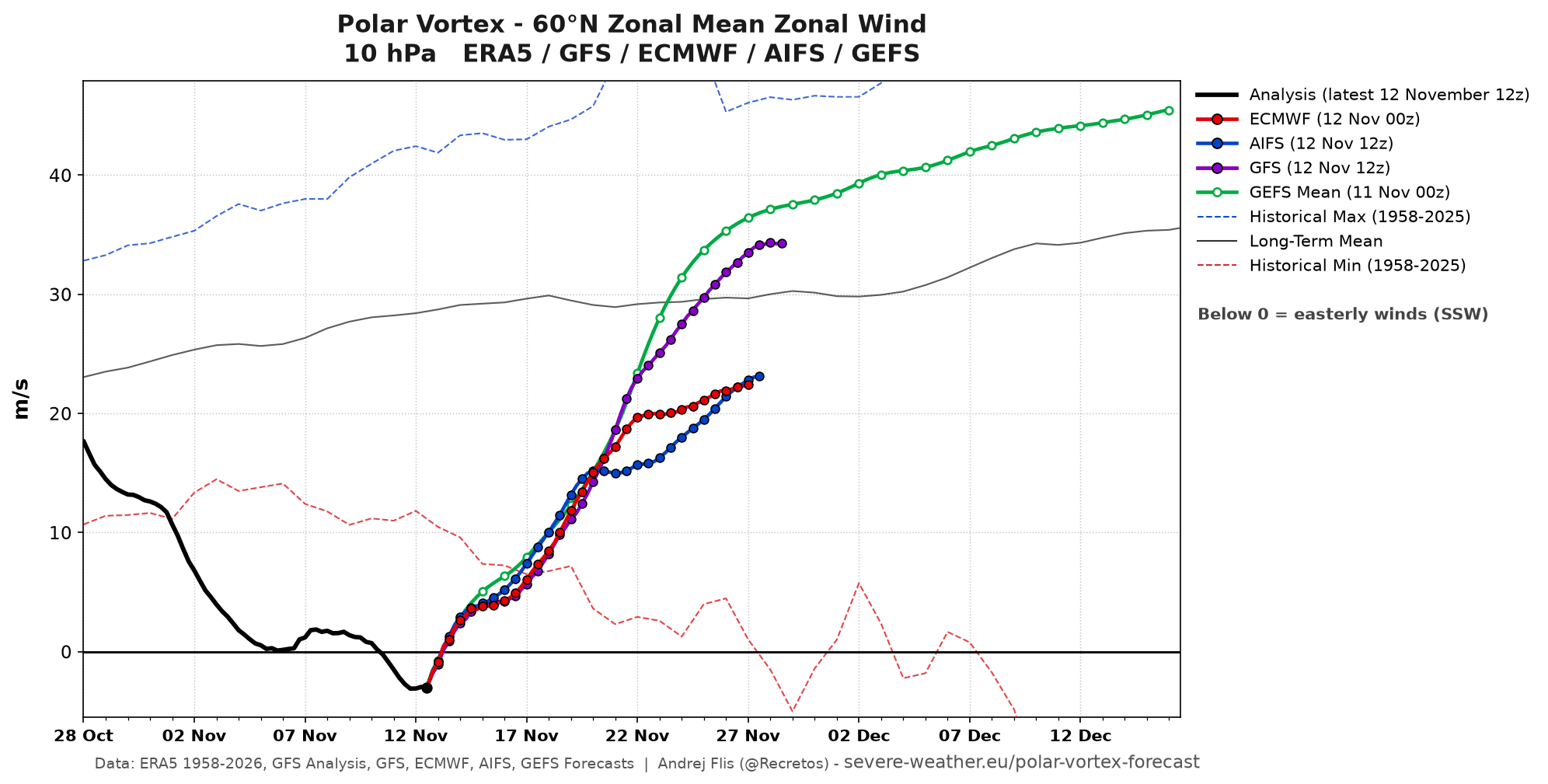
Instead of the typical strong high latitude westerly winds at 10 mb, today’s data shows that winds are now actually weak and easterly when averaged over 60N latitude across the hemisphere. This reversal in wind from westerly to easterly is the classic definition of a SSW and polar vortex breakdown — and as hinted by the record warm temperatures at 10 mb, this is the earliest we have seen this occur by about three weeks.

Obviously, we are not going up to 100,000 feet AGL anytime soon (well, at least most of us are not). The reason why we are concerned about this meteorological event in the stratosphere is because of that interplay between the stratospheric polar vortex and the tropospheric polar vortex I mentioned earlier. The breakdown of the stratospheric polar vortex often results in a disruption of the tropospheric polar vortex, which enables colder, arctic air to be forced south into lower latitudes.
That disruption and plunge of arctic air in the troposphere typically lags the actual SSW event by a few weeks and is typically centered on a particular region (e.g., the Eastern United States or Europe). It is often difficult for models to anticipate exactly when and where this cold air outbreak will occur — so meteorologists can only really alert people generally about the stratospheric polar vortex disruption and then closely monitor longer range model forecasts for signs of a potential arctic outbreak.
Making things even more challenging this time is that this is the earliest such an event has occurred, and the arctic air that has typically built up to be tapped by an event like this is not yet in place. Hence, the actual tangible impacts on lower latitude weather are even greater than normal. Needless to say, I will be keeping a close eye on things in the coming days and updating accordingly.
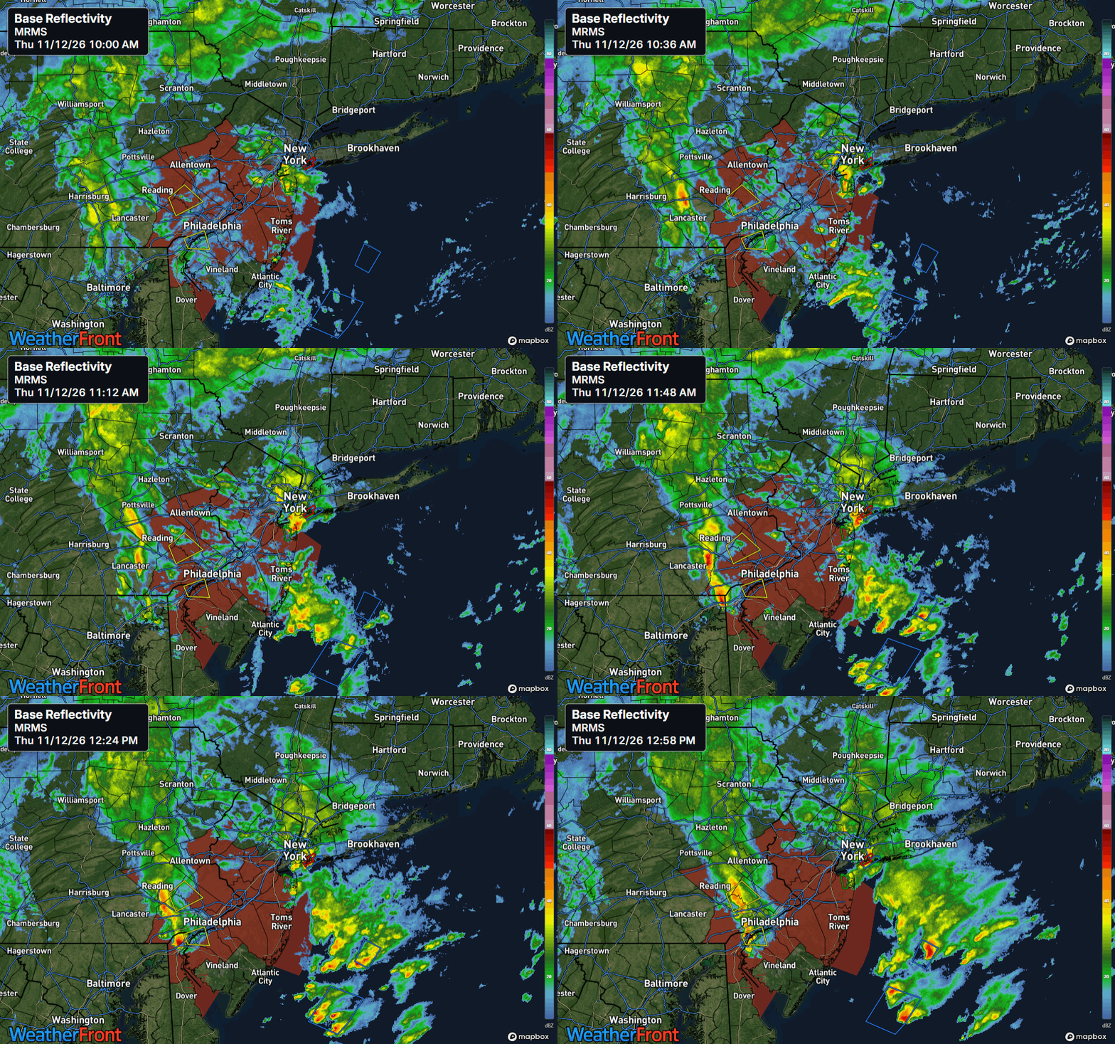
The main impact weather focus today is in the I-95 corridor from Philly to NYC. The storm system we have been discussing for this region is combining with unseasonable warmth and moisture to result in unusual November thunderstorms, including a risk for some severe weather. A tornado watch is in effect for the Philadelphia metro area across New Jersey.
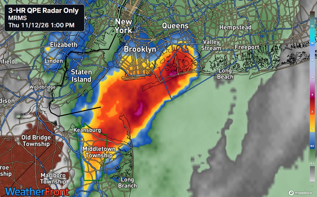
Some isolated flash flooding will also be a concern, particularly in urban areas. In fact, training thunderstorms have already brought very heavy rainfall over the last few hours to portions of the NYC metro area. A flash flood warning is in effect over parts of northern New Jersey, and rainfall amounts of up to 5” in the last 3 hours per radar is likely causing flash flooding in The Rockaways and areas around JFK airport.
Programming note: I will be busy tomorrow attending the retirement function of a great longtime colleague, so there will likely not be a Friday newsletter. Look for a new post over the weekend.


Leave a Reply