
Active weather pattern looks pretty locked in for region next couple of weeks
1 minute ago
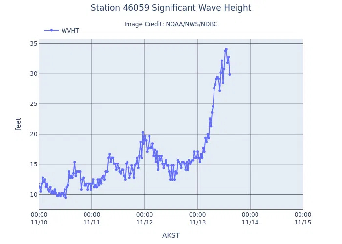
The storm system we discussed earlier this week impacted California the last 36 hours, bringing heavy precipitation and strong winds, as well as impactful high surf and coastal flooding. An offshore buoy about 350 miles west of San Francisco measured wave heights of 34.1 feet Friday evening, and these high waves impacted the coast of northern and central California on Saturday
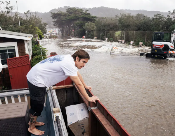
Coastal communities saw inundated streets and water impacting homes and buildings as the huge waves pushed water inland. Videos from the San Francisco Chronicle show people who ventured near the beach to watch the surf being overwhelmed as particularly large “sneaker” waves overwhelmed sea walls (by the way, such sightseeing is dangerous when high surf warnings are in effect — definitely not recommended).
Heavy rain (and mountain snow) will continue along the West Coast mainly from the Bay Area north into tonight. By Tuesday a new intense storm system will approach the coast, bringing a new round of heavy surf to northern and central California for the middle of the week as shown in this BlueSky post from SF Chronicle meteorologist Anthony Edwards (who is an incredible follow for western US weather).
Signs are pointing toward an active weather pattern continuing along the West Coast into Thanksgiving week, when another period of unusually high tides due to astronomical tides and elevated water levels due to El Nino is expected. Given the impactful coastal flooding that has already occurred from prior situation when there was not significant weather on top of the tides, this is something we will be watching very closely.


Leave a Reply