
In this week’s weather, El Nino continues to dominate
16 minutes ago
I want to start off this week by acknowledging the passing of a tremendous contributor to the weather community. Nolan Doesken, the retired long-time Colorado state climatologist, passed away over the weekend after dealing for several years with Parkinson’s Disease. He was 74 years old.
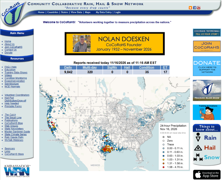
Nolan was a fixture in Colorado’s weather and climate scene, but what he was most known for nationally was founding the Community Collaborative Rain, Hail and Snow Network, better recognized by its acronym CoCoRaHS. CoCoRaHS is a network of more than 25,000 citizen volunteer weather observers outfitted with standard rain gauges who report precipitation measurements and observations of extreme or unusual weather every day.
CoCoRaHs started as a local effort in the Fort Collins, CO area where Nolan was based at Colorado State University. After a massive and deadly flash flood impacted Fort Collins in July 1997 with limited warning, Nolan saw a need for a denser network of rainfall observations to help improve flood forecasts and warnings. He obtained a small grant from the Colorado Office of Emergency Management to engage high school students in the area to help recruit volunteers to measure and report rainfall — the project was called the “Colorado Collaborative Rain and Hail Study” (CoCoRaHS).
I can remember seeing Nolan present about CoCoRaHS at meetings of the National Weather Association in the early days of the project, and his passion for it was obvious and infectious. Of course, the need for denser ground truth precipitation reporting was not unique to Colorado. As explained on the CoCoRaHS website, other scientists at Colorado State University helped develop funding requests to the National Science Foundation and NOAA to expand the network — first regionally, and then nationally — over the next decade.
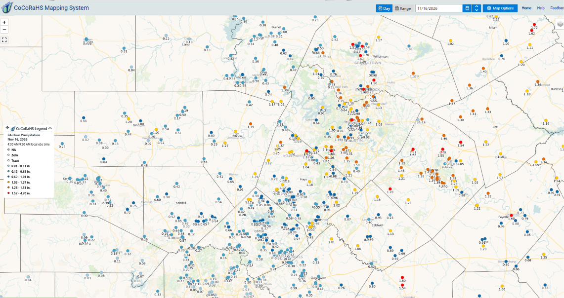
Nearly 30 years after it started, CoCoRaHS has become a relied upon fixture in operational and research meteorology. This map of 24 hour CoCoRaHS rainfall reports from the Austin-San Antonio area this morning shows the incredibly dense network of rainfall reports that we can now use in real-time to help validate radar rainfall estimates and significantly improve river forecasts and flood warnings.
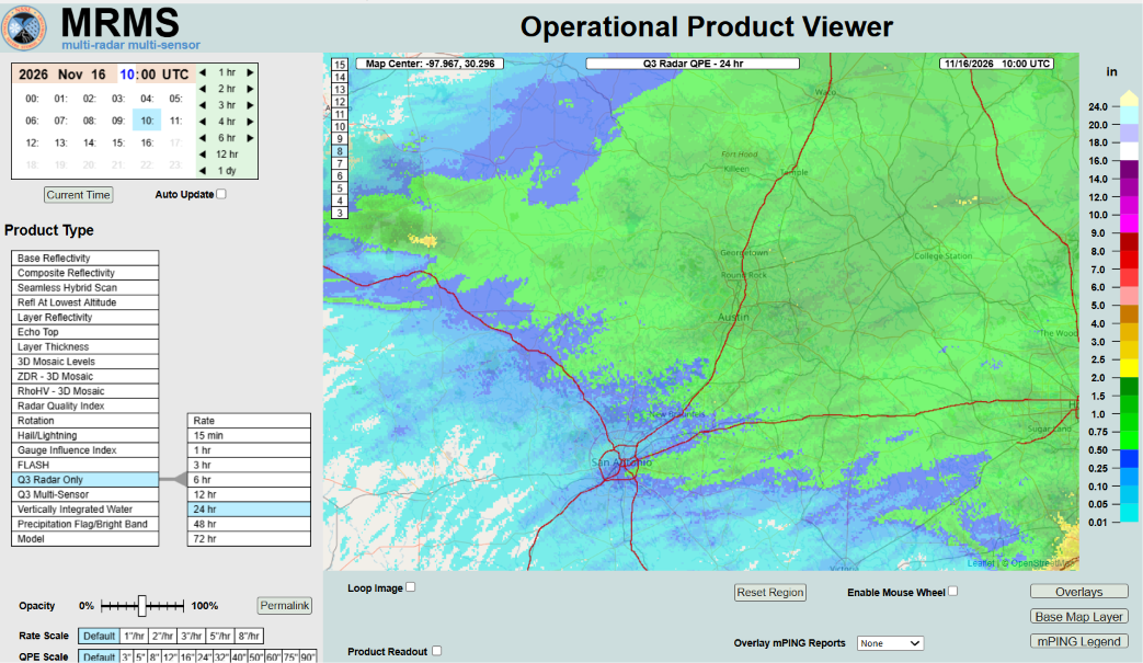
CoCoRaHS has also helped improve the radar rainfall estimates themselves, by providing research scientists with ground truth data to help validate new techniques of estimating rainfall using radar data. I know from my time at the National Severe Storms Lab what an important role CoCoRaHS data played in projects such as developing the techniques that leverage dual-polarization radar data to produce accurate real-time estimates of rainfall in the Multi-radar Multi-sensor System (MRMS) that is foundational to NWS flood forecasts and warnings.
Nolan had a distinguished career in climate and weather outside of being the founder of CoCoRaHS, including co-developing the Standardized Precipitation Index which is “one of the most commonly used metrics worldwide for assessing drought severity.” His incredible influence across our community is to me an enduring example of the many meteorologists and climatologists who have a deep passion for our glorious atmosphere, and use that passion to further our science to help humanity. Dr. Russ Schumacher, the current Colorado state climatologist, shared this quote from Nolan:
Each year the general cycle is the same — driven by the calendar and the position of the sun. But the details are always different — the dry years, the early snowmelts, the wet years, the big spring surprises. And every year I have had the honor of tracking and reporting the conditions and the results – like the scorekeeper in the biggest game of the year. What could be more fun than that?
Myself and so many of my colleagues can resonate deeply with this sentiment. RIP Nolan, and thank you for everything you did for our science and community over the years — the tributes pouring in show how much you contributed, and how much you will be missed.
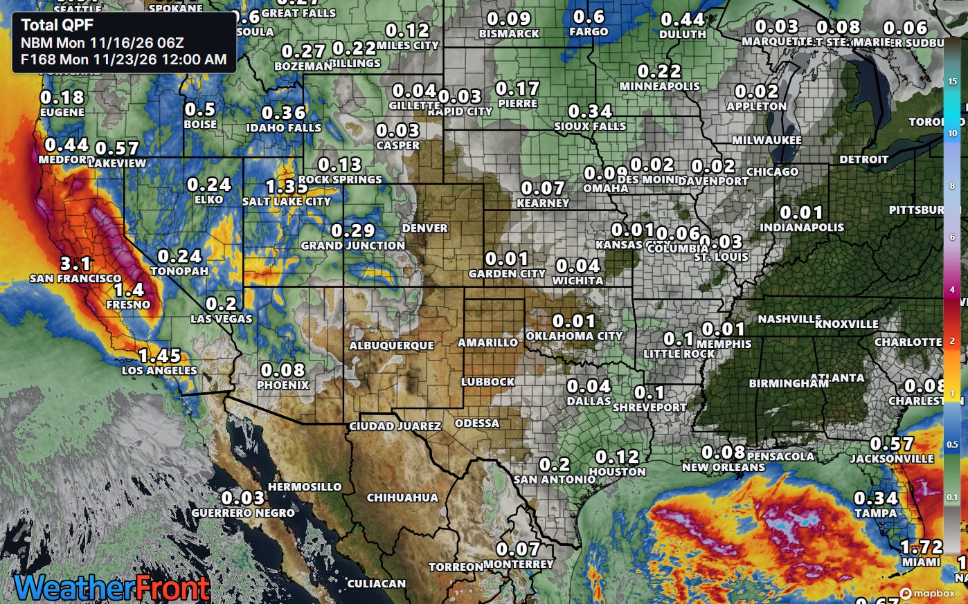
The atmosphere this week is going to continue its evolving trend toward a typical El Nino winter pattern, with active weather in California and Florida. A series of storm systems will bring heavy rainfall (and high elevation of snowfall) to California this week with potential for flooding, particularly in coastal areas. Meanwhile, a strong and active subtropical jet stream will support the development of a low pressure center off the Florida East Coast, which will bring increasing heavy rainfall and potential flooding to that area by the middle to latter part of the week. These storm systems will also cause significant issues with high surf both on the US West Coast and Florida East Coast, and high surf advisories/warnings and rip current statements are in effect for areas along the coasts.
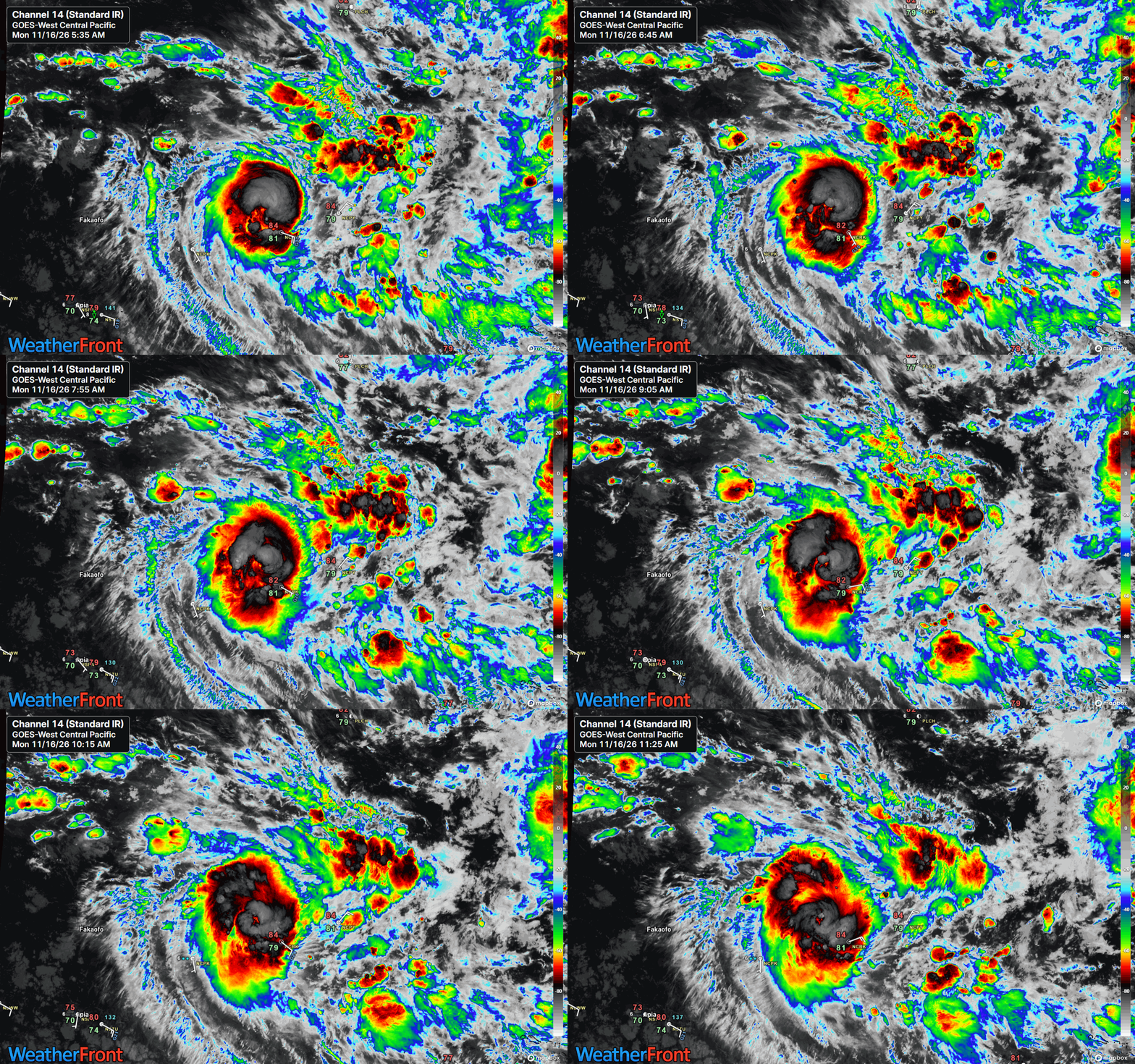
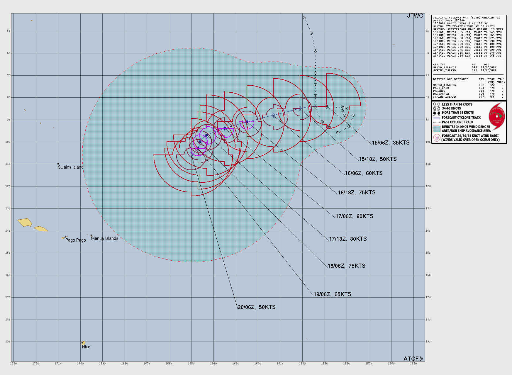
For the Monday tropical update, the main system of interest is Tropical Cyclone Xavier in the south central Pacific. Infrared satellite imagery this morning shows that Xavier is becoming better organized and is forecast by the Joint Typhoon Warning Center to approach the equivalent of a major hurricane on the Saffir-Simpson Hurricane Wind Scale (SSHWS) over the next few days as it moves slowly west and southwest. This system could eventually be of concern to some island regions of the South Pacific — and also could be a sign of a westerly wind burst that could provide another surge to the ongoing intense El Nino event.


Leave a Reply