
Low pressure system with some potential tropical characteristics could cause impacts farther up coast as well
4 minutes ago
I have been talking about this being a week where weather will be a particular issue on the coasts of the US — and I want to dive today into what is evolving along the East Coast as it has been trending even more interesting and potentially impactful in the last day or so.
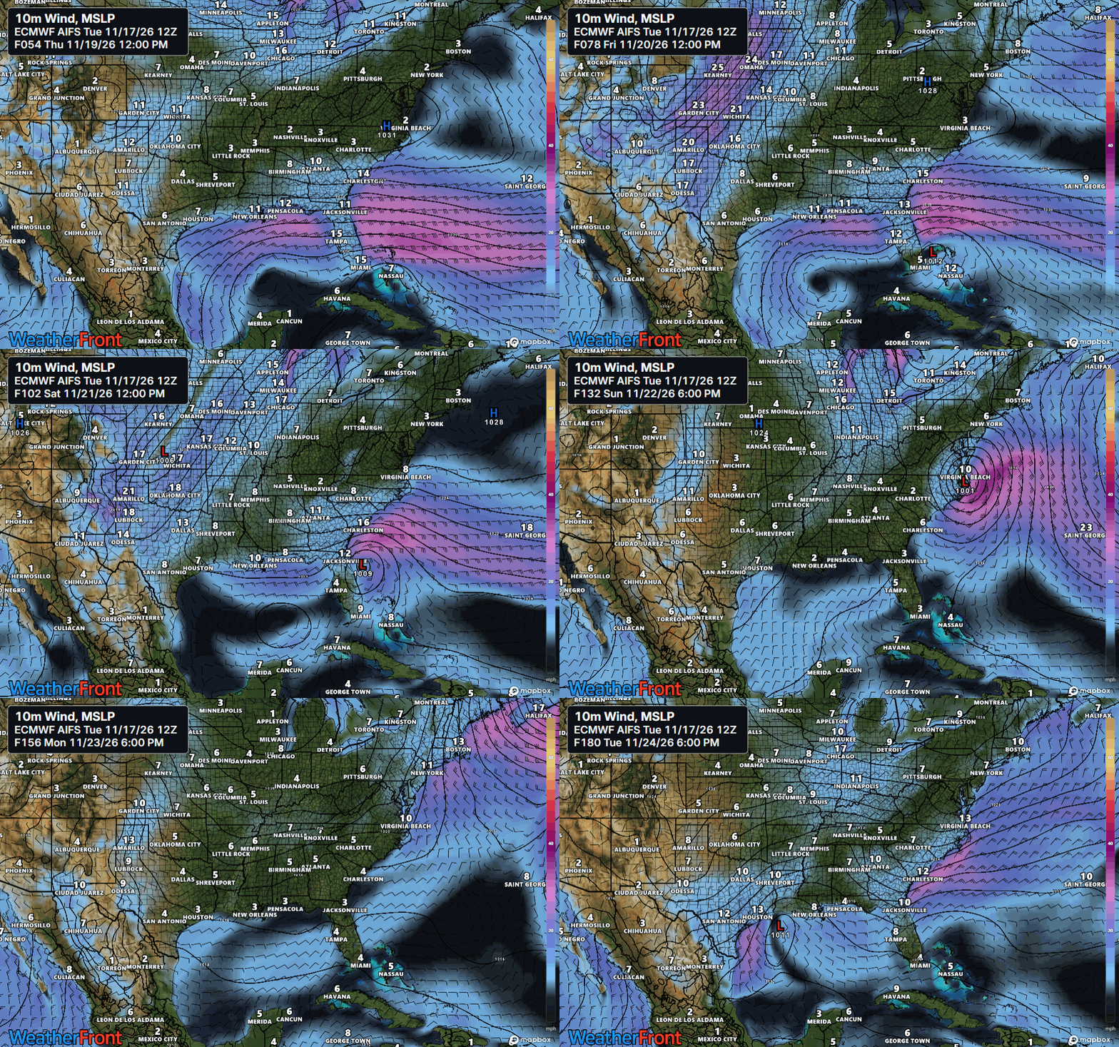
The models have been gradually focusing in on the scenario of a disturbance in the strong subtropical jet stream across the Gulf and Florida eventually spawning the development of a low pressure system somewhere in the vicinity of the Bahamas later this week and then moving north and northeast as it intensifies. The most recent run of the European AI model for Thursday through Tuesday is shown above — showing the low developing just east of Miami and then moving north along the coast while intensifying.
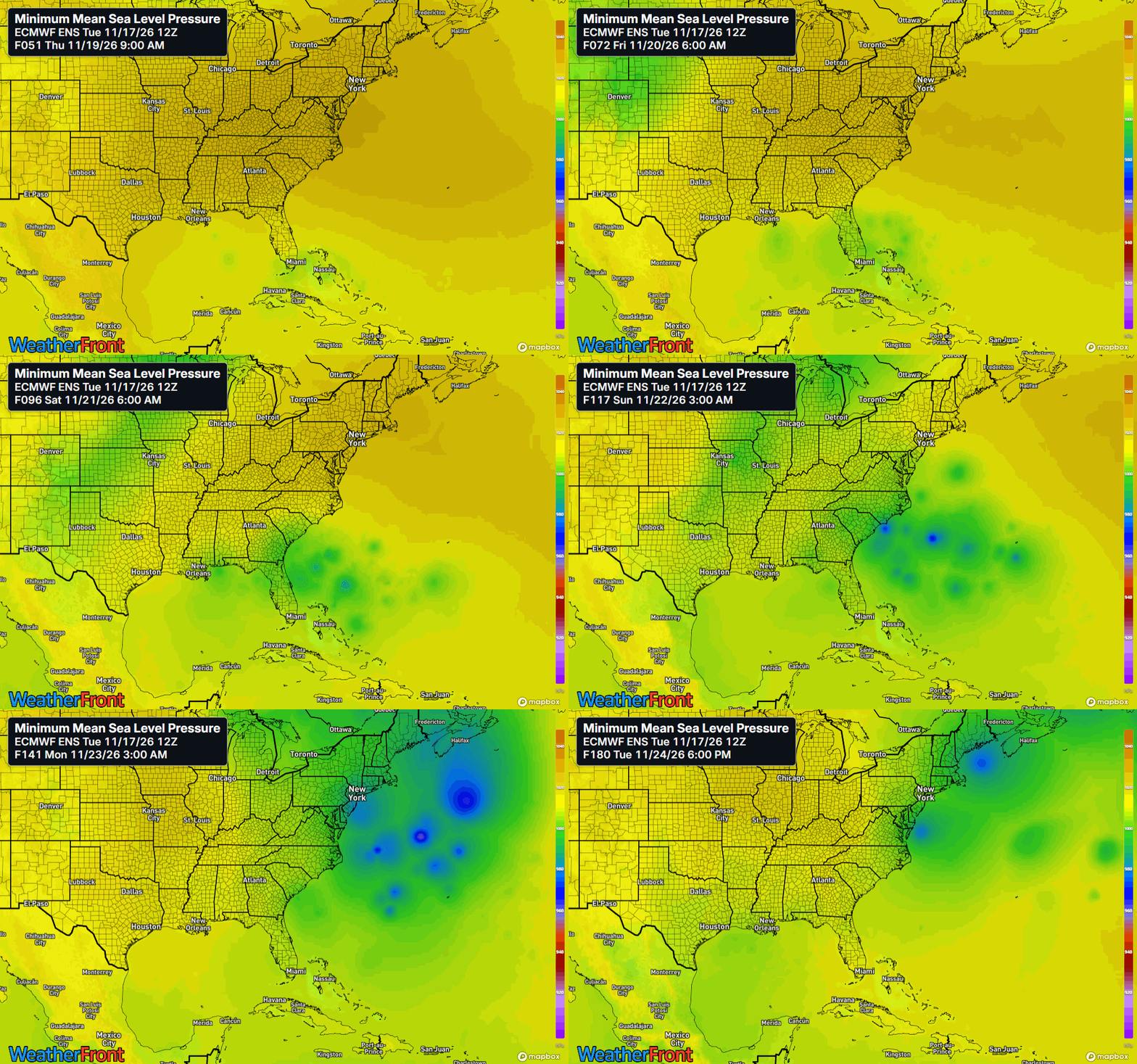
The Euro AI model was one of the first models to sniff out this system several days ago, and while it has been consistent with this general idea, it is a deterministic model and the details have varied in each 6 hourly run. If we look at a loop of lowest pressure from each of the members of the most recent European physics based ensemble, we can see there is quite a bit of spread in where the low develops, how close to the coast it tracks, and how intense it gets. So at this point there is still a fair amount of uncertainty as far as specific impacts.
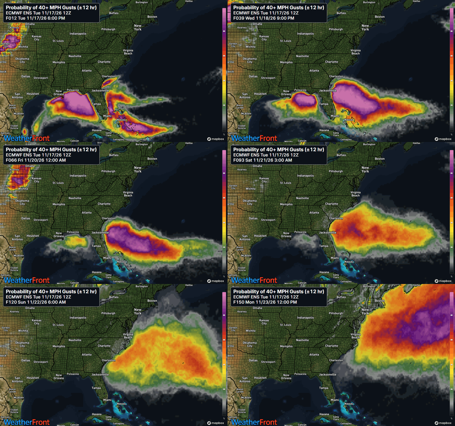
Having said that, the European ensemble probabilities of wind gusts greater than 40 mph shows that dangerous marine conditions and rough surf (including life-threatening rip currents) are very likely to develop across the northeast Gulf and along the Florida East Coast the next few days, and then spread north and northeast along the coast through the weekend into early next week — with increasing uncertainty with regard to timing and location.
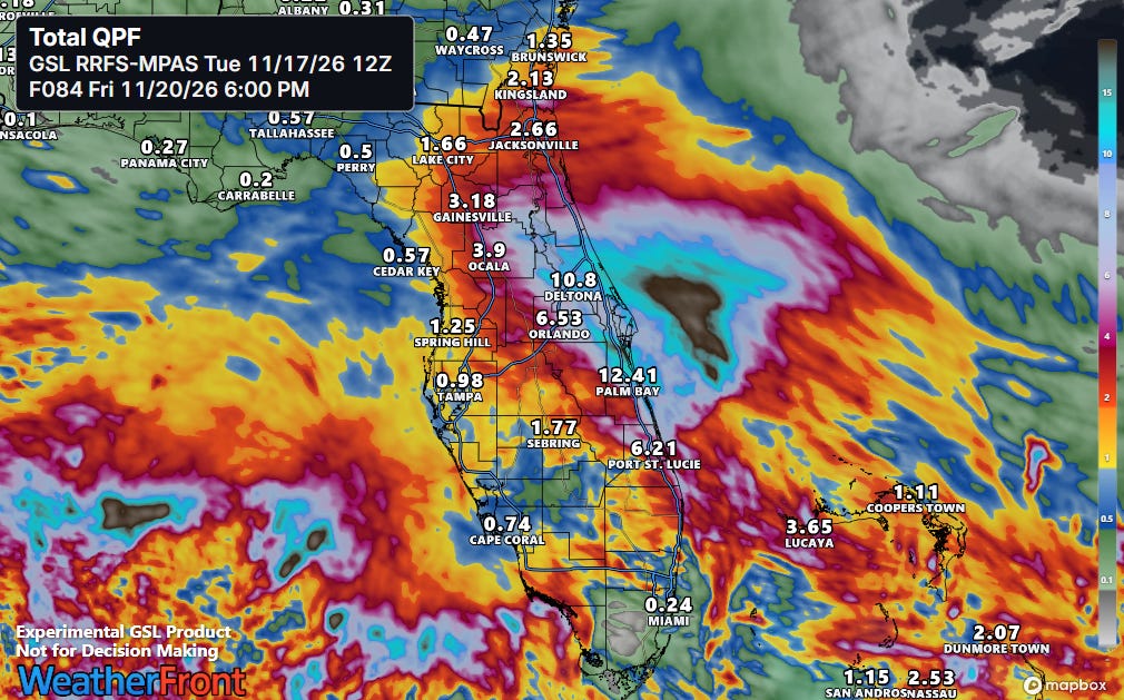
This scenario will yield strong onshore easterly flow across Florida and once again set the stage for training showers and storms with very heavy rainfall, particularly along the east coast of the peninsula. Heavy rainfall is already occurring across much of the peninsula today, and high resolution models are suggesting the potential for some spots to pick up more than 10” of rainfall over the next few days in a setup similar to what we saw a couple of weeks ago.
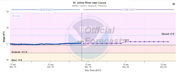
The St. Johns River near Cocoa is already at its third highest stage on record (back to 1950), and depending on how extreme additional rainfall gets, could threaten the record stage.
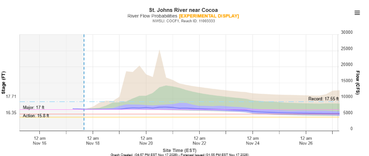
The NWS ensemble river forecast about a 20% chance of the river reaching the record flood stage by this weekend.
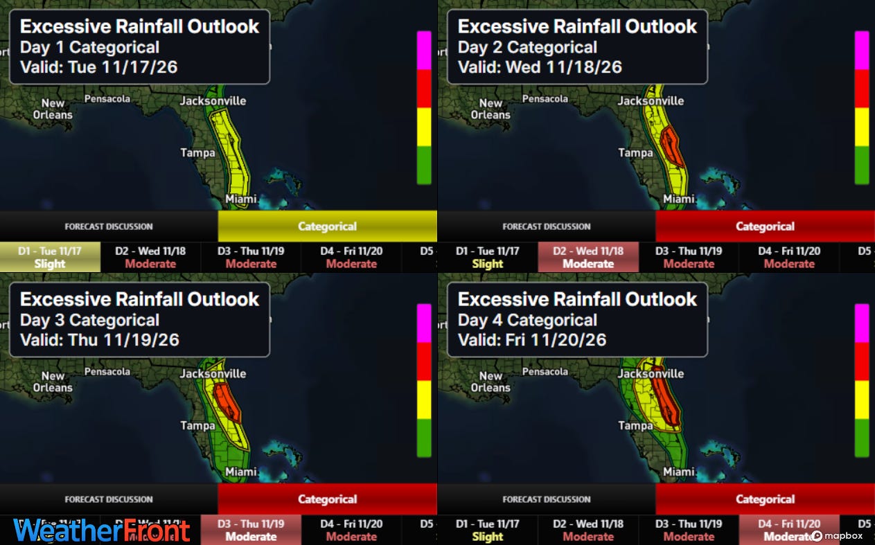
Other rivers in eastern Florida are high or in flood, and antecedent conditions are wet. Hence, this heavy rainfall will yield a multi-day period of significant flood risks for the region, with the Weather Prediction Center having a moderate (level 3 of 4) risk up somewhere along the coast each day Wednesday through Friday.
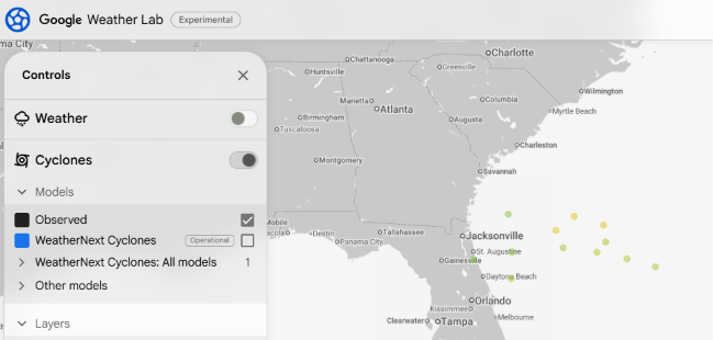
Sea surface temperatures off the east coast of Florida are still plenty warm to support tropical development, and the models are hinting that there is at least some possibility of this system having some tropical characteristics. About a quarter of the most recent version of the Google DeepMind tropical model show a system. The European ensemble above also has a handful of members showing low pressure centers intensifying to below 980 millibars while still south of the latitude of North Carolina — a scenario unlikely to occur without some sort of tropical development. While a tropical system is still a low probability scenario at this point, it is worth keeping an eye on given the envelope of model solutions.
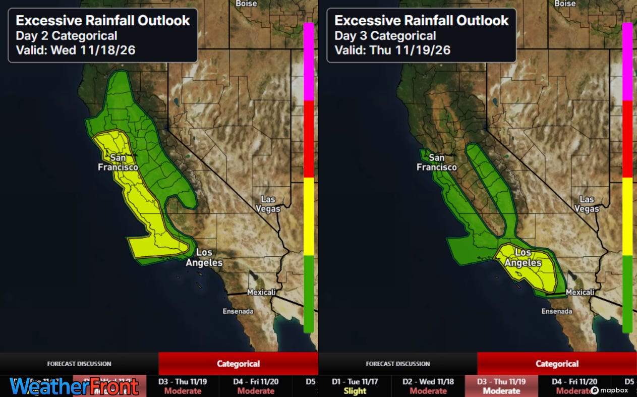
California is also going to be dealing with flash flood and coastal hazard threats the next couple of days as another storm system impacts the state.
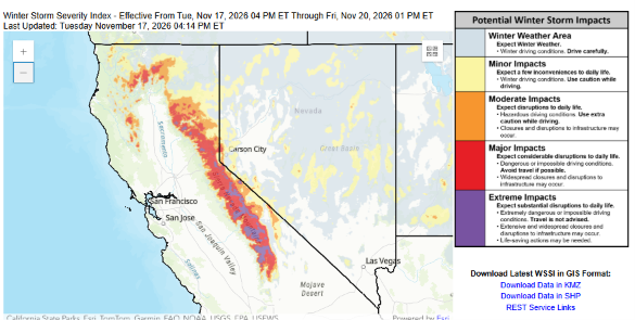
Prolonged very heavy snow will also be causing serious impacts at higher elevations of the Sierra Nevada through Friday. The weather pattern is expected to remain active along the West Coast through the weekend and into next week — with increasing coastal flooding impacts as astronomical high tides will peak again along with elevated water levels due to El Nino and abnormally warm sea surface temperatures.


Leave a Reply