Significant tornado risk in Arklatex region…increasing flash flood risks
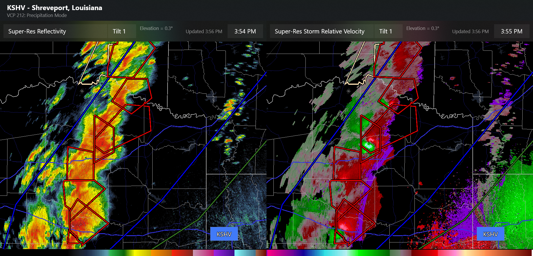
Hi everyone, we’ve got a rapidly evolving severe weather situation as several supercells have developed over northeast Texas. A couple of tornadoes have already been reported, and the environment looks very favorable for the next few hours in this area. Additional significant severe weather risk is in place and expected to increase into tonight northeast from this region through the lower Ohio Valley. Meanwhile, multiple areas are under an increasing flash flood risk this evening, including the St. Louis, Springfield, MO and Fort Smith areas.
I have a live Substack chat going, similar to NWSChat I will be posting updates about specific storms and how the various threats are evolving. Join at the link below, given that I am still learning how to use all this, it’s free today to all paid or free subscribers. If you join the chat, please let me know you’re on and feel free to share a location if you’d like to know more about the weather situation in your area.

Leave a reply to Balanced Weather Cancel reply