Increasing flash flood risk overnight and especially Friday/Friday night
Here is a quick update on severe weather and flash flooding for the next 24 to 36 hours.
Today was a quieter with regard to severe weather than yesterday. Several supercells did develop across parts of Arkansas and the mid-South, with additional severe storms in West Virginia. About 65 reports of severe weather were received by SPC, including several 2.5 to 3” hail reports from parts of Arkansas and Tennessee.
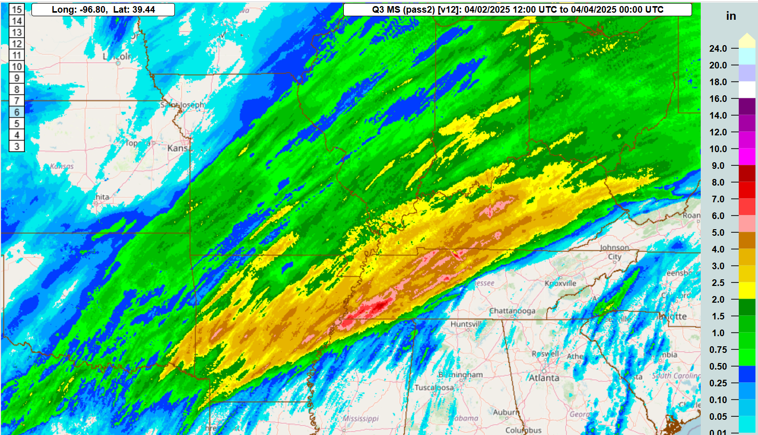
Along with severe weather along the Arkansas to West Virginia axis, heavy rain and flash flooding has been an increasing issue over the last 24 hours. MRMS 36 hour rainfall ending at 7 pm this evening now has a wide swath of 2+ inches in this area, but focused areas of 4 to 7 inches from the Memphis metro area northeast across the Nashville metro and into parts of Kentucky. A number of incidents of flash flooding have already occurred in this region.
A loop of MRMS rainfall rates this evening shows a trend toward increasing training of higher rainfall rates from northeast Arkansas through the Ohio Valley including the Louisville metro area.
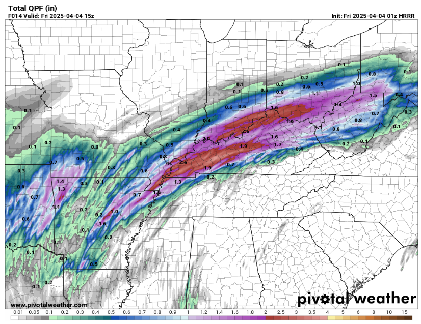
The latest high resolution HRRR model shows that this region will be the most vulnerable to heavy rainfall overnight, with swaths of 2 to 4 inches likely to cause additional flash flood issues.
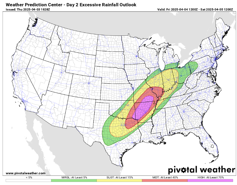
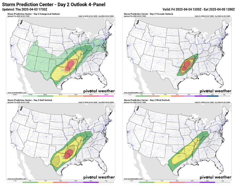
The latest day 2 excessive rainfall and severe weather outlooks are really targeting the region from the Arklatex across much of western and central Arkansas and into southeast Missouri for severe weather and flash flooding Friday into Friday night as the atmosphere will support multiple waves of intense storms capable of producing torrential rain, large hail and potentially strong tornadoes.
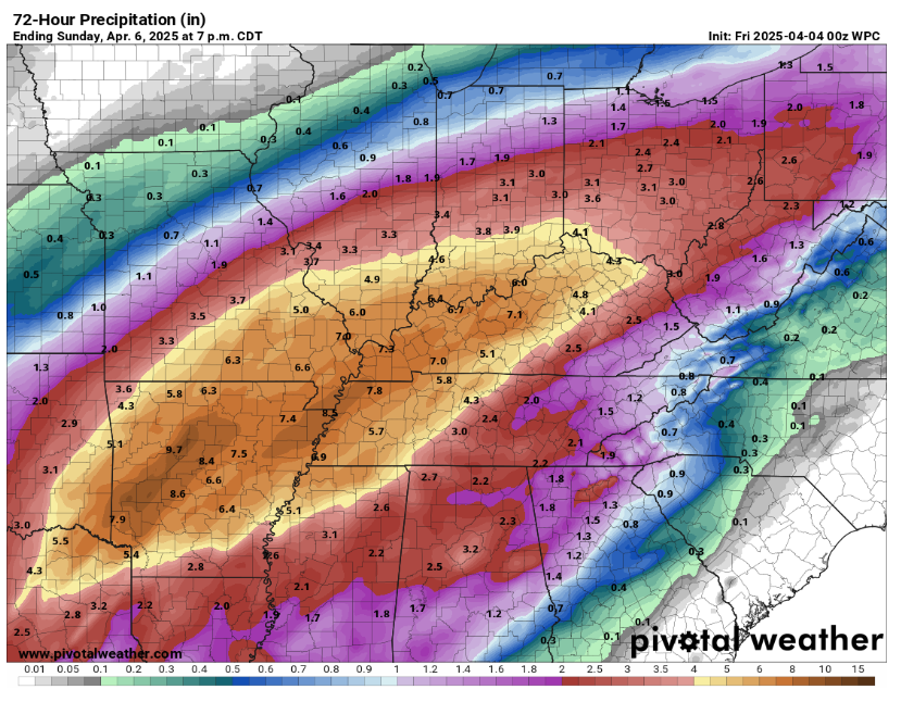
The latest rainfall forecast from the NWS Weather Prediction Center shows a large region receiving more than 4” of additional rain over the next 72 hours, with a wide axis of 5-10” from the Arklatex up the Ohio River. Evening high resolution models certainly suggest that there will be more localized bands of heavier amounts of 10-15” within this area. Given the antecedent rainfall and already moist soil conditions, these sorts of rainfall totals would cause potentially catastrophic flash flooding as well as widespread major river flooding.
I will have a more detailed, full newsletter update in the morning, along with planning frequent updates Friday into Friday night.

Leave a comment