Active severe weather pattern continues into the weekend
Welcome to Friday and almost the weekend. Lots going on with the weather to talk about. A big story with severe weather yesterday was an intense supercell that moved through the area around and to the west of Lubbock, TX. The storm started in extreme eastern New Mexico and produced tornadoes shortly before 4 pm local time.

Northwest of Morton, TX the storm intensified further with radar showing very strong rotation, and a large wedge tornado was viewed by a number of storm chasers.
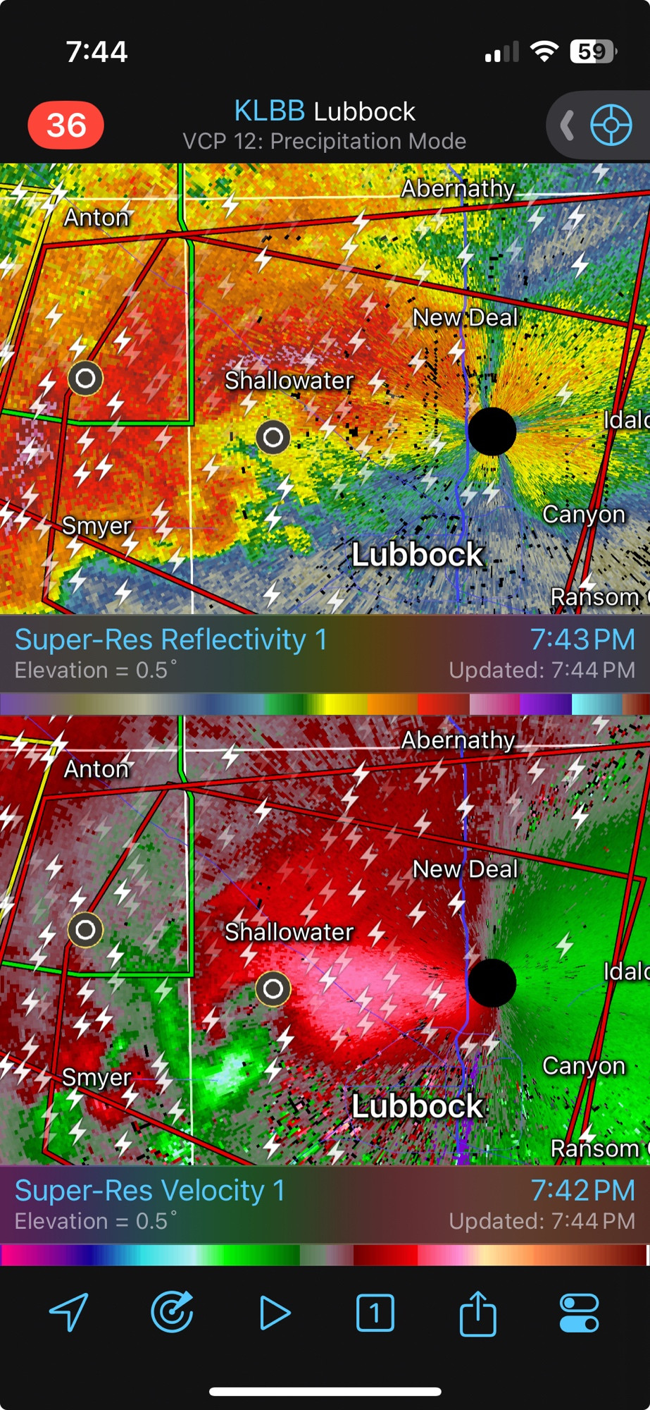
The storm remained intense as it moved toward the western parts of the Lubbock area, with multiple tornadoes again reported in eastern Hockley and western Lubbock tornadoes near Reese Center with structural damage and at least one injury.
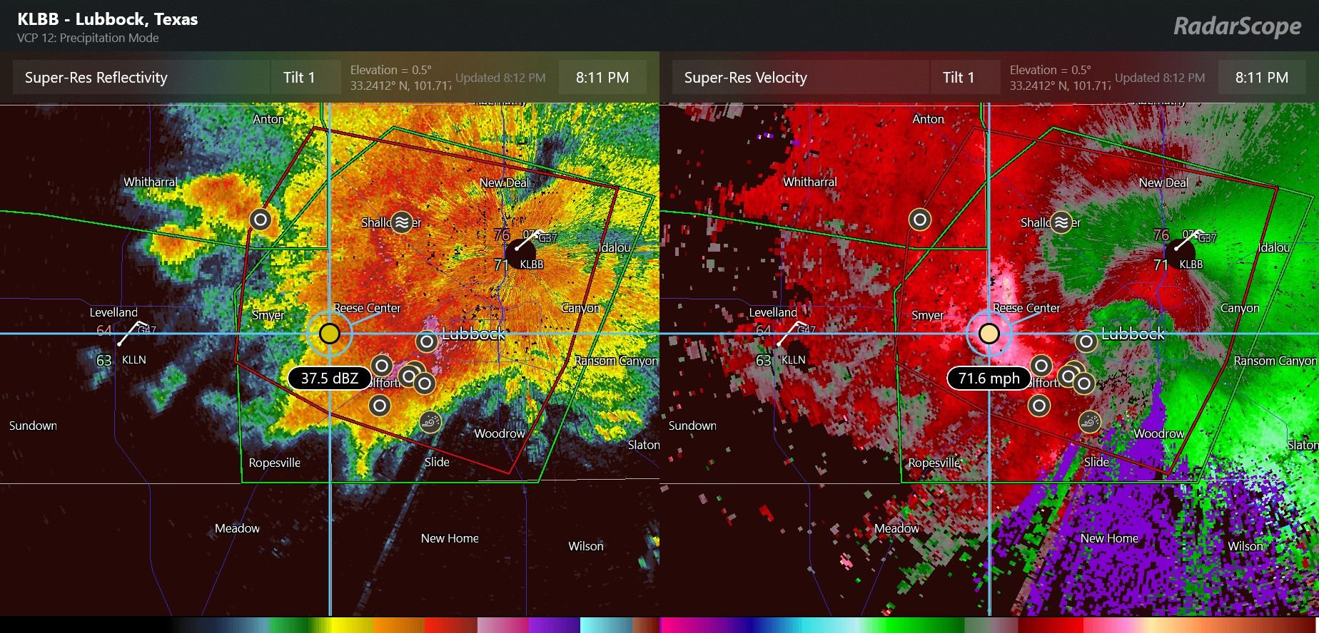
As the storm slowly moved east it evolved into even more of a “high-precipitation supercell” in which the rotation with the storm was embedded within torrential rain and very large hail. Interestingly, very strong winds easterly winds developed on the back edge of the storm (I realized in doing this post I looked at the radar data wrong when I posted on BlueSky about it last night), with the radar showing a rather large area of greater than 70 mph winds. A number of reports of golf ball to tennis ball sized hail were received from the Lubbock area, making this the third time in last ten days that a Texas metro area was hit with very large hail (Austin and Fort Worth being the others).
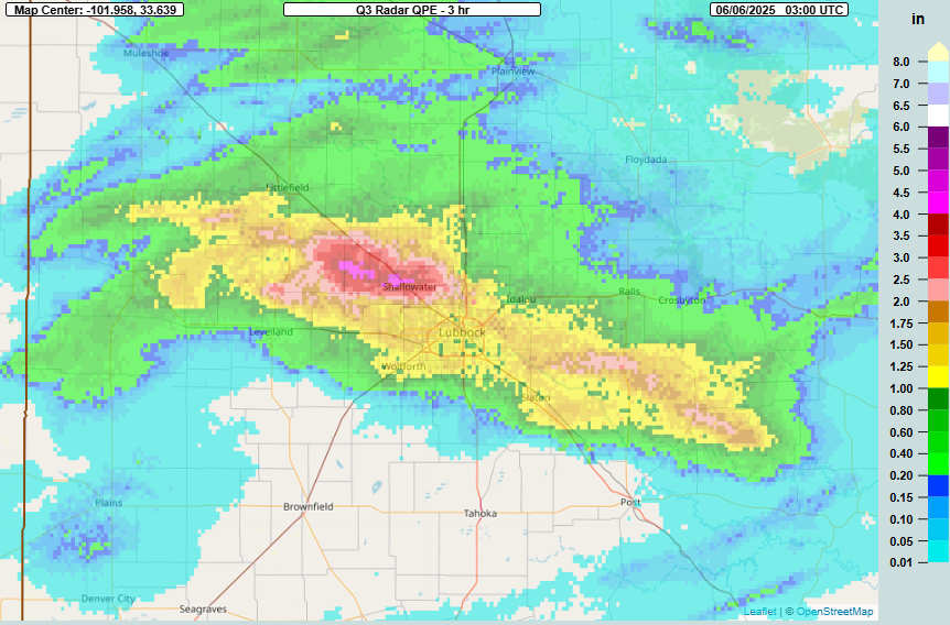
As their name implies, high-precipitation supercells can produce extremely heavy rain, and this slow moving storm produced as much as 4-5” of rain in a short period of time. Flash flooding was reported along the path of the storm.
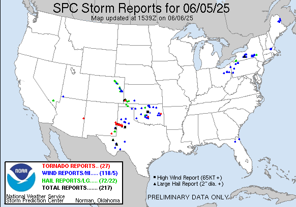
It was an active day overall in the Central and Southern Plains with nearly 200 reports of severe weather. Somewhat surprisingly, it also ended up being pretty active as far as severe weather in the eastern Great Lakes and upstate New York, as a couple of clusters of severe storms during the afternoon produced a number of reports of damaging winds and large hail, including rather unusual very large hail occurrences in central New York state with up to 3” diameter hail reported.
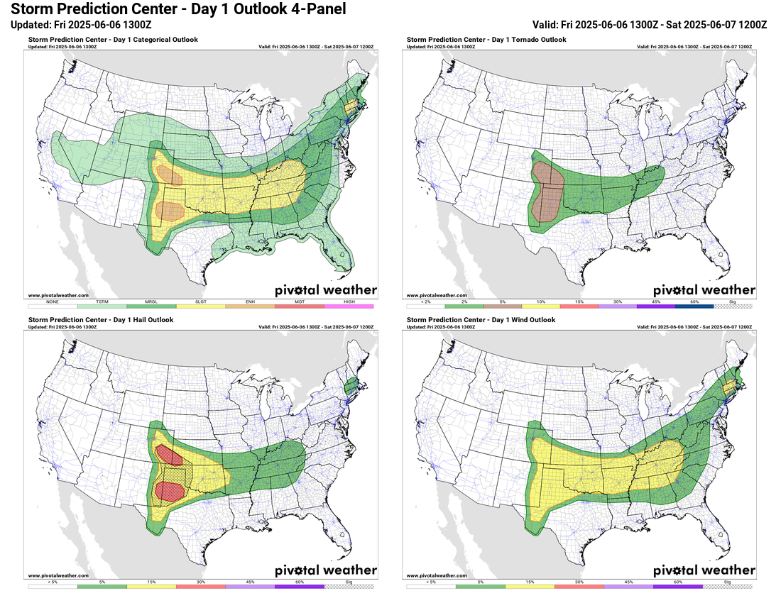
Today looks to be another busy day in the Central and Southern Plains as intense supercells should develop in the High Plains with very large hail and tornadoes possible with the most intense storms. These storms should evolve into a couple of complexes of severe storms that will move east this evening and overnight. Meanwhile, clusters of storms that started from yesterday’s activity have now moved east into the region from the lower Ohio Valley west and southwest into the Arklatex, and should reintensify this afternoon as they move east with additional risks of damaging winds and hail. There will also be a risk of severe storms in the Northeast with the greatest risk in southern New England where SPC has a slight (level 2 of 5) risk for storms producing damaging wind gusts.
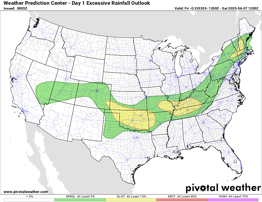
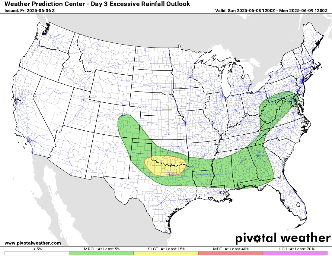
Flash flooding will be possible as well in local areas where storms move repeatedly over the same location.
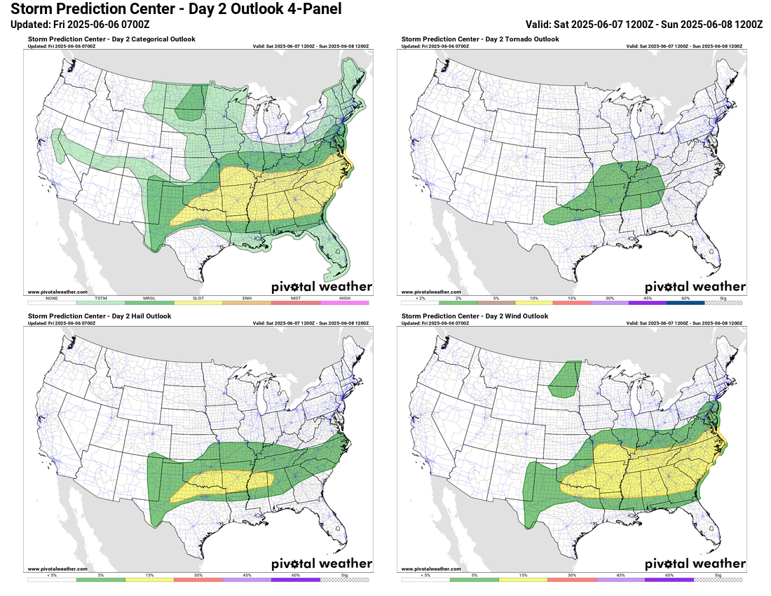
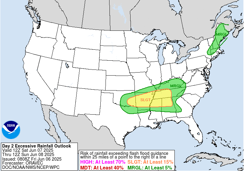
By Saturday, the weather pattern will start to transition with the beginnings of the development of an upper level trough of low pressure over the eastern United States. Clusters of strong to severe storms with damaging winds, large hail and torrential rainfall will continue to be a risk from the Southern Plains east to the Southeast coastal region.
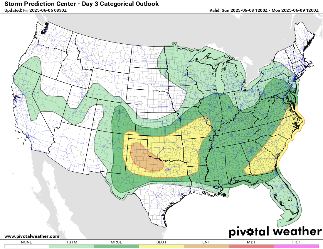
By Sunday, the developing upper level trough over the eastern United States will cause an area of surface low pressure to develop over the lower Great Lakes and Mid-Atlantic region. The threat of severe weather in the east will become focused in the Mid-Atlantic and Southeast along a cold front trailing from that storm system. Meanwhile, farther west a strongly unstable airmass combined with northwest flow aloft in the atmosphere on the backside of the developing eastern US upper level trough will result in a very favorable environment for potentially significant severe storms over the Southern Plains. SPC has already placed an enhanced (level 3 of 5) risk of severe storms for much of northwest Texas.
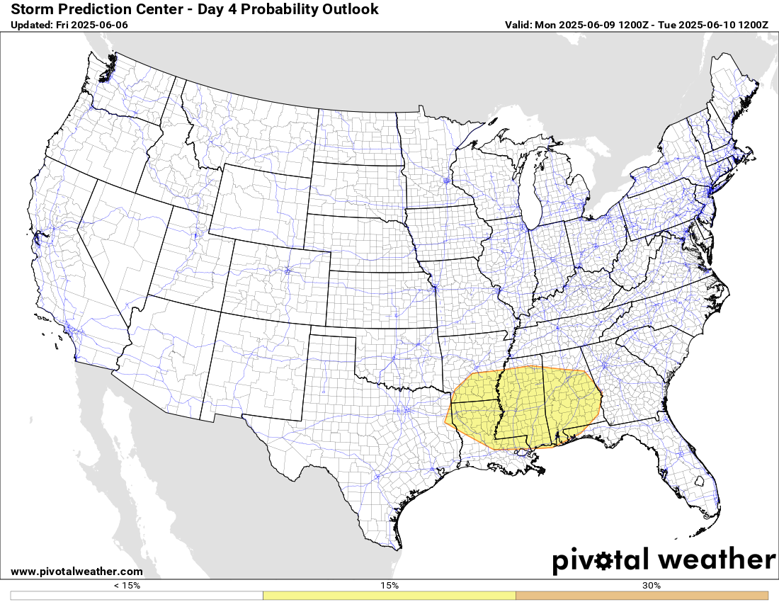
Severe weather will continue to be possible early next week along the central Gulf Coast region in the west to northwest flow aloft on the south side of the eastern US upper trough. That overall weather pattern looks to be fairly transient, and as of now it looks like by the middle to latter part of next week a rather nondescript weather pattern will be in place for much of the country.

Leave a comment