Major severe weather risk expected across central US on Friday
Apr 16, 2026
Plenty of weather to talk about again today, but I need to start today with an article that was published by Evan Bush at NBC News about the tornadoes near Kansas City Monday night in an area that was not outlooked by the Storm Prediction Center or local office for any severe weather risk. Evan focused on the concern I raised in my post about the lack of balloon data upstream of these tornadoes Monday morning due to staffing and budget constraints at the NWS forcing changes to when the NWS releases upper air balloons. In the article, myself and other independent meteorologists explain our concerns about how the lack of balloon data might be causing forecasts to suffer, particularly given the reduced data in the morning high resolution model runs.
You can read the article for yourself — but I feel I must share some perspective on the comment provided by the NWS spokesperson Erica Grow Cei defending the new NWS balloon schedule.
“NOAA’s weather model performance has not been impacted by any changes to the schedule of our twice-daily radiosonde (weather balloon) launches,” she said in a statement. “NOAA’s Environmental Modeling Center regularly evaluates the performance of the Agency’s weather models and publishes its findings on the EMC’s website. NOAA’s weather model performance shows no evidence of degradation.”
First off, it is true that the Environmental Modeling Center (EMC) does conduct model verification and post it on its website.
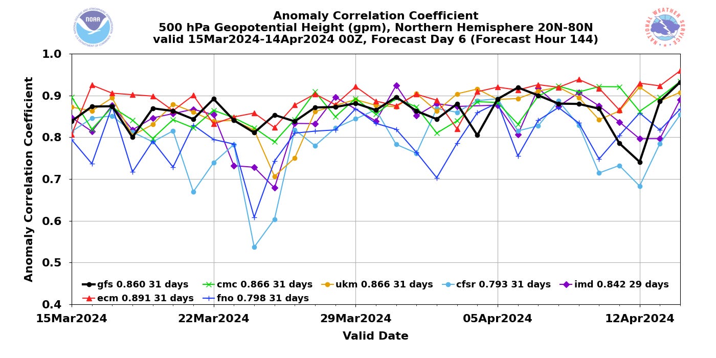
This is an example of the kind of verification statistics you can find on the EMC model verification site, in this case the anomaly correlation coefficient for the day 6 forecast of 500 millibar heights (the basic weather pattern in the middle levels of the atmosphere) over the last month. This — and other similar verification statistics such as root mean square error — are meant to give a perspective of how a weather model is performing at a global, hemispheric or continental scale. In this case, this chart shows that over the last month the NWS global model (GFS) trails the other major modeling center models — the European Centre (ECMWF), the UK Met Office (UKMET), and Environment Canada — and is ahead of lesser used global models such as the Indian Meteorological Department and US Navy (FNO) model. This positioning of the GFS model accuracy behind the ECMWF, UKMET and Canadian model is pretty consistent with statistics for the last several years — so in this way, the NWS statement is accurate in that there is not a noticeable change.
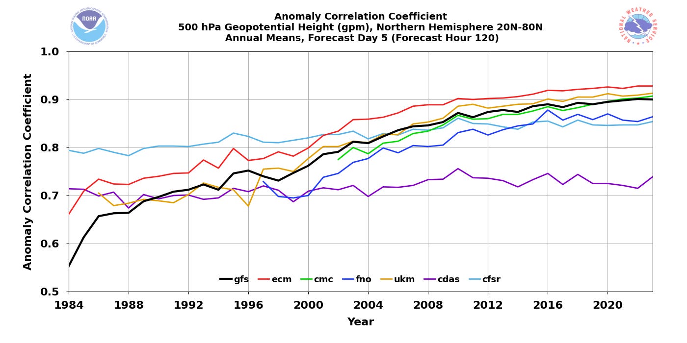
However, that graphic is only for the last 30 days, and to really know if there is a decline in skill in the GFS due to the NWS change in balloon cadence we would need to be looking at a much longer term trend. Unfortunately, the annual trend data in model verification on the EMC site does not appear to have been updated since 2023, which makes such an analysis impossible (if any of my colleagues know of a site where updated data can be found, please let me know — comments are open on this post).
Furthermore, the impacts of the NWS upper air changes on the global models is not my primary concern (although it is a concern, see my writeup about the poor forecasts of the cyclone that caused massive storm surge flooding in Alaska last fall) — in this case, it is the impact on the high resolution models that are used for forecasting thunderstorm impacts and other fine scale weather impacts. The models that comprise the High Resolution Ensemble Forecast (HREF) system that is a primary tool for forecasting severe weather and flash flood impacts by the NWS and broader meteorological community is comprised of models that only run twice a day, 1200 UTC and 0000 UTC.
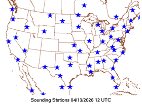
Those high resolution models were run on Monday morning with all of the NWS balloon data from the Four Corners region to South Dakota missing — the exact area where the atmospheric forcing for thunderstorm development across the central US was emanating from.
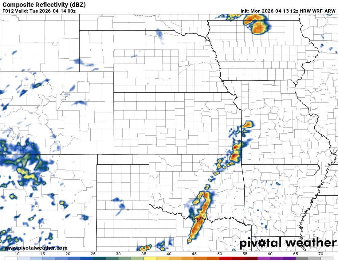
This is the forecast radar image for 7 pm CT Monday from the Monday morning WRF-ARW model, one of the models that goes into the HREF. I have looked at the other models from this morning and they were all relatively similar.
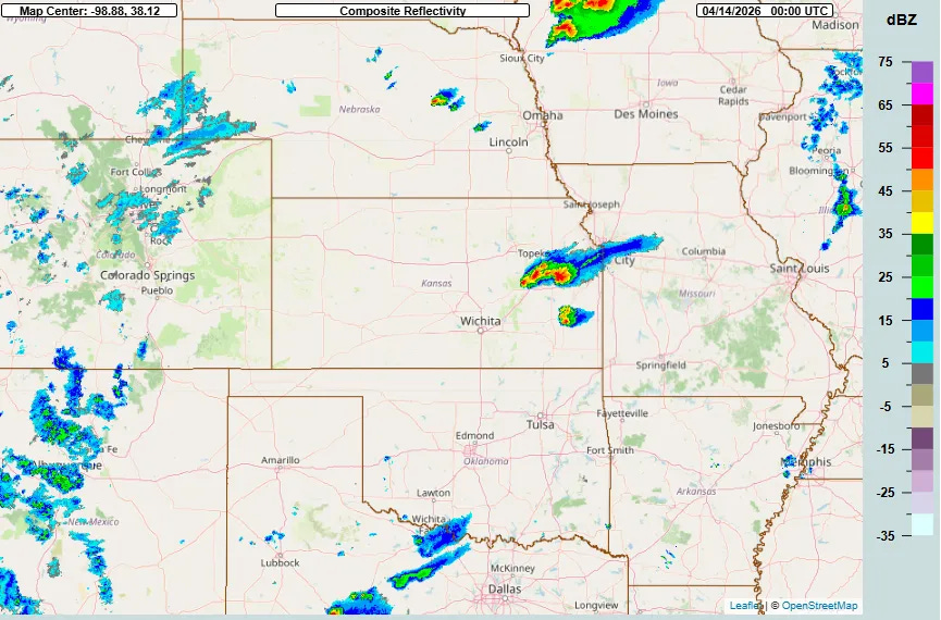
This is what the radar mosaic actually looked like at 7 pm CT Monday. You can see that none of forecast storms from southwest Missouri across Oklahoma (where SPC did have a risk of severe weather forecast) in the model were actually there — while there were unforecast tornadic supercells just southwest of Kansas City.
I want to be crystal clear — I am not claiming that the lack of NWS balloon data upstream of these storms is the definitive reason for this poor forecast. High resolution, convective allowing modeling is very challenging and remains prone to error even with the best data available. What I am saying, though, is that as an experienced meteorologist when I look at that map of 1200 UTC upper air soundings from Monday, it is hard for me to imagine that it does not have some negative impact on those model forecasts. Furthermore, to the best of my knowledge, routine ongoing verification statistics for these high resolution models are not being tracked by EMC — at least, they do not appear to be available anywhere on the NWS websites.
This is why I say we are running a real-time experiment on these models by routinely denying observational data to them, but we as a meteorological community have no way to track the results of the experiment. Until there is some sort of definitive scientific work done to truly evaluate the impacts of these changes in real-time, these questions are going to continue after events in which the NWS forecast is perceived to have been subpar, particularly in cases where the high resolution models play a key role in the forecast.
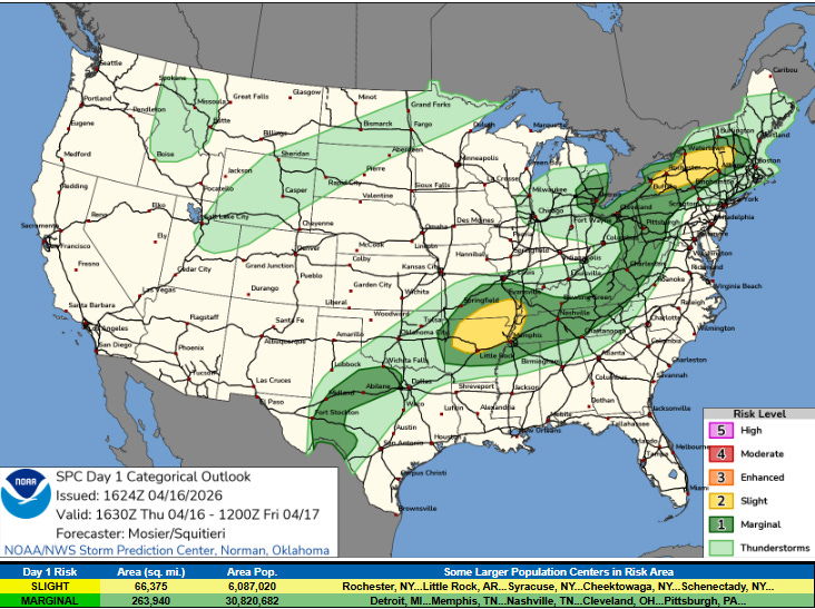
Taking a quick look at the actual weather, the latest Storm Prediction Center outlook for today has two slight (level 2 of 5) risk areas. In the Northeast, some organized severe thunderstorm activity capable of damaging winds, large hail and a few tornadoes are expected. In the Ozarks and Mid-South, scattered supercell storms with a risk of very large hail and damaging winds look to be the primary threats.
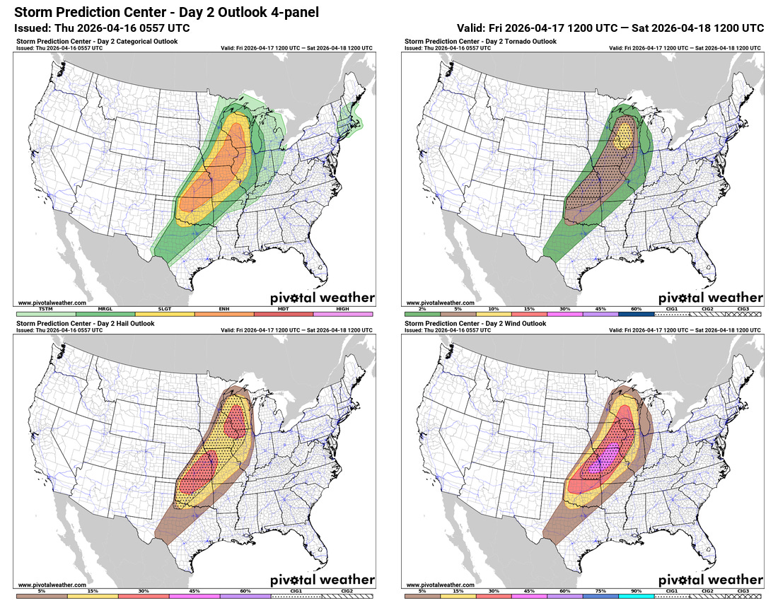
This will be the lead up to what is anticipated to be a much more impactful and widespread severe weather event on Friday, as a strong low pressure system will combine with unusually unstable air across the central part of the country to result in widespread severe thunderstorm activity with the potential for very large hail, swaths of damaging straight line wind, and tornadoes which could be strong. It would not be surprising to see parts of this region upgraded to a moderate (level 4 of 5) risk of severe weather in later SPC forecasts.
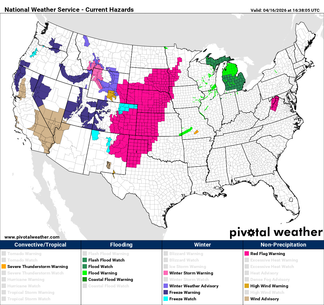
Fire weather will also be a serious concern across areas to the west of the main severe weather risk into Friday afternoon. Red flag warnings are in place for a large swath of the central US.
I will have more on the weather situation on tap for Friday in posts and/or videos later today and this evening.

Leave a comment