And more thoughts and perspectives on the issues with upper air soundings and weather models
Apr 17, 2026
Happy Friday! Today’s newsletter will focus on the high impact weather expected for large parts of the country today — but I have had a lot of great feedback on my articles yesterday about weather model performance and NWS upper air soundings that I want to quickly address first.
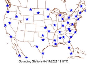
This is today’s map showing the sites that performed upper air balloon releases for the standard 1200 UTC (7 am CT) time. There is obviously a large dearth of observations from Arizona, New Mexico and western Texas north across Utah and Colorado and into South Dakota. By my count, data is missing from 20 upper air sites in this region and other parts of the central United States. To be clear, a large number (but not all) of these will be performing 1800 UTC (1 pm CT) soundings, meeting their 2 per day quota by doing the sounding at that time when they have available staffing not available for a 1200 UTC release.
The bottom line in my opinion — and the reason why this story keeps coming up — is that no experienced meteorologist is going to look at that map of upper air data on a day on which a severe weather outbreak is anticipated and say, “cool, no problem here!” We release balloons for a reason, and missing 20 upper air sites is almost certainly having some negative impact, at a minimum from the 1200 UTC high resolution models on those models’ forecast of this upcoming event. Obviously, getting the additional observations at 1800 UTC will help forecasters in the regions where those balloons are released and the High Resolution Rapid Refresh that runs at that time. But what would be optimum for a severe weather outbreak day — and to be clear, this was typical standard operating procedure for the NWS prior to 2025 — would be to have all of the normal 1200 UTC upper air observations and then release additional supplemental 1800 UTC balloons.
A few offices that did 1200 UTC releases will probably release 1800 UTC supplemental balloons today, but for most it will be either 1200 UTC or 1800 UTC. It is hard to see how these changes are not a step backwards from the NWS being positioned to provide the most accurate forecast and warning services. To be clear, it does not mean the NWS is still not able to perform well — just that (at least in my opinion) it is not as well positioned as before these issues with the upper air operations arose.
Having said all that, the other key bottom line — and one I feel like I cannot stress enough — is that the potential implications of these changes on weather model accuracy is an extremely complex and challenging science question. I have had some great e-mails and comments from colleagues with more expertise than I have in numerical weather prediction, and as one of them commented to me, actual analyses into these questions often give non-intuitive answers about what observations make the most difference in model performance.
The impact of the NWS upper air cadence changes have always instinctively seemed most likely to me to impact the high-resolution models. While my post last night outlined some of the potential signs of missing upper air data degrading global models, a colleague pointed out me that we also lost some satellite microwave data sources last year which could have been a big impact on the model performance as well. So…

…and I’m sure we will be discussing it more in the future. I will also be talking more about NWS organizational and infrastructure issues — which I actually think are in reality much more concerning and impactful than these scientifically intriguing upper air issues — in future posts
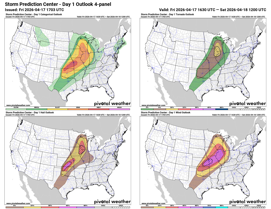
As we have been discussing for a few days now, today still looks on track to see a rather widespread, high impact outbreak of severe weather. With their midday update, the Storm Prediction Center did indeed upgrade areas from northern Oklahoma through west central Missouri to a moderate (level 4 of 5) risk of severe thunderstorms for this afternoon.
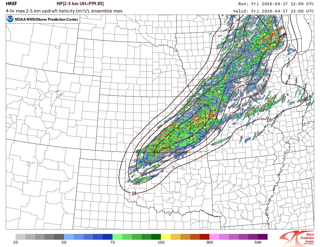
The atmosphere across this region is becoming extremely unstable, and wind shear will be increasing as the strong upper level trough of low pressure to the west starts to move into the region. Intense supercell thunderstorms should erupt in the area of the Kansas/Oklahoma border in the next few hours and move east-northeast as shown by this forecast of 4-hour probability of supercell storms from the morning High Resolution Ensemble Forecast system. These storms will likely produce giant hail and significant straight line winds. Strong tornadoes are also a concern, but that risk is a bit more uncertain due to the potential of the storms to gradually be overtaken by the cold front moving southeast through the region. Given this, the moderate risk from SPC is actually for wind and hail rather than tornado risk.
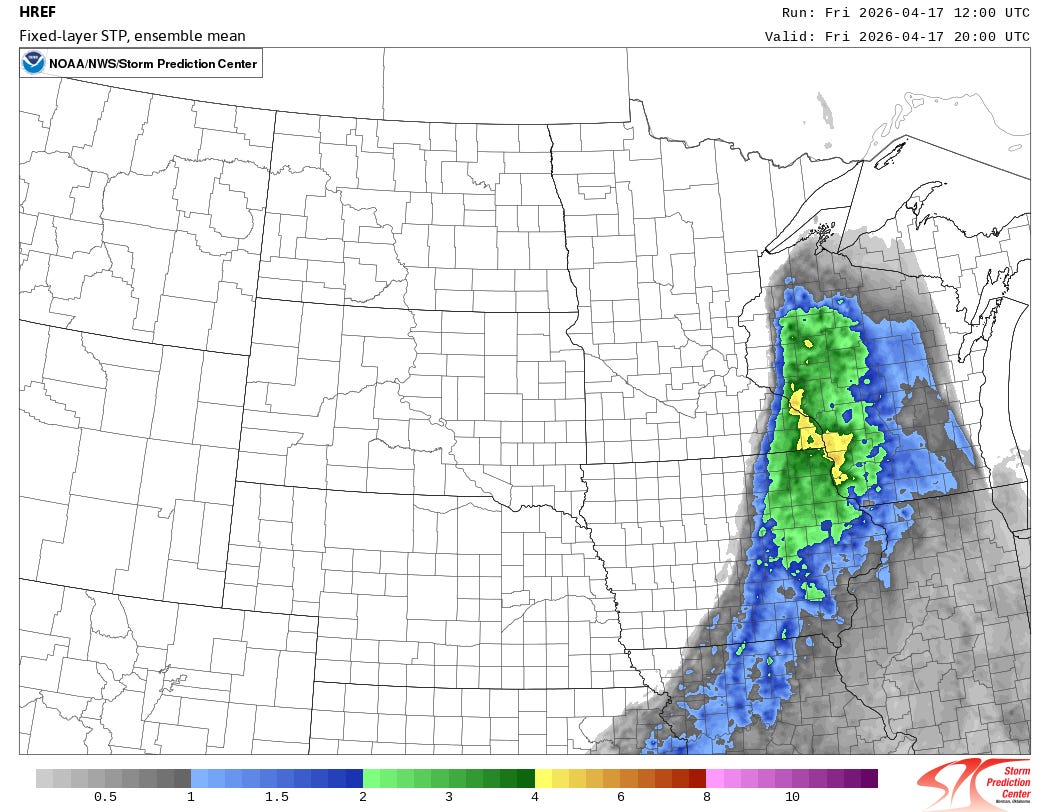
SPC’s greatest risk for significant tornadoes today is actually in the upper Mississippi Valley where the combination of unstable air and low level wind shear to support storm rotation will be greatest as shown in this HREF forecast of significant tornado parameter (parameter that combines instability and low level shear) for 3 pm today. Storms in this region are also expected to be more discrete and moving east into a broad sector of air favorable for tornadic storms. SPC has tornado categorical intensity group 2 area here, indicating an enhanced risk for potential EF3+ tornadoes.
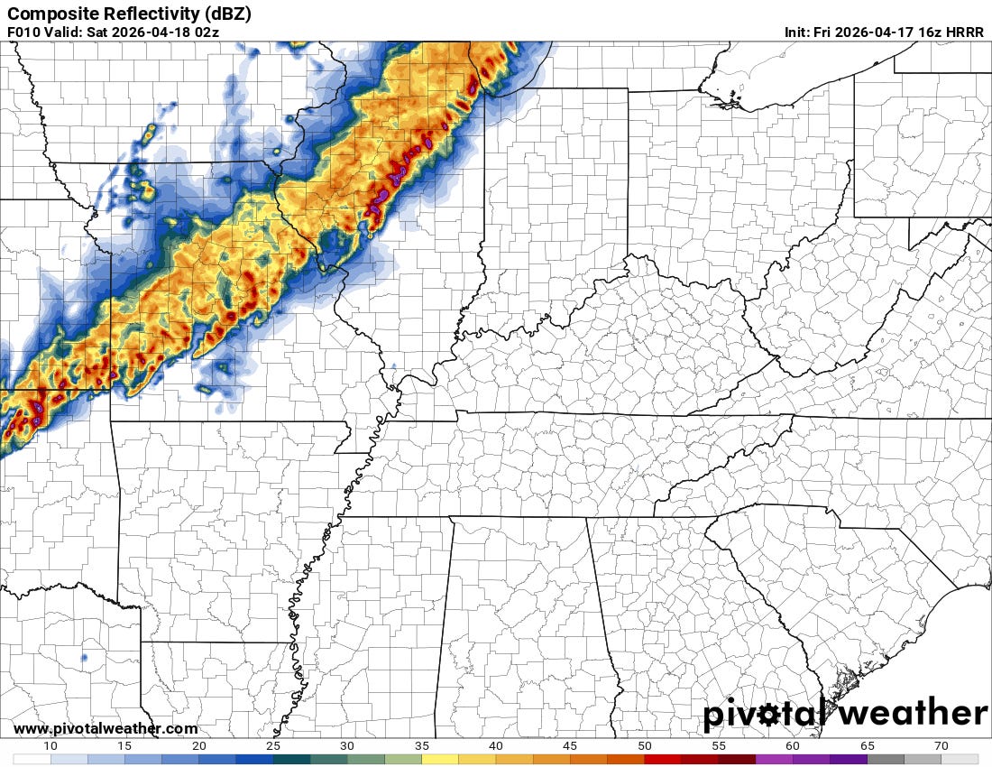
Eventually by later this evening all of these storms should congeal into a large band of southeast moving strong to severe storms capable of producing swaths of damaging straight line winds as well as large hail and a few tornadoes.
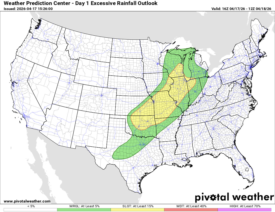
The storms will also be producing very heavy rainfall and will move repeatedly over some areas, and this could result in flash flooding. The Weather Prediction Center has a slight (level 2 of 4) risk of flash flooding in place.
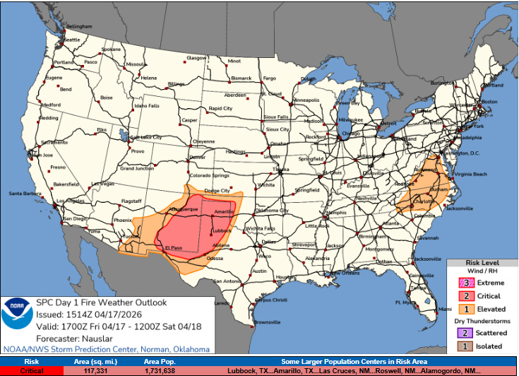
Another big concern with this weather system remains critical wildfire danger across the southern High Plains. Strong and gusty westerly winds and relative humidity values of 5-15% will support rapid spread of any wildfires that develop in the very dry conditions of this area.

Leave a comment