NWS comms outage leaves missing radar data and backup offices having to issue warnings for parts of Ohio Valley
Jun 06, 2026
A quick update on a pretty active Saturday afternoon of weather. A band of severe thunderstorms has been moving across the upper Ohio Valley today producing damaging gusts, with more than 125,000 customers without power from central Ohio into western Pennsylvania and northern Maryland per PowerOutage.us.
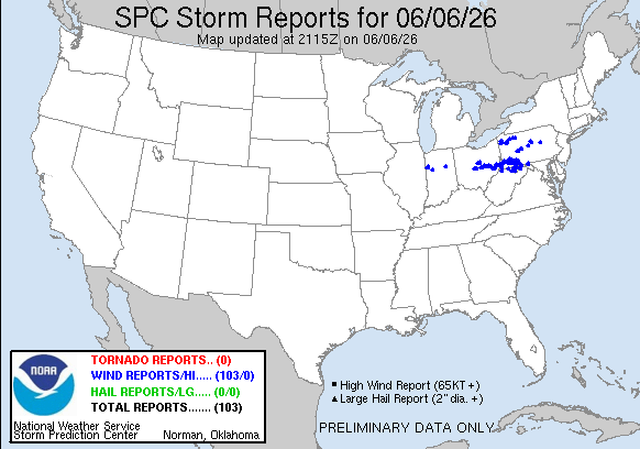
There have been more than 100 reports of wind damage and severe (58+ mph) gusts, with a maximum of 74 mph in the Pittsburgh metro area.
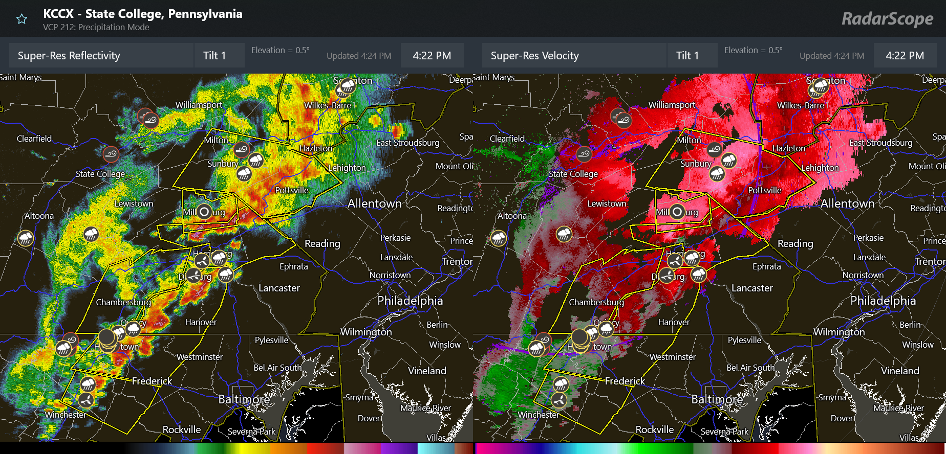
Heading into early evening, this band of severe storms will be pushing east across eastern Pennsylvania, northern Maryland and parts of New Jersey and Delaware where temperatures rose into the lower 90s this afternoon. The threat of damaging winds will continue as the storms move east, and severe thunderstorm watches are in place along with an enhanced (level 3 of 5) risk of severe weather.
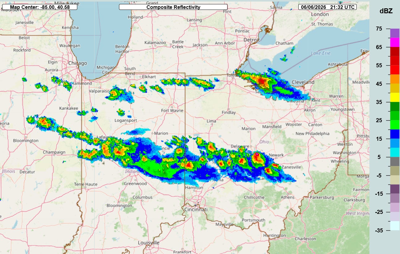
Additional sporadic severe storms with damaging winds and large hail are expected to pop up back to the west along and north of the Interstate 70 corridor across Ohio and Indiana ahead of the cool front sagging into the region.
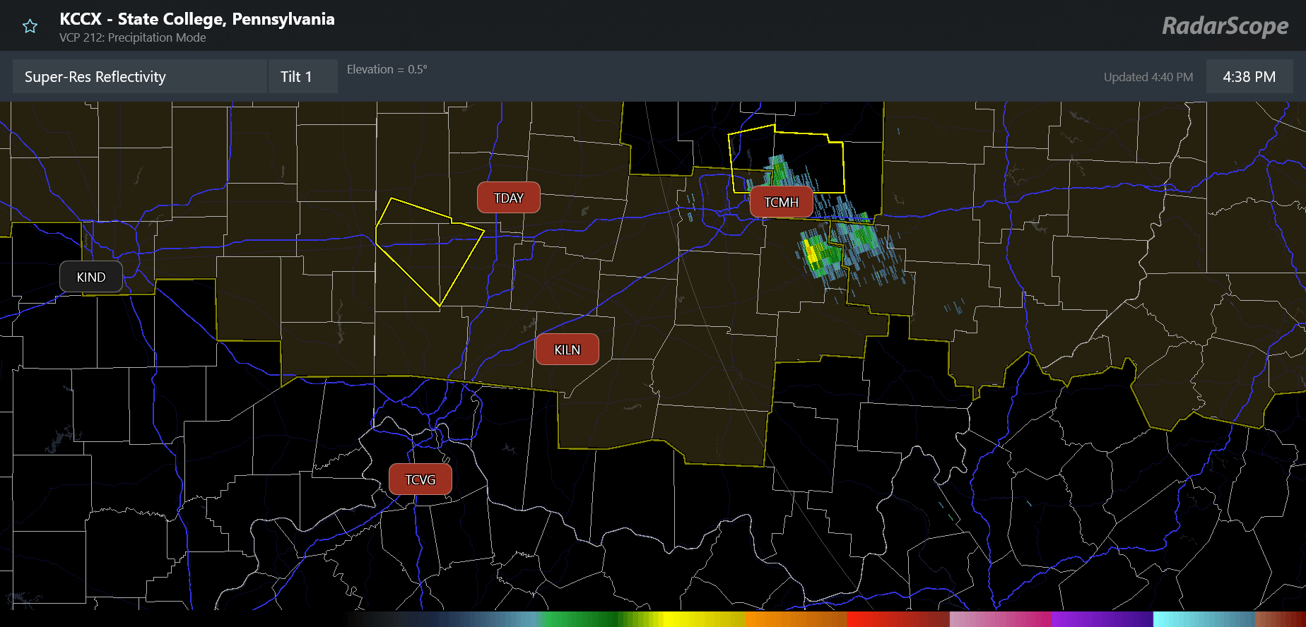
Unfortunately, very similar to a situation back in March that I posted about here, the NWS office in Wilmington, OH appears to have lost communication for at least the last couple of hours as this severe weather is ongoing. As can be seen in the RadarScope image above, this means the radar data from their NEXRAD radar and the three terminal Doppler radars in southwest and central Ohio are unavailable. The local NWS forecasters may have access to their NEXRAD data depending on the reason for the outage, but they cannot issue warnings — hence, the NWS office in Jackson, KY is providing backup services and issuing warnings for this severe weather in the central and western Ohio region.
As I talked about in that earlier post, these sorts of comms issues are part of a long, ongoing issue the NWS has had with infrastructure. These are a serious concern for me as NWS leadership pursues a rapid reorganization that will have significant impacts on how the agency handles support for their local and national offices — and that we still know little about publicly. We are entering what looks to be a potentially active weather period in the next couple of weeks with significant wildfire conditions in the West, excessive heat risks across many parts of the country, possible tropical weather threats — along with daily severe weather and flash flood risks. Meanwhile, based on conversations I have had with a number of current and recently retired NWS employees, the agency is also planning to provide decision support services to emergency managers who are supporting World Cup venues around the United States, which will involve some NWS staff temporarily deploying to other offices to help supplement staffing. In these conversations, I have heard some worry about how the agency and (still shorthanded) staff will be able to handle all of this — and I am certainly concerned. I will be continuing to provide information and perspective about all of this over the next several weeks.

Speaking of that active weather, an enhanced (level 3 of 5) risk of severe storms is also in place for this evening across parts of Montana and North Dakota, while flash flooding risks will exist over parts of the Arklatex and central Gulf Coast regions. Meanwhile, critical fire danger is in place for parts of the Great Basin and Southwest with Red Flag Warnings in place. This is the start of what is expected to be a particularly active fire weather period over the next several days for this region into the central and southern Rockies, with strong winds, dry air, and potentially some dry thunderstorm activity that could produce fire initiating lightning strikes.
I will be traveling on Sunday so I will likely not be making a full post tomorrow — but will try to put out a note or comment in Substack chat about anything of import I see with this active weather situation.

Leave a comment