High end severe weather, record heat, flash flooding and critical fire danger all in store
Jun 08, 2026
Happy Monday and welcome to a new work week. An extremely busy week of weather is anticipated this week, with multiple days of high end severe weather potential, flash flooding risk, excessive heat, serious wildfire danger and some tropical risks.
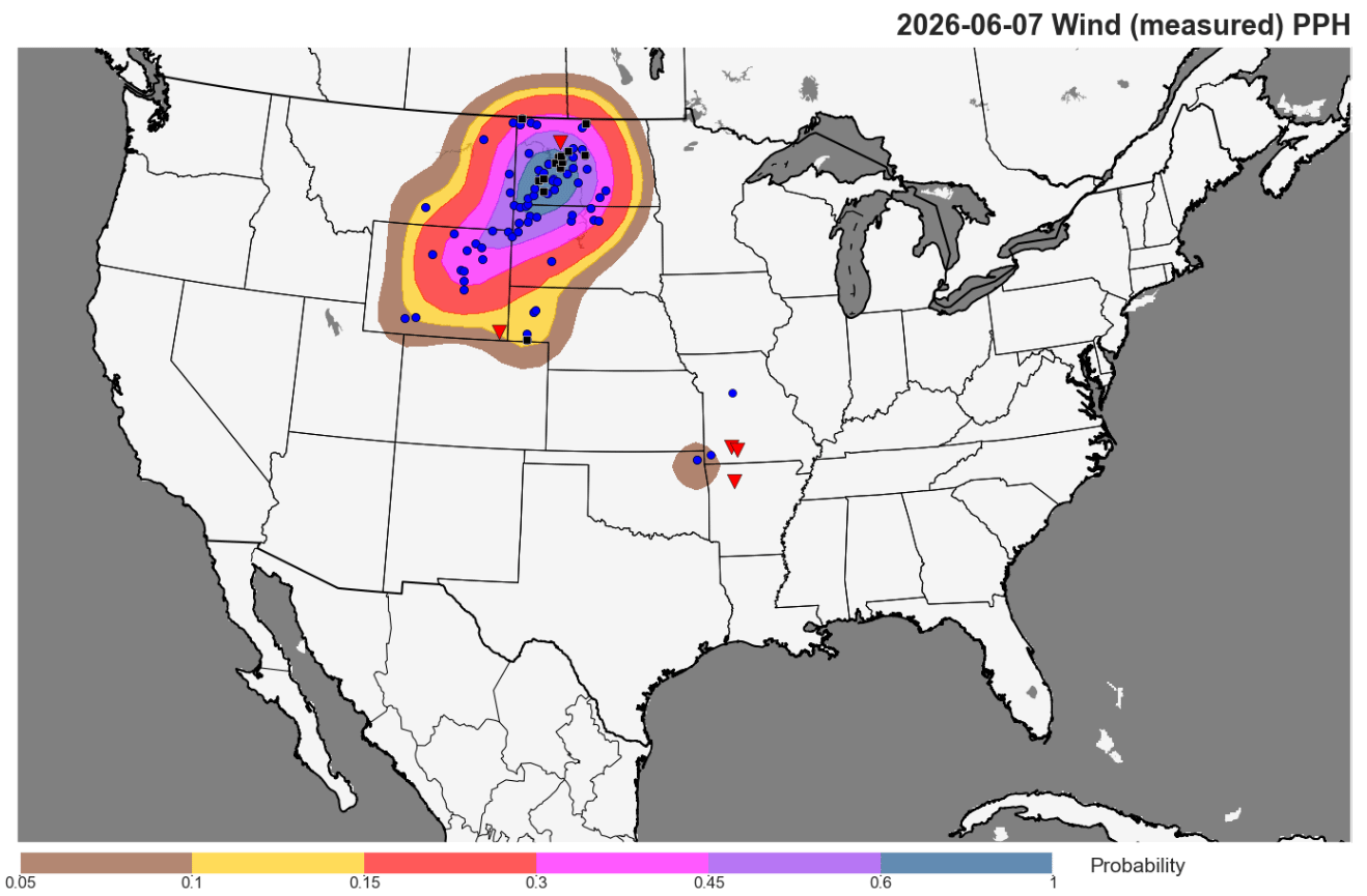
Starting off with severe weather and a quick recap of an active Sunday night in the Northern High Plains. Widespread severe straight line winds were the major impact as an intense squall line developed and swept across the region, with more than a dozen reports of measured significant (75+ mph) severe wind gusts including a few greater than 90 mph. Earlier in the event as supercell severe storms initially developed there were also a number of reports of very large hail.
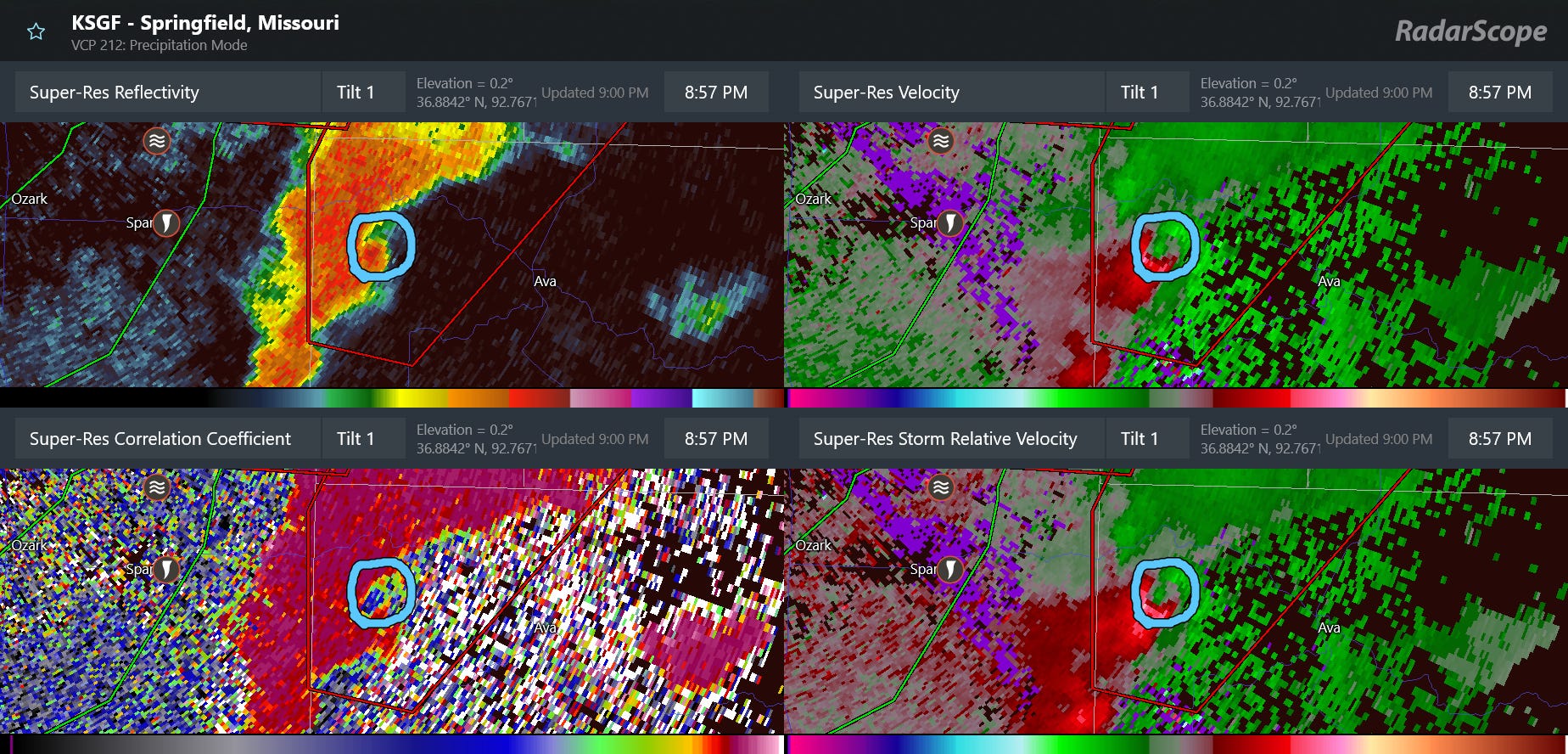
Several tornadoes also occurred in a tropical sort of environment in the Ozarks region, including this one last evening just east of Springfield, MO that resulted in a very well developed tornadic debris signature (circled).
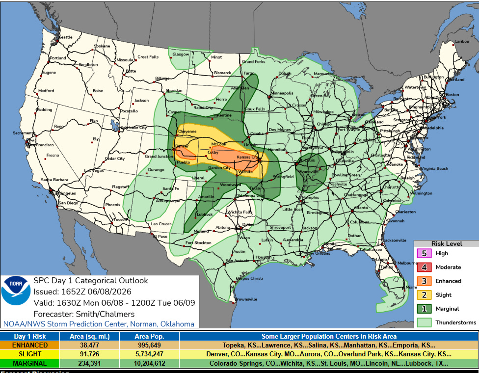
Today the risk of severe weather will be focused farther south from the Front Range into the Mid-Missouri Valley, where an enhanced (level 3 of 5) risk of severe storms is in place. Very large hail, significant straight line winds and a few tornadoes will be possible with the most intense severe storms today.
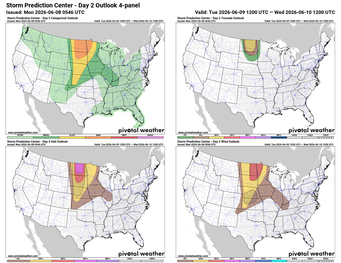
A serious risk of severe weather will return to the Northern Plains on Tuesday as a strong upper level disturbance shifts across the region. The combination of the disturbance and strongly sheared, very unstable atmosphere is expected so support numerous intense supercell storms capable of producing strong tornadoes and very large hail, particularly across North Dakota and adjacent areas of southern Saskatchewan and Manitoba where the risk may actually be highest. These supercells should eventually evolve into a squall line (quasi-linear convective system or QLCS) that will have a risk of significant straight line damaging winds and tornadoes as it moves across the Dakotas and into parts of Minnesota late Tuesday evening.
Additional severe weather will be possible Tuesday afternoon and evening farther southeast along a warm front extending across the Midwest and into the Lower Ohio Valley. While right now SPC only has a marginal (level 1 of 5) risk of severe weather, depending on how thunderstorms the next 24 hours evolve the atmosphere along this warm front could become rather favorable for severe storms. Some of the reliable AI guidance suggests higher probabilities of severe weather in this region so this will be something to keep an eye on.

Tuesday will be the start of an anticipated multi-day period of high end severe weather risks across the northern tier of the United States. As that initial upper level disturbance shifts east, another period of potentially significant severe weather including tornadoes is anticipated across the Upper Midwest on Wednesday and Wednesday night. By Thursday, another strong upper level disturbance is expected to move into the Midwest and produce another area of significant severe weather risk a bit farther south across the Midwest including portions of Missouri and Illinois — while the initial disturbance will bring a risk of severe storms to parts of the Mid-Atlantic and Northeast. Additional severe storms will be possible in this region on Friday as that second weather disturbance shifts east.
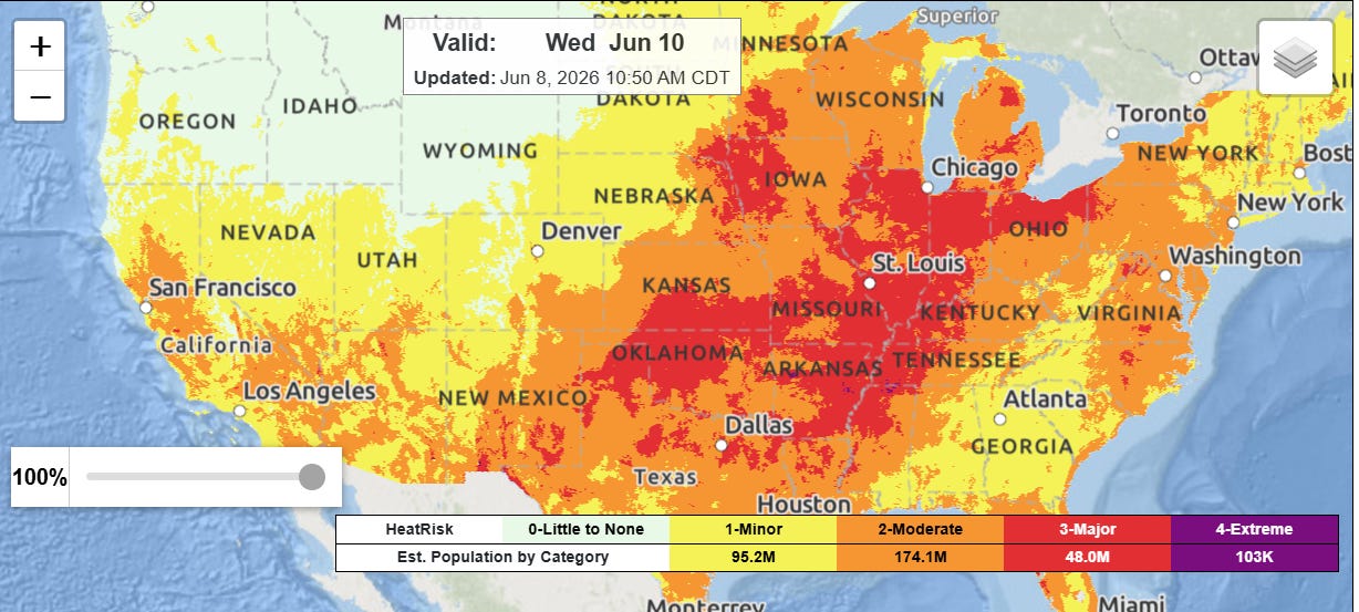
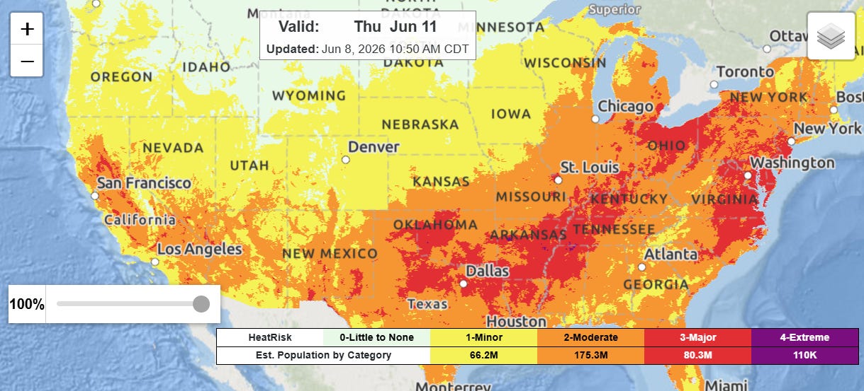
These storms will be fueled by a combination of heat and humidity that will also result in moderate to major heat risk across much of the eastern half of the country the next several days.
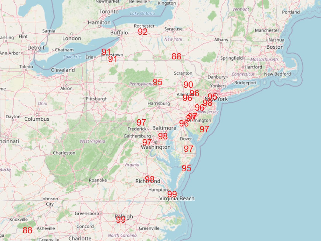
A number of record high temperatures will be possible across the East Thursday (shown above) and into Friday.
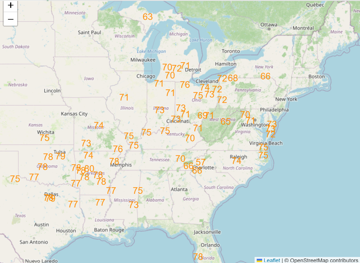
Even more notable — and as we are seeing more frequently due to climate change — will be the widespread record warm minimums, with dozens of records possible across the eastern half of the country Wednesday into Friday (Thursday shown above).
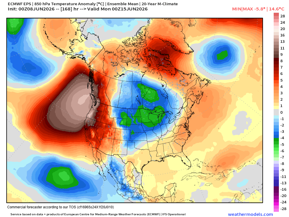
An even more anomalous heatwave looks to develop along the West Coast this weekend into the first part of next week as a strong upper level ridge of high pressure builds across the region. Numerous warm records — both highs and lows — are expected.
Record warmth is also occurring over many other parts of the world including Asia and Africa — and Antarctica, as this post from climatologist M. Herrera outlines with the continent setting its all-time winter records for both warm maximum and minimum temperatures.
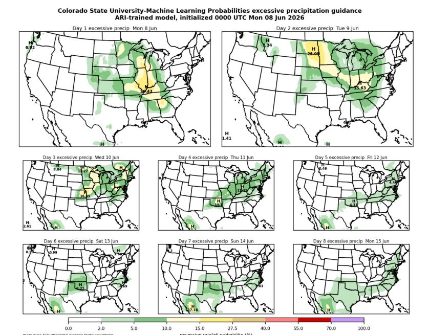
The high levels of moisture in place across the country east of the Rockies will also fuel risks of flash flooding, as shown in the Colorado State University Machine Learning probabilities of excessive rainfall for the next week.
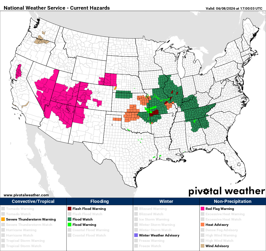
Flash flood watches are in effect for large parts of the central part of the country. Meanwhile, farther west, widespread critical fire danger is expected the next several days as strong winds and dry air to the south of the upper level disturbances moving along the US/Canada border result in the potential for rapid wildfire spread in areas dealing with significant drought. Red Flag Warnings are in effect for many areas from California to the High Plains.
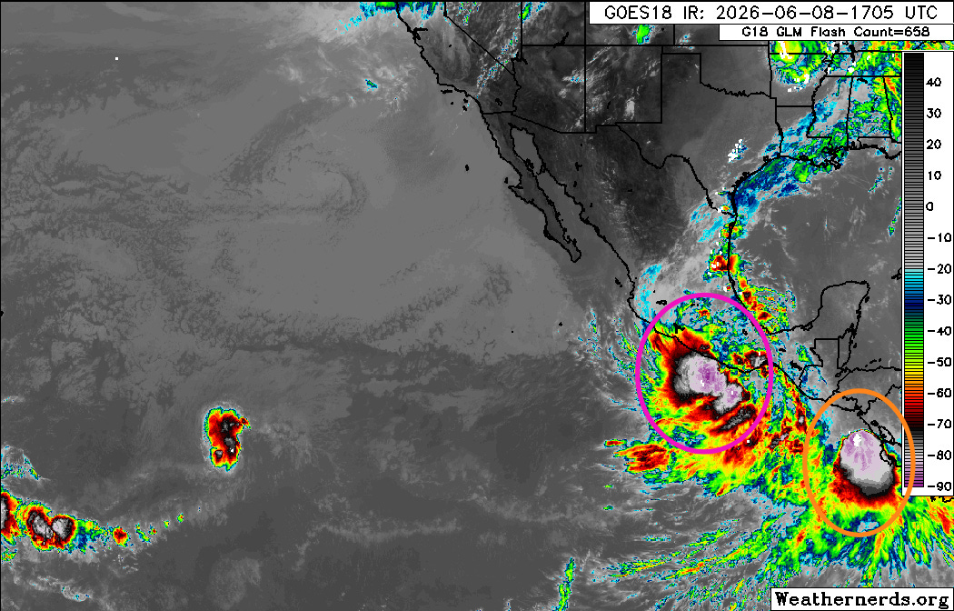
I will have a more complete tropical update in the next day or two, but wanted to mention that there are currently two Eastern Pacific tropical systems causing issues. Boris (purple circle above) is a minimal tropical storm that is expected to bring potentially flooding heavy rainfall and gusty winds to parts of the Pacific coast of Mexico around Acapulco as it moves inland the next 24 to 48 hours. Tropical Depression Three-E (orange circle) should become a minimal tropical storm before it moves inland with potentially flooding rainfall across parts of Central America the next few days.
Programming Note: Given the increase in active weather, I started utilizing the Substack Chat feature again yesterday to share occasional updates. I will be utilizing chat and occasional live videos over the next several days — as a reminder, these are benefits that paid subscribers receive for their support of Balanced Weather. Any videos I do will also be recorded and shared to all subscribers.

Leave a comment