
Heat and flash flooding are major concerns for the US as we head toward the weekend
Jul 22, 2026
I want to start off this newsletter by thanking everyone who shared condolences and perspectives on the post about my mom’s passing. It has been an incredibly emotional last 10 days navigating this loss — sadly at the same time as the loss of two of the pet members of our family. The support from the Balanced Weather community was a real help.

Thankfully, I am also blessed with an incredible family that came together to support each other, which is a gift I never, ever take for granted. We were able to share a lot of wonderful memories of my mom and how she loved and cared for our family. I know that she would be happy about how much family bonding was able to happen in the last week.
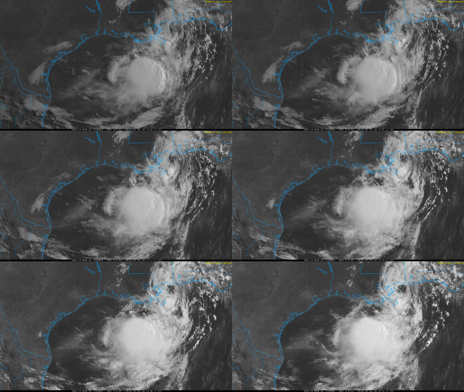
We are back at home for a few days, and I am starting to work my way back into the weather world. The biggest headline today is probably Tropical Storm Bertha, which is nearing landfall in southeast Louisiana. This visible satellite loop shows the the low level circulation of Bertha very clearly as it passes slowly west just offshore of the Mississippi Gulf Coast. The reason we can see the circulation so clearly is that Bertha is being bombarded by strong upper level north to northeast winds, which are shearing the system and blowing all of the thunderstorm activity being produced by the storm to the south of the center.
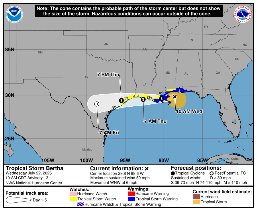
Bertha’s low level circulation has been quite robust, and in spite of the strong wind shear it was able to intensify to a 60 mph tropical storm yesterday. However, the shear is taking its toll and it has now weakened a bit — and that weakening is expected to continue as the shear continues and the system interacts with land. With the strong northerly shear, most of the impactful weather is south of the center and offshore, although some tropical storm force winds and locally heavy rainfall is possible along the coast along with some ongoing minor to moderate coastal flooding. My colleague Michael Lowry has a really good summation of Bertha on his Substack.
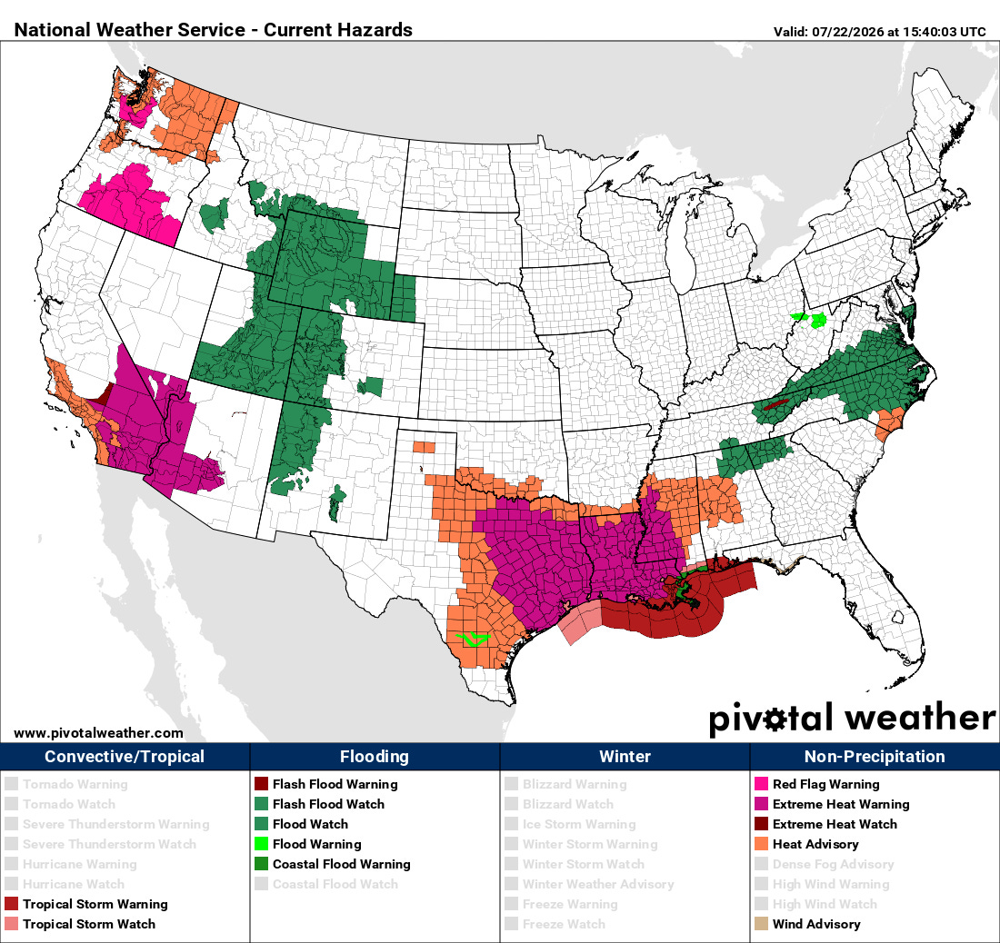
Bertha is a pretty clear example of how societal impacts from weather are not tied to whether or not a particular weather system has a name. By far the more significant weather impact anticipated across the South today is not flooding or wind from Bertha — rather it is extreme heat, with warnings in effect for much of the central Gulf Coast region.
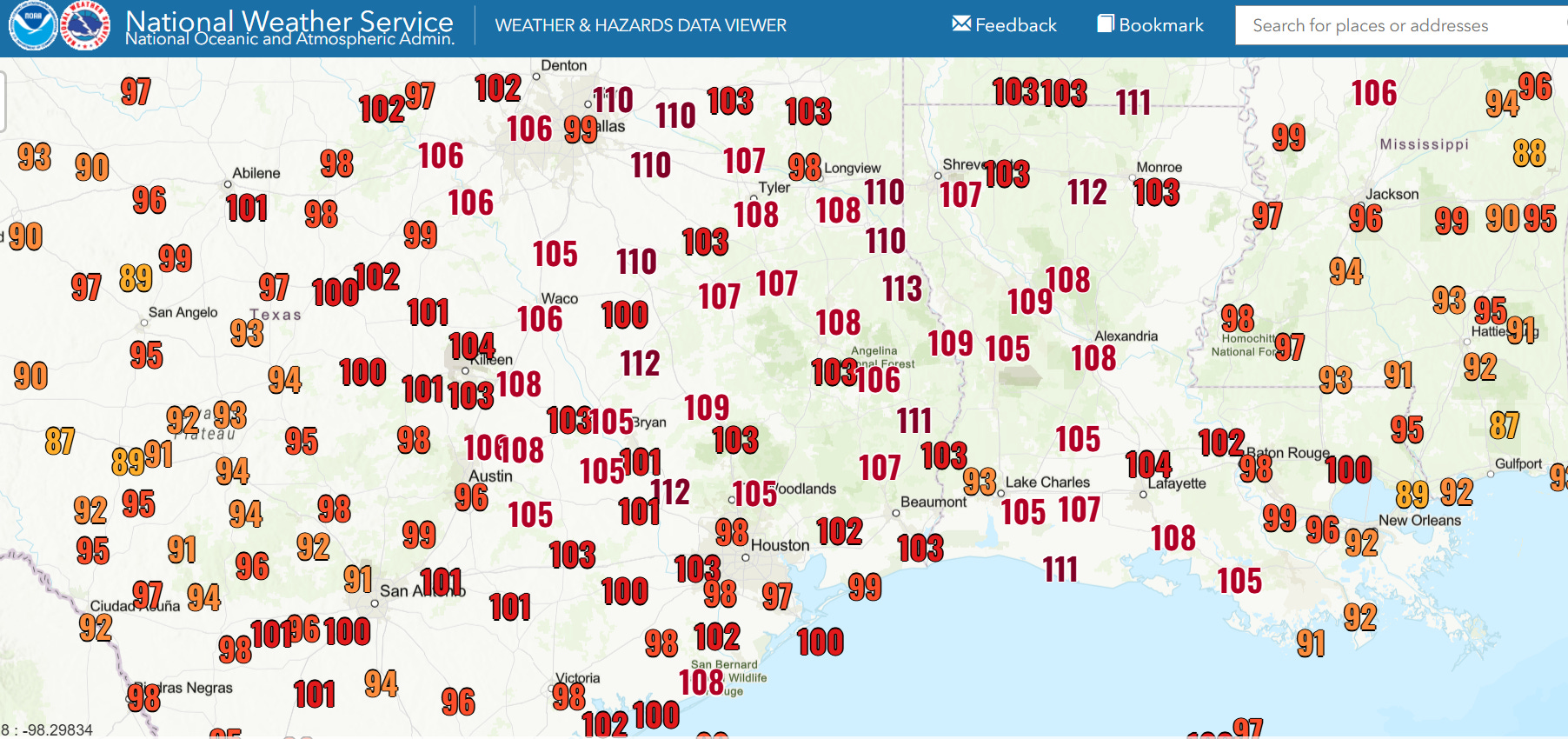
The combination of dewpoint temperatures approaching 80F and temperatures in the 90s will support widespread heat index values of 110F or higher in the region today after minimum temperatures this morning in the upper 70s and lower 80s. Some elevated fire weather risk will also exist in the region due to gusty northeast winds to the north of Bertha.
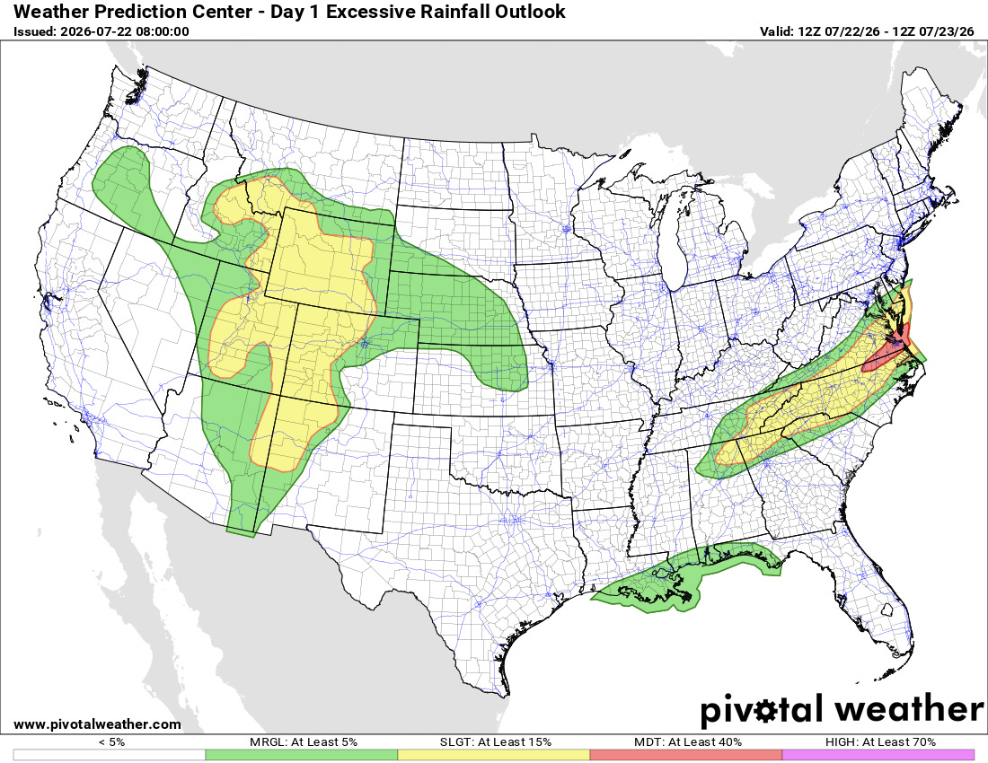
Flash flood risk will actually much be greater today in other parts of the country well away from Bertha. Monsoonal moisture will fuel slow moving thunderstorms with unusually high rainfall rates in the Intermountain West that could produce instances of significant flash flooding — and training thunderstorms along a slow moving cold front could also produce some significant flash flooding in the Mid-Atlantic and southern Appalachians.
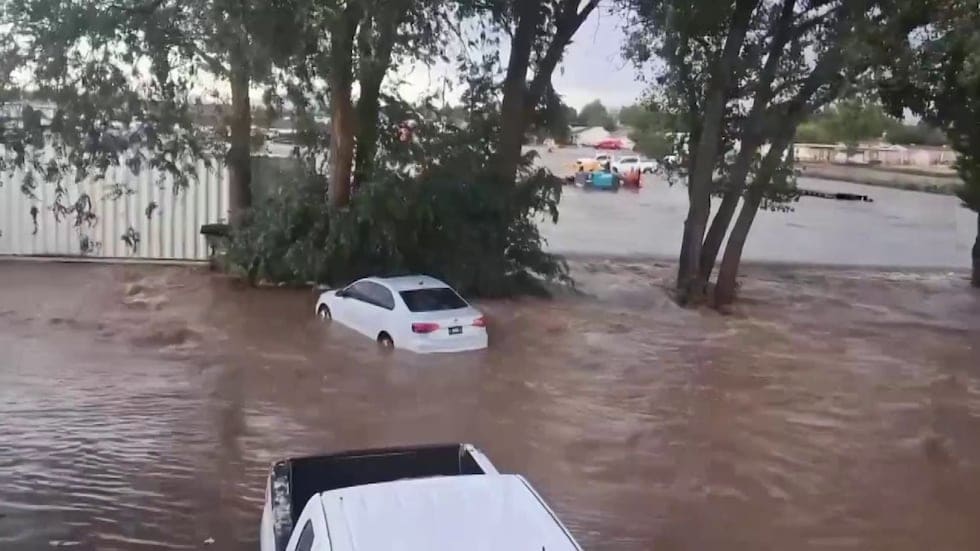
These weather setups have already produced serious flash flooding over the last couple of days. Thunderstorms producing up to 3” of rain in an hour caused major flash flooding in the Prescott Valley region of Arizona on Monday, while flash flood emergencies were issued in West Virginia on Tuesday afternoon and evening as numerous people had to be rescued from flood waters.

Meanwhile, Tuesday’s storms in the East also produced extensive severe weather, with nearly 400 severe weather reports including a number of tornadoes across Ohio, Kentucky, Pennsylvania and West Virginia.
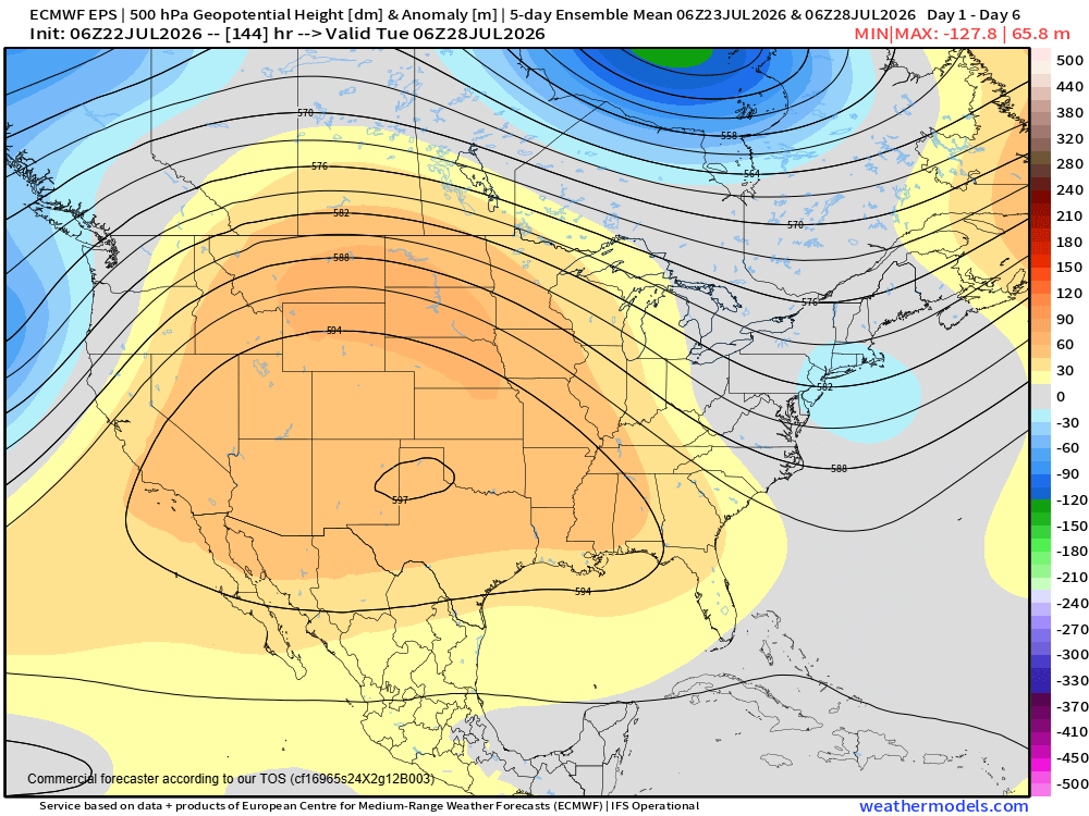
The upper level area of high pressure that has been meandering around the middle part of the country for the last 10 days or so bringing unusual and at times record heat is expected to take up residence from the Southwest into the Midwest for the foreseeable future. This will result in a building period of extreme heat across this region, while the eastern US will continue to be the focus for thunderstorm activity.
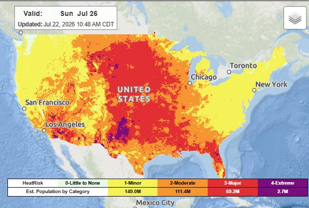
After a number of record high temperatures today in the Pacific Northwest, the heat will become increasingly focused by this weekend from the Desert Southwest across the central third of the nation as well as the Southeast. Widespread major to extreme heat risk is expected with a number of record warm temperatures (both maximums and minimums) expected each day.
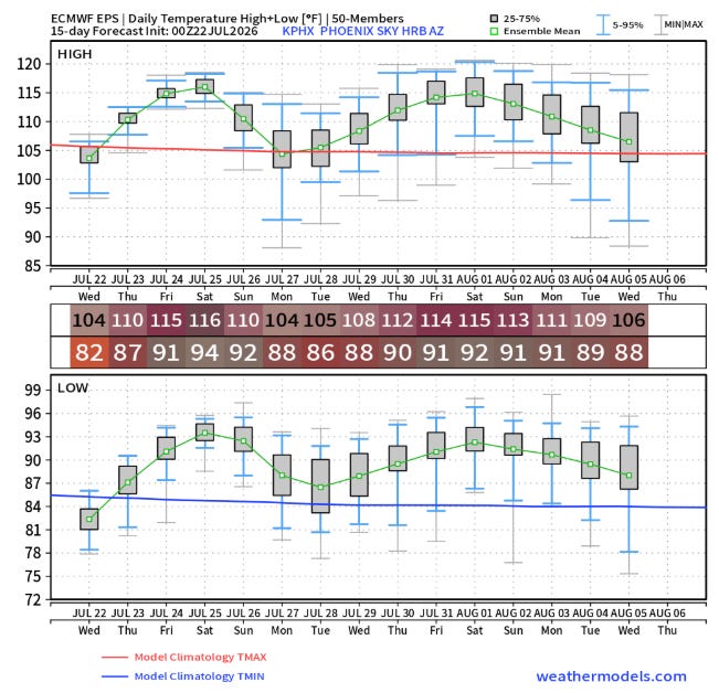
While a surge of monsoonal moisture may take a bit of the edge off early next week, the Desert Southwest including places like Phoenix, Las Vegas and Tucson look to be in for an extended period of unusually intense heat into early August.
Programming note: I am intending to post semi-regularly again — but family commitments and travel after the passing of my mom will mean those posts will not be as frequent or consistently timed as they typically have been.


Leave a Reply