
Phoenix sees consecutive days with minimum temps of 95F or higher for first time on record
Jul 26, 2026
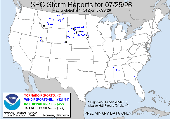
The severe thunderstorms I talked about in last evening’s post across South Dakota continued to move east through the Sioux Falls area late in the evening, producing additional wind gusts of up to 80 mph and causing tens of thousands of customers to lose power. Luckily, the storms did not maintain intensity overnight as implied by the high resolution model runs I discussed, and in fact weakened as they moved across Iowa.
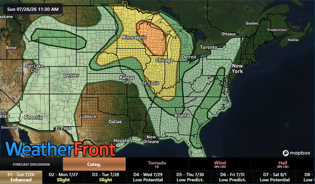
Today’s risk of severe weather will shift farther northeast, with an enhanced (level 3 of 5) risk of severe storms in place for Wisconsin. Severe storms capable of destructive wind gusts and very large hail along with a few tornadoes are expected across this region later today into tonight.
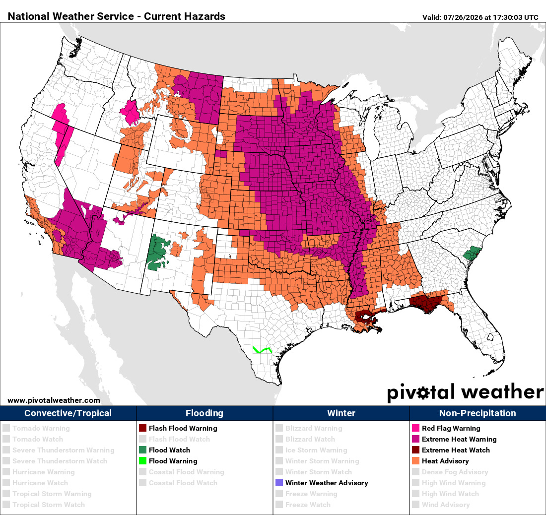
These storms are being fueled by an extreme combination of heat and humidity across the central part of the nation, with extreme heat warnings in effect for much of the region as heat index values are expected to climb above 110F in many locations today.
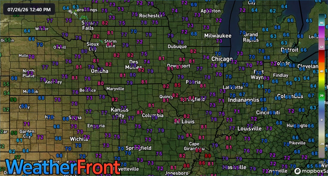
Dewpoints remain in the upper 70s to middle 80s across much of the Midwest early this afternoon, which is unusually high even allowing for the contribution that typically occurs this time of year due to moisture from growing agricultural crops. My retired NWS colleague Brandt Maxwell noted to me that this appears to be the most widespread coverage of 80+ degree dewpoints across the region since August 2023.
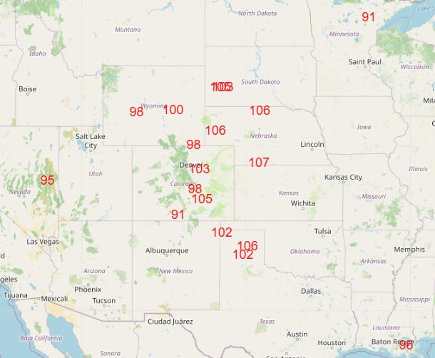
A number of record high temperatures are expected again today across the central part of the country, along with numerous record high minimum temperatures. In the Southwest, with a low of 95F on Saturday, Phoenix saw consecutive days with a minimum temperature of 95F or higher for the first time on record.
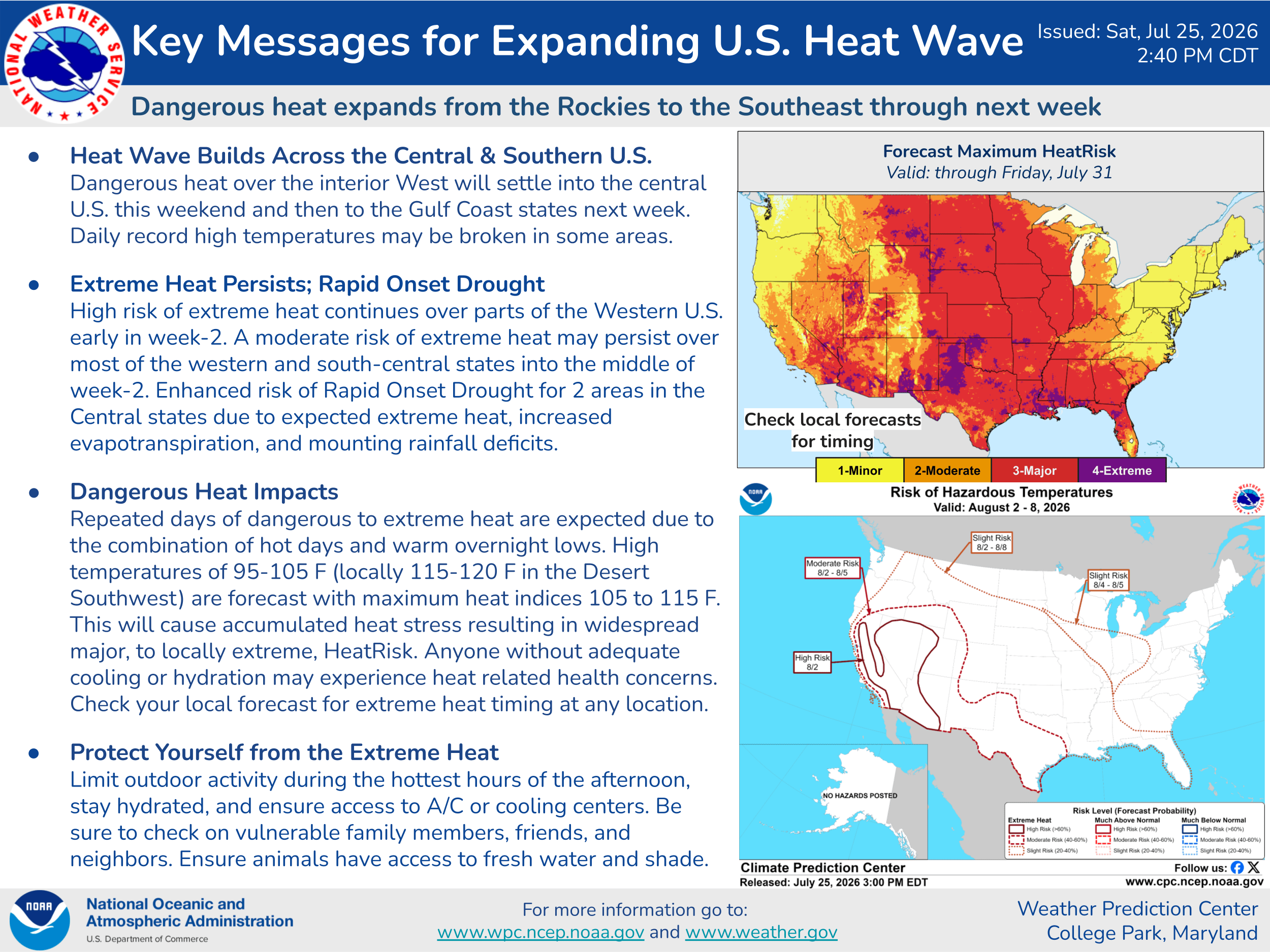
The heat wave is expected to expand early this week toward the Southeast, with prolonged heat expected across parts of the Intermountain West and Southwest into at least next weekend.
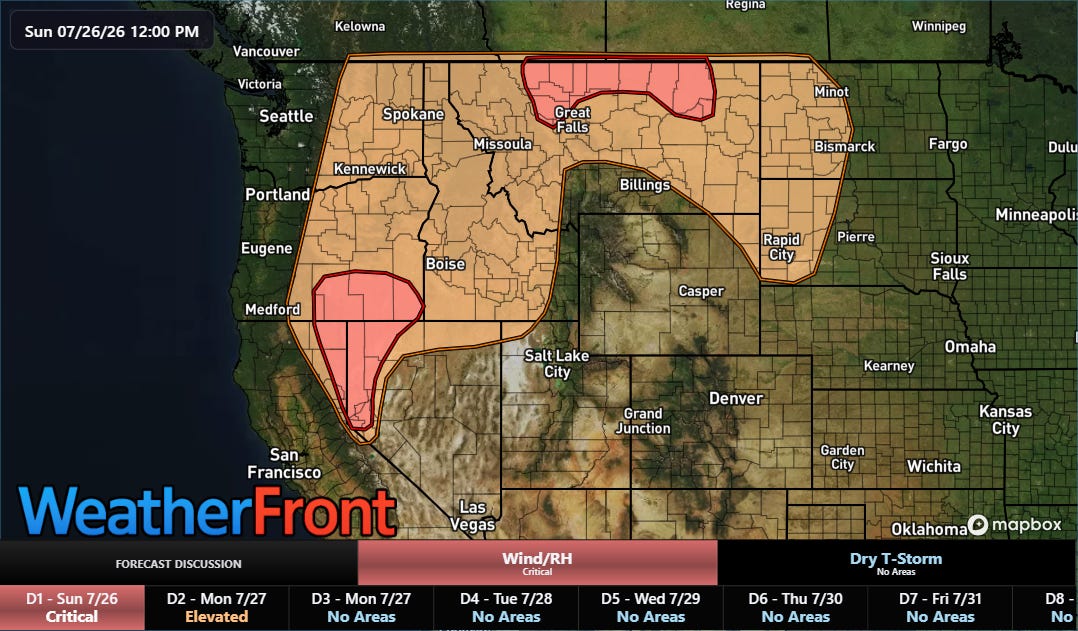
The Northwest states will see yet another day of elevated to critical fire weather conditions today as dozens of large wildfires continue to burn across the region, especially in Oregon.
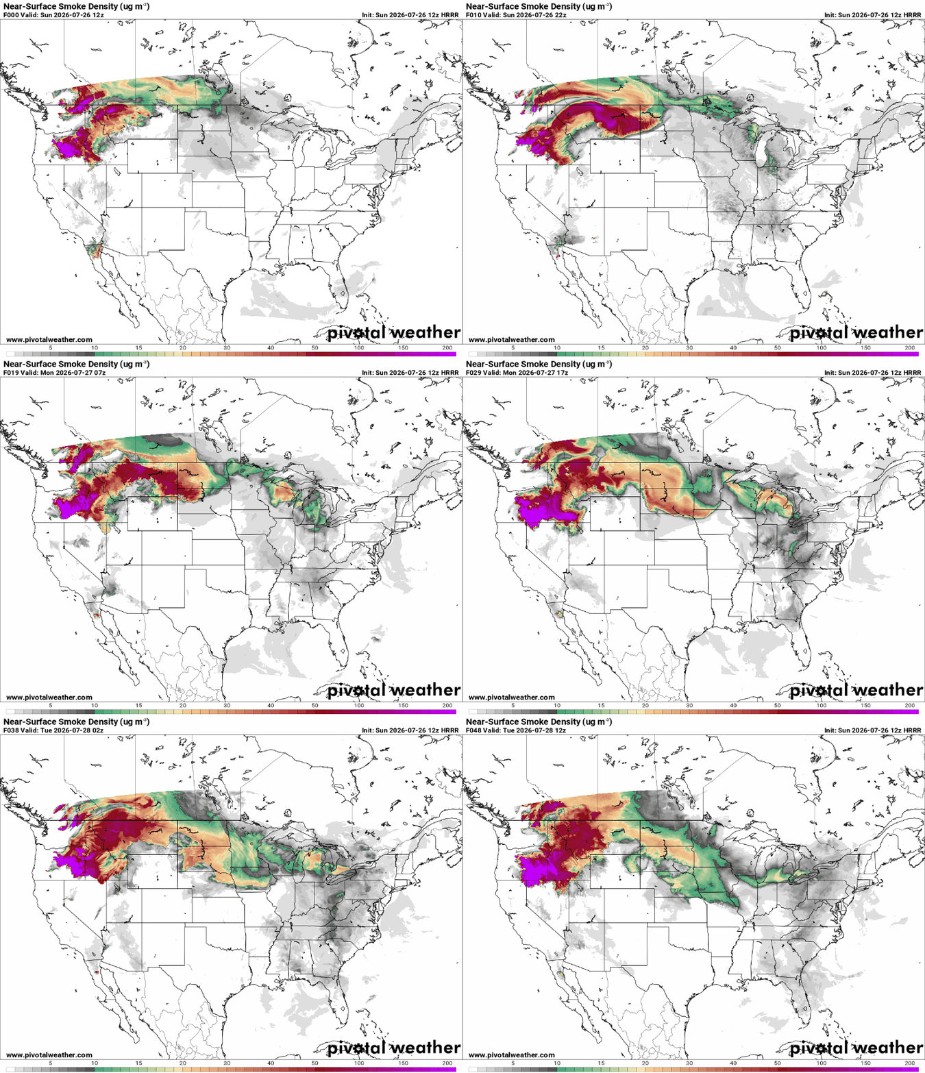
Forecasts from the High Resolution Rapid Refresh smoke model indicate that smoke from these wildfires will become an increasing issue for parts of the upper Midwest over the next couple of days.
Programming note: I am posting semi-regularly again — but family commitments and travel after the passing of my mom will mean those posts will not be as frequent or consistently timed as they typically have been.


Leave a Reply