
Severe weather caused damage and injuries Monday across the Northern Plains and Mid-South
Aug 18, 2026

Thanks to Balanced Weather subscriber FFSBoise for sharing yesterday’s edition of the comic Non Sequitur (one of my faves) in a comment on yesterday’s newsletter. Given what I have been writing about lately, I thought it would be a humorous (if somewhat depressing) way to start off today’s newsletter. I particularly like the “Lethal Hail” target.
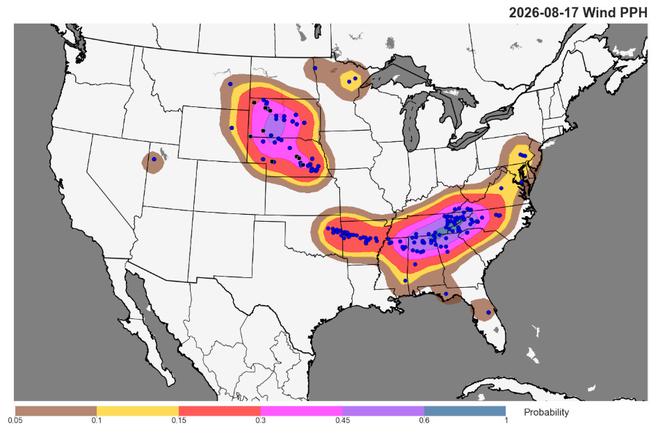
Yesterday ended up being a relatively active day for severe weather across the Southeast and Northern Plains, with over 300 reports of severe weather. There were several reports of significant (greater than 75 mph) wind gusts across the Northern Plains, including a 97 mph gust near Ardmore, SD and a 79 mph gust at the official observation site at the Grand Island, NE airport.
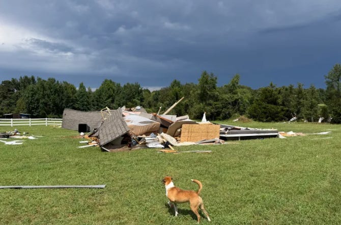
A complex of severe storms that moved across eastern Oklahoma and central Arkansas caused widespread tree and powerline damage and also damaged some homes, with the NWS in Little Rock reporting 3 injuries. The official observing site at the airport in Little Rock reported a 63 mph gust, and tens of thousands of customers lost power with PowerOutage.us showing that nearly 20,000 customers remain without power this morning along the track of these storms.
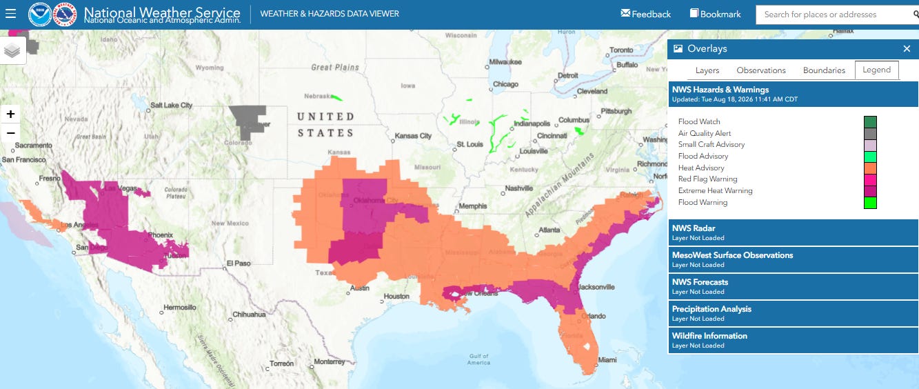
For much of the southern United States, the focus this week will remain on extreme heat as the large dome of upper level high pressure that has been dominating the Southeast will gradually build back more toward the Southwest and Intermountain West this week. Record warm temperatures are expected in parts of the south-central and southeast US the next several days — and extreme heat warnings and advisories are in effect.
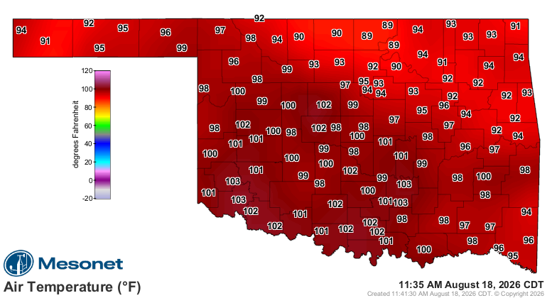
Oklahoma and north Texas will be seeing some of the hottest weather this region has seen in a few years. Temperatures were already in the triple digits across much of this region before Noon.
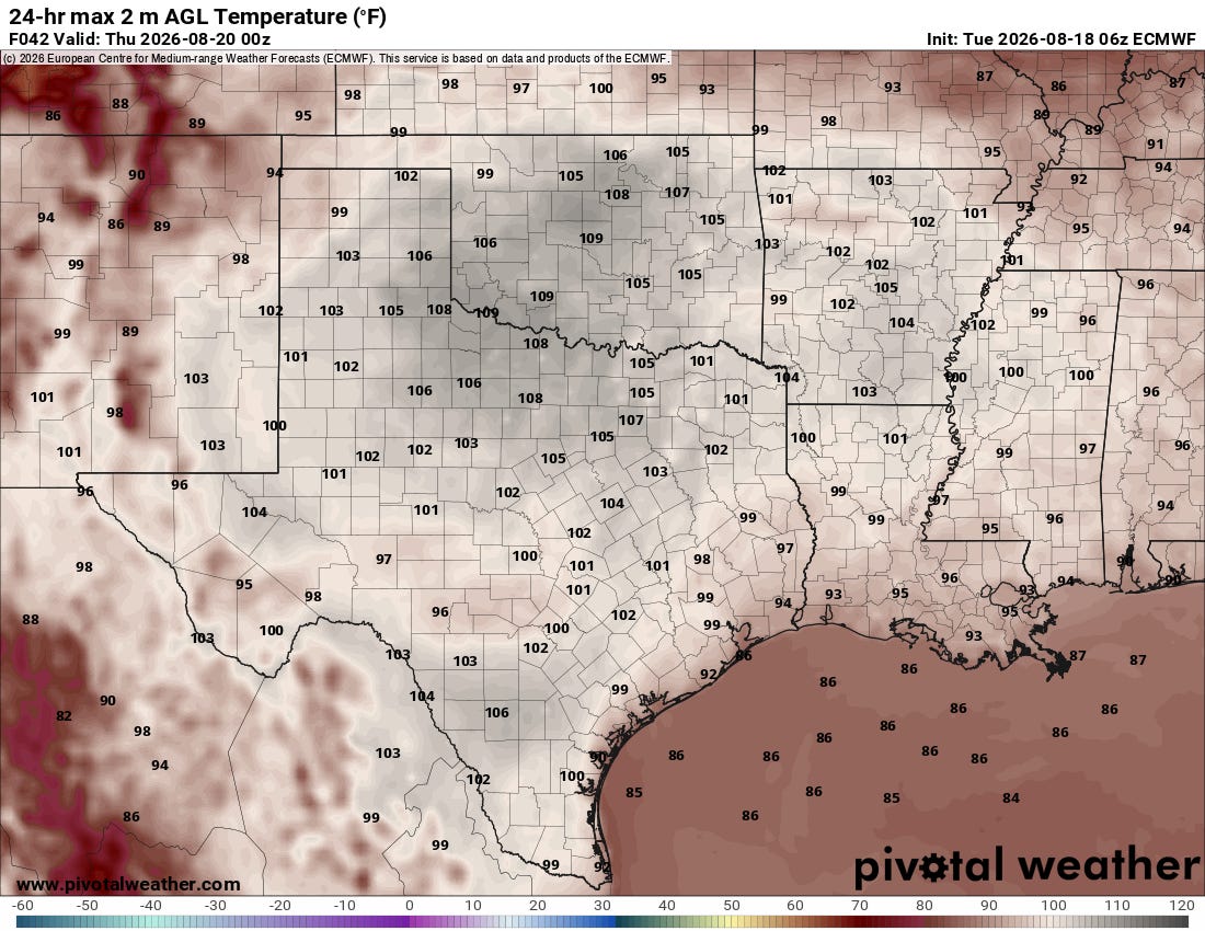
Afternoon high temperatures will peak in the 105-110F range today with Wednesday likely to be the hottest day for Oklahoma. If Oklahoma City hits 110F, it would be the first time since 2022 and would tie for the sixth hottest day on record. Luckily, humidity will be lower here as building drought is resulting in drier (and hotter) air in this region.
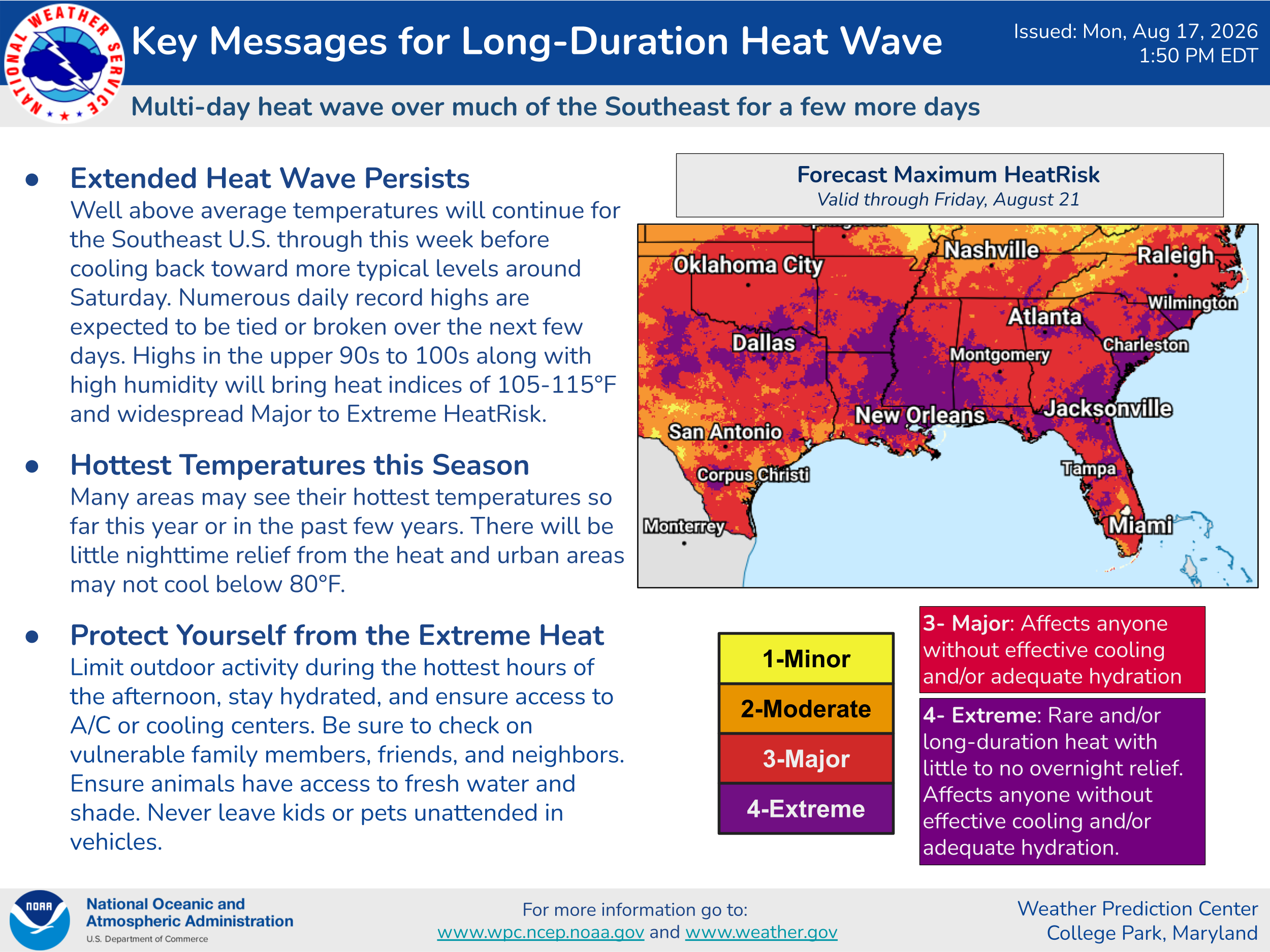
The very hot temperatures will still result in major heat risk in this area — and humidity will be much higher to the east this week over the Mid-South and Southeast where large areas of extreme heat risk are expected
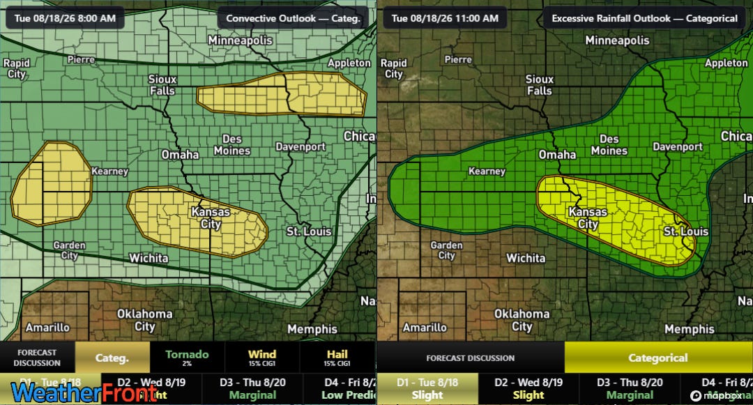
While not as potent and widespread as we saw last week (nearly 100K customers are still without power in northwest Indiana from the derecho a week ago), thunderstorm complexes will still be an issue across the Midwest to the north of the high pressure area. Slight risks of severe weather (left) and flash flooding (right) are in place as shown above.
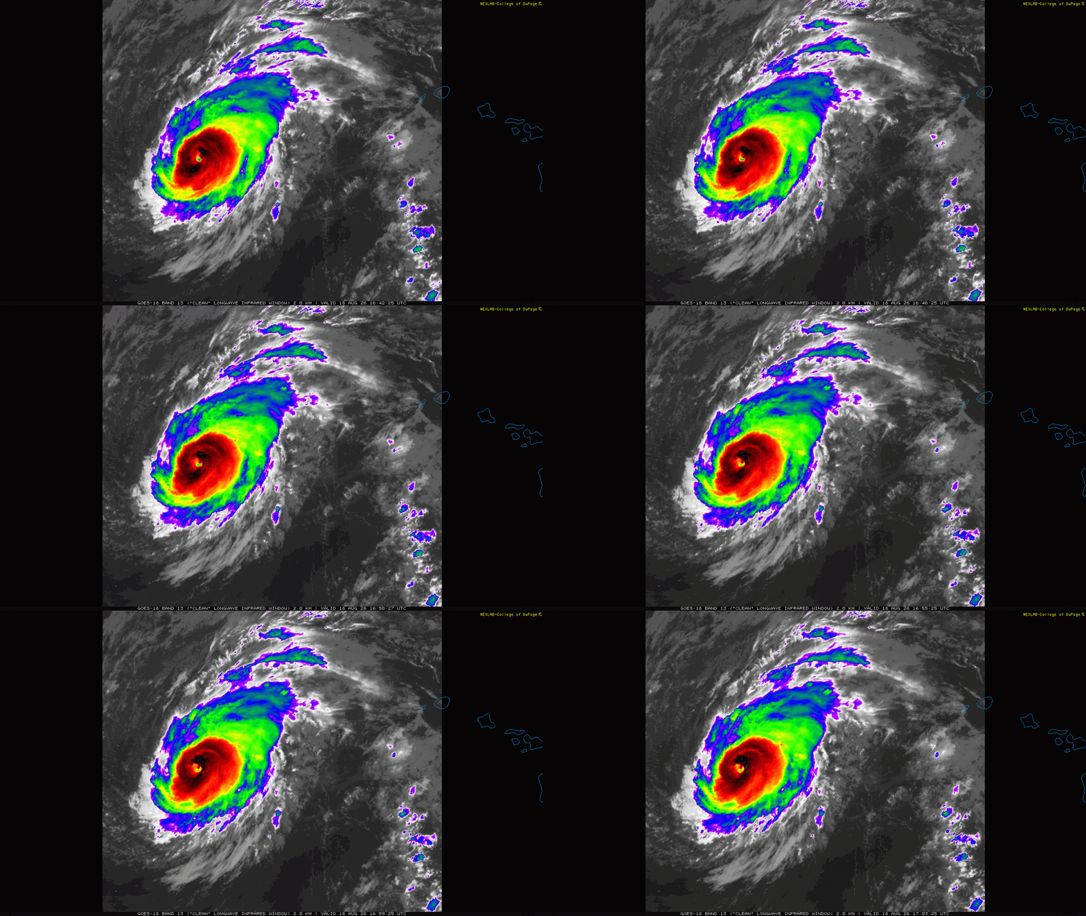
Lala has become a hurricane again as it continues to move farther away from the main Hawaiian islands, and certainly on satellite looks the most impressive it has at any time during its existence. Cold-topped thunderstorms are wrapping around a relatively apparent eye in infrared satellite. NHC is estimating it to have 85 mph sustained winds. It is now forecast to intensify to a category 2 hurricane with 100 mph winds — and NHC said in its technical discussion this morning that it could get more intense than that given recent trends and the anticipated environment ahead of the hurricane.
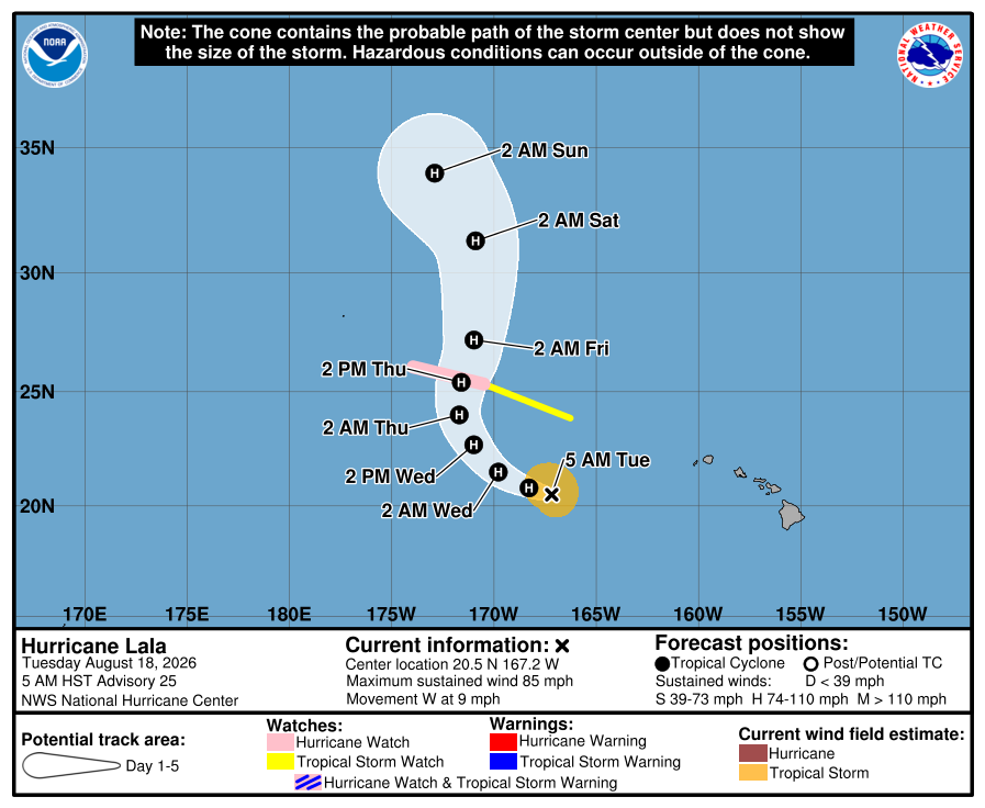
Luckily Lala should not pose any additional threat to land other than the small islands of the Papahanaumokuakea Marine National Monument northwest of the main Hawaiian Islands, where a hurricane watch is in effect from Lisianski Island to Maro Reef.
Hawaii is slowly recovering from its encounter with Lala, which produced as much as 43” of rain (before and after Lala video of same waterfall above, courtesy CNN) above and numerous hurricane force wind gusts. State officials now report one fatality and more than 100 homes and roads destroyed on the Big Island with significant damage on the other islands as well. More than 50,000 customers remain without power in the state per PowerOutage.us.


Leave a Reply