
Last weekend in August will see extreme heat in many parts of the globe
Aug 28, 2026
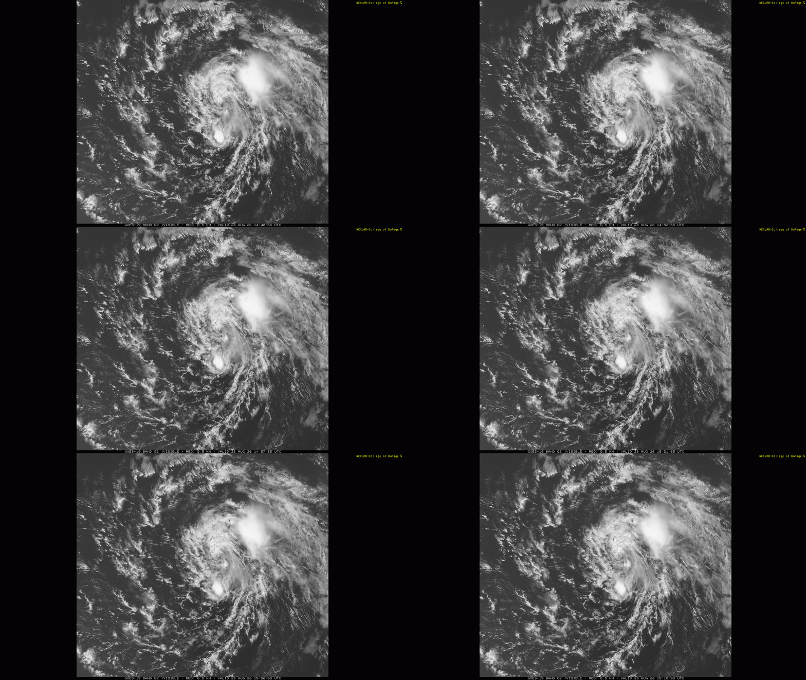
Well, that didn’t take long. The National Hurricane Center has already issued its final advisory on Tropical Storm Dolly, just 24 hours after it developed. To be honest, it does not look a whole lot different to me on visible satellite imagery than it did yesterday — but NHC reports that Dolly passed just to the north of a NOAA buoy that did not report westerly winds, indicating that it no longer has a closed circulation and has degenerated back into a tropical wave.
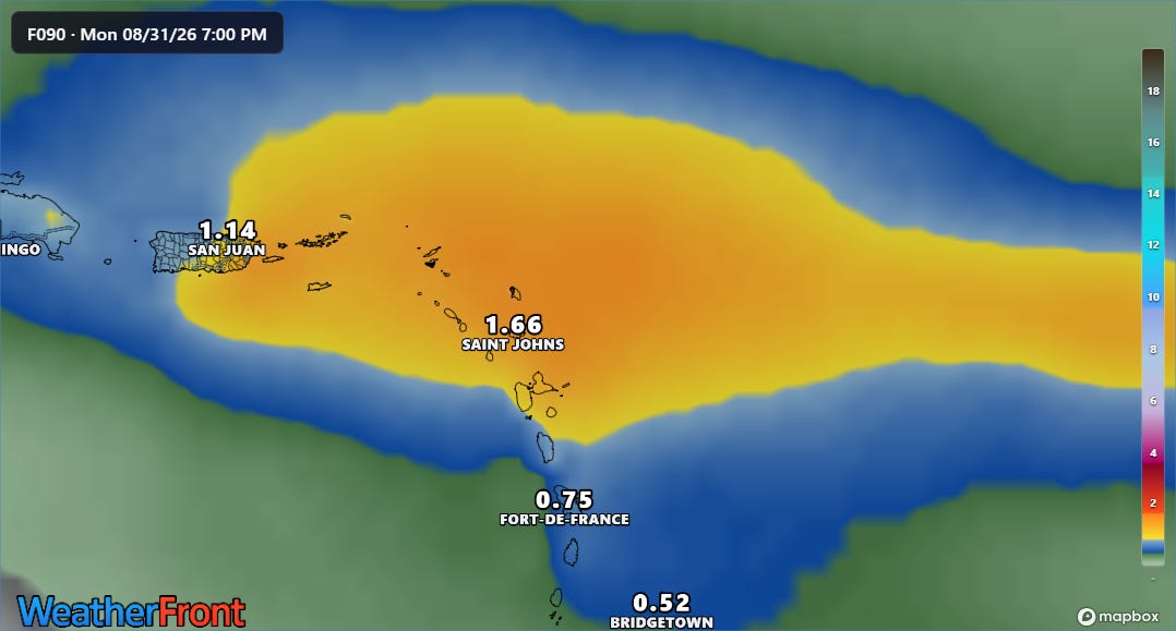
Given the rapid weakening of the system, the expectations for it as it crosses the northeast Caribbean have not changed much, with 1 to maybe as much as 3 inches of rain anticipated. While most of this rain would be beneficial given ongoing drought in the region, some concern for flooding exists in the higher elevations of the Leeward Islands.
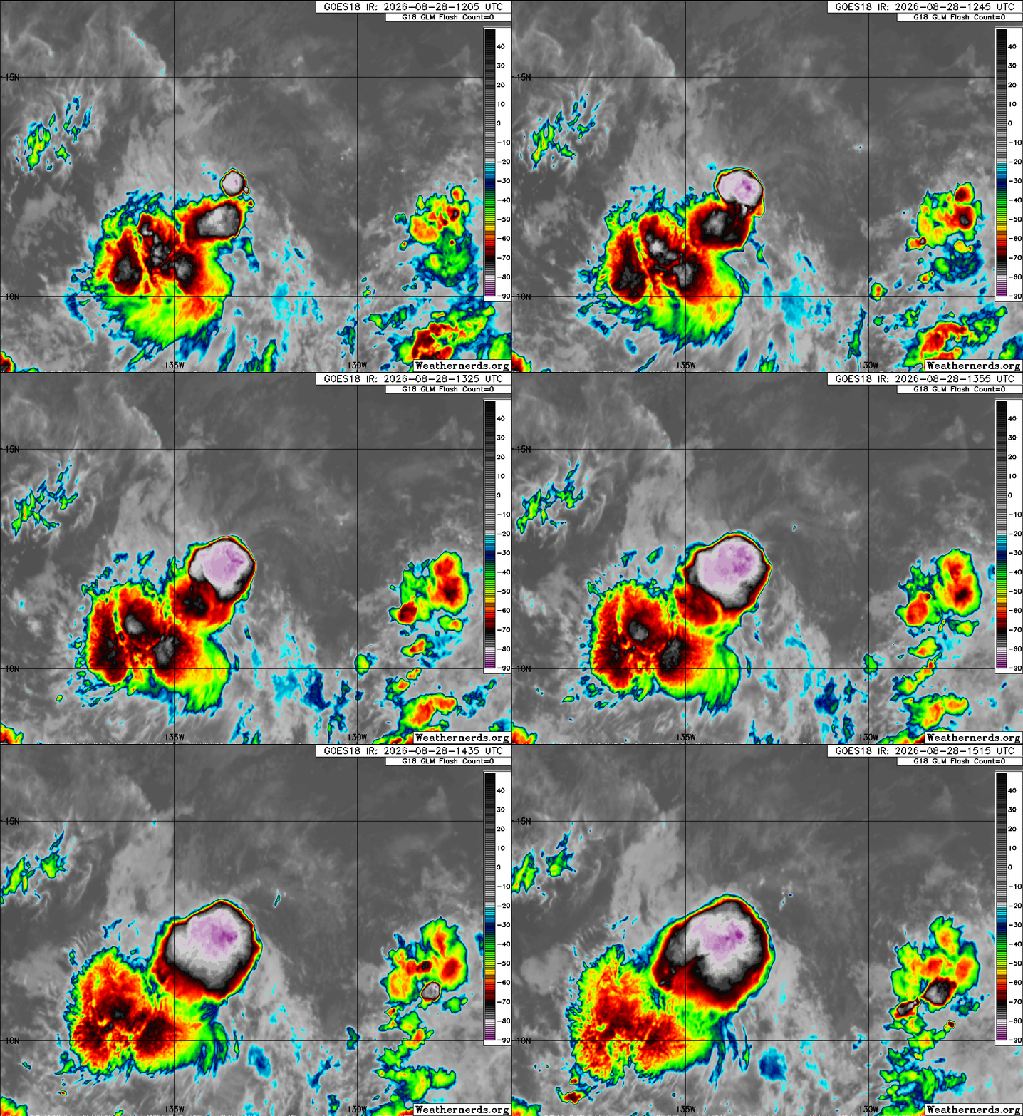
Perhaps of more ultimate interest to US interests in the tropics is Tropical Storm Lowell. Lowell is early in its genesis process, just designated as a system by NHC yesterday. It is currently undergoing some easterly shear, which is causing its intense thunderstorms to be west of the center.
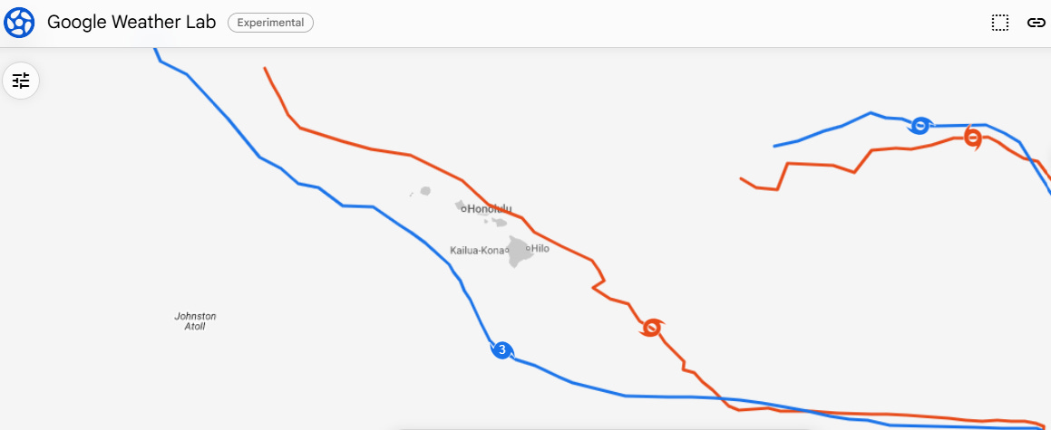
The disruptive shear is expected to diminish and Lowell is forecast by NHC to intensify to a 110 mph hurricane by early next week. While still more than a week away, the long range models suggest that Lowell could once again pose some risk to Hawai’i. The Google DeepMind AI model (blue in map above) shows a track for Lowell coming up from the south and passing southwest of the islands. The European AI model tracks even farther south, while the mean European physics based model (orange track) is just north of the islands but looking at the individual members it shows a very wide dispersal of tracks from well south of the islands to farther north.
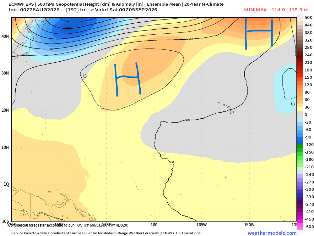
The steering flow next week in the central Pacific looks disjointed as one piece of the upper level subtropical ridge will be shifting northeast of Hawai’i while another builds to its northwest near the International Date Line, leaving the area around Hawai’i in somewhat weak mid and upper level steering flow. The bottom line is that given the pattern and time range for now anticipating where Lowell goes beyond the next week is quite uncertain, but it is worth keeping an eye on as we head into the weekend.
Outside of the tropics, record heat was once again a big story on Thursday, with several locations hitting record highs including Las Vegas with 111F. Even more impressive were the record warm minimum temperatures, as Las Vegas tied an all-time monthly record with a low of 92F. Interestingly (?), all of the 90F+ minimum temperatures in August in Las Vegas have come since 2018, with the exception of a lone 90F on August 12, 2003.
Phoenix also tied its all-time record warm minimum for August with a low of 95F on Thursday. Here as well, August warm minimums have been increasing in recent years, with all but one of the top 50 warmest August low temperatures occurring in the 2000s (lone exception, 92F on August 10, 1995). The majority have occurred since 2020.
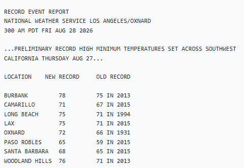
Numerous record warm minimums also occurred in southern California on Thursday.
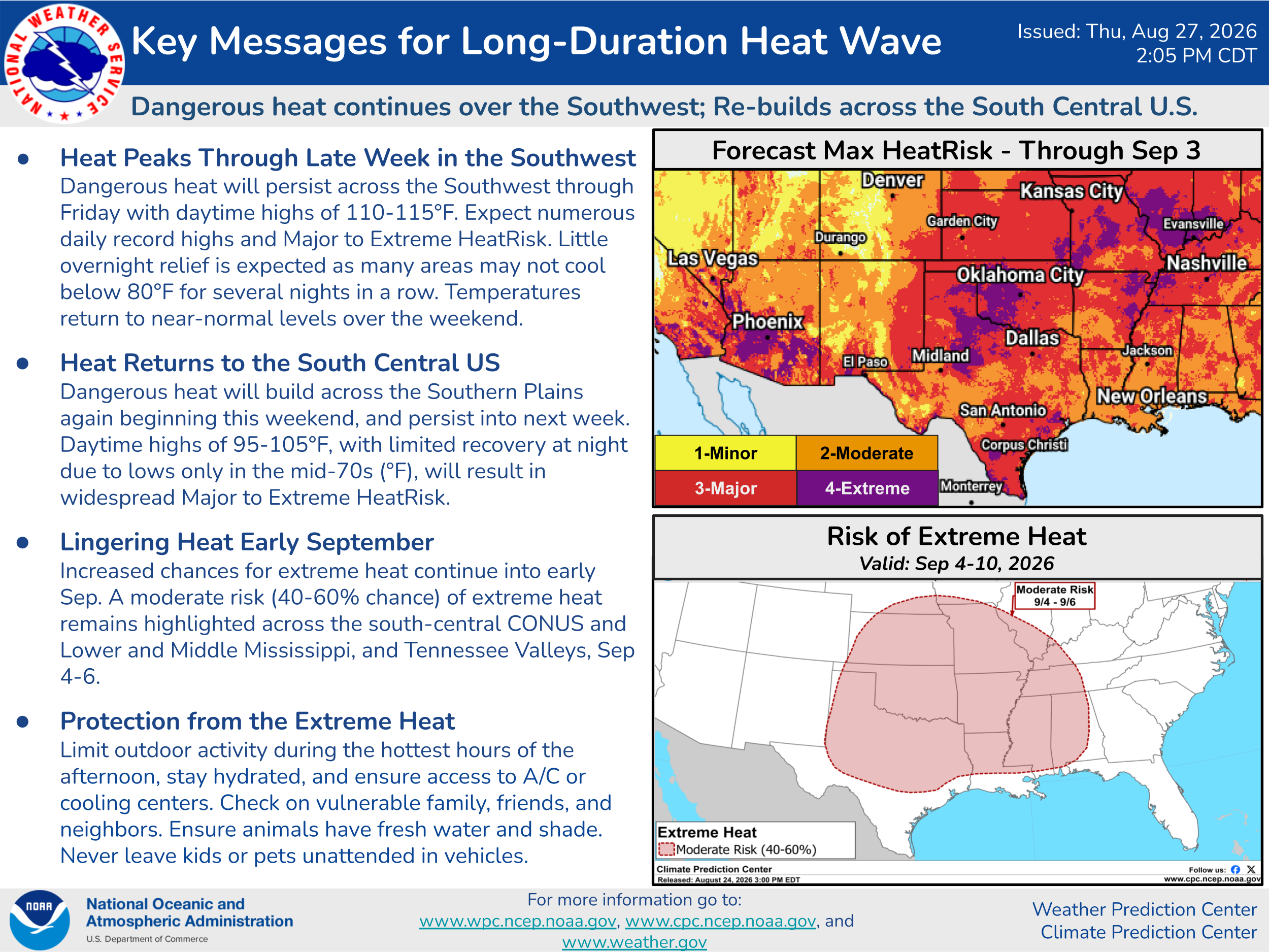
The extreme heat will gradually be shifting east back into the south-central United States this weekend, and looks likely to expand into parts of the Midwest next week.
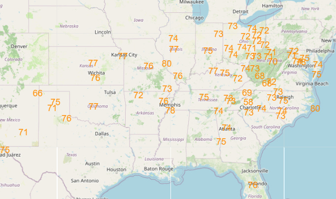
Much of the East will also be seeing increasing warmth and humidity into next week, and by the middle of the week record warm minimum temperatures are expected to be widespread across a large swath of the country east of the Rockies (above: NWS forecast min temperatures near or above record warm readings for next Wednesday).
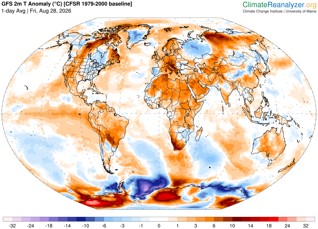
The unusual heat is certainly not unique to the United States, as many sections of the globe are dealing with ongoing record heat waves. As reported by climatologist M. Herrera on his Extreme Temperatures around the World Bluesky account, South America, South Africa, eastern Asia and the Mediterranean regions are dealing with particularly brutal heat. A number of locations in north Africa set all-time record warm temperatures, with spots in Algeria and Tunisia seeing afternoon highs near 50C (122F).
Locations in Brazil, Colombia, and Paraguay — where it is winter — have reached 41C (106F), and as he notes Brazil set a record today for warmest winter night.


Leave a Reply