
In weather, a Saturday tropical deep dive
Aug 29, 2026
Happy weekend! Starting off this morning with a story from the Texas Tribune detailing that the Trump Administration has still not approved the federal disaster request from the state of Texas for the disastrous mid-July flash floods that hit the Hill Country and other surrounding areas of southern Texas. Of course, for parts of the Hill Country this was the second disastrous flash flood in a matter of a year, and that is making recovery from this flood even more precarious:
In Kerr County, where many residents are recovering from a second flood in two years, the community doesn’t have the money to give everyone the needed temporary places to stay, help fixing or replacing vehicles and help making homes liveable again, said Todd Bock, executive director of the Kerr Economic Development Corporation. “We’re in desperate need of that (federal aid) in order for us to start on what we call a full recovery,” Bock said.
Last year, Trump signed off on major FEMA help including for individuals within days of the deadly July 4 flood, which received significant media attention and caused at least 137 deaths, including 119 in Kerr County alone.
To be clear, Texas is not alone in dealing with significant delays in obtaining a federal disaster declaration. Analysis conducted by the Texas Tribune as well as the Urban Institute shows that the time between submission of a federal disaster request by a state and a final decision by the President has taken 9.5 weeks, three times longer than the average from 2000 to 2024 of 3 weeks.
While White House spokespeople say that these delays are due to President Trump wanting to ensure he takes “‘great care and consideration’ to make sure tax dollars are well-spent and that the federal government isn’t stepping in where states are responsible,” these delays are much longer than what were observed in the first Trump Administration. New FEMA Administrator Cameron Hamilton also appeared to undercut this explanation for the delays when he pledged during his confirmation hearings that he would work to speed up the approval process. While obviously it is important that due diligence must be taken with the review of disaster requests, that consideration must be balanced against the reality that time is of the essence for disaster victims to receive critical aid.
Texas is at least lucky in that it is a state that voted for President Trump, which may mean a greater likelihood that their disaster request is ultimately approved. Analysis by the Associated Press showed that the president “has approved more than three-fourths of the requests from states that voted for him in the 2024 election but less than half the requests from states that did not. Although there are federal criteria for disaster aid, decisions ultimately are at the president’s discretion.”
All of this is taking place while Congress and the President consider the recommendations of a President Trump appointed FEMA review panel to make major changes to the agency and the federal emergency management structure. While there is healthy debate within the disaster community about what changes would be of most benefit, I think it is safe to say that there is broad consensus that new directions are needed.
One place where that consensus exists would be enabling FEMA to move faster to bring federal resources in to provide relief and support recovery after disasters. At the meeting announcing the FEMA panel’s recommendations, former Virginia Gov. Glenn Youngkin, a council member, said “these recommendations are all about accelerating federal dollars, streamlining the process, making it less bureaucratic so that Americans can get the help they need on the worst day of their lives.”
What we are currently seeing from this administration and FEMA seems to be the opposite of meeting this goal. Now that FEMA Administrator Hamilton was confirmed in his position earlier this month, it will be interesting to see if he can make good on his pledge to improve the situation.
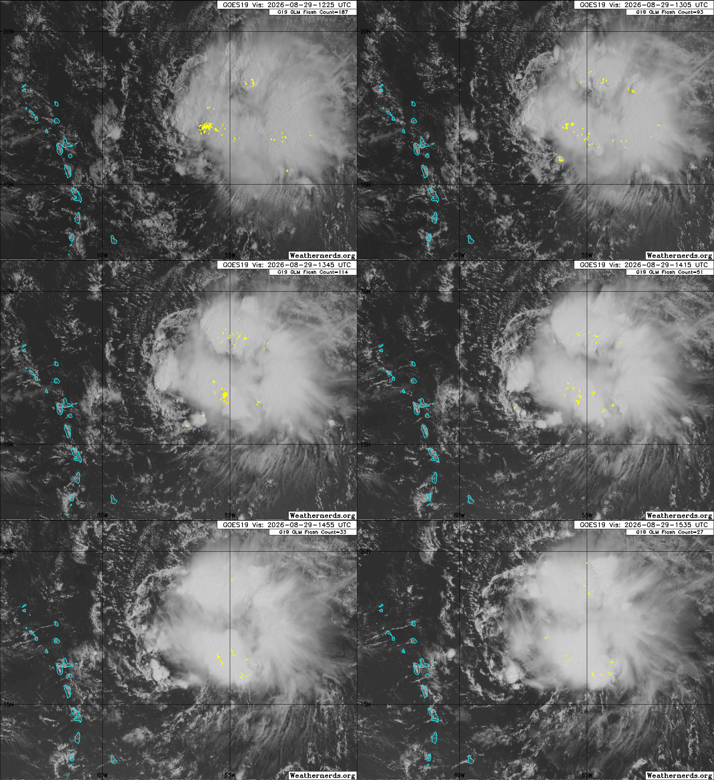
Quite a bit going on in the tropics this morning, so I am going to take a deeper dive into what is cooking. While the remnant of Dolly may no longer have a closed circulation, it looks pretty healthy from a overall perspective with numerous thunderstorms wrapping around the tropical wave. Interesting note: one of my fellow retired colleagues who worked at the National Hurricane Center noted to me that many systems show a surge in thunderstorm activity as they cross 55 degrees west longitude as the remnant of Dolly currently is doing.
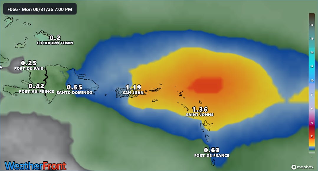
Conditions ahead of the wave for the next several days still appear rather hostile, and the model forecast expectations of rainfall across the northeast Caribbean have not changed much since yesterday. The longer range models have become slightly more bullish on the idea of something potentially redeveloping from the remnants of Dolly once it tracks farther northwest into the area around Florida or the eastern Gulf. This is still a low probability but we will keep an eye on it.
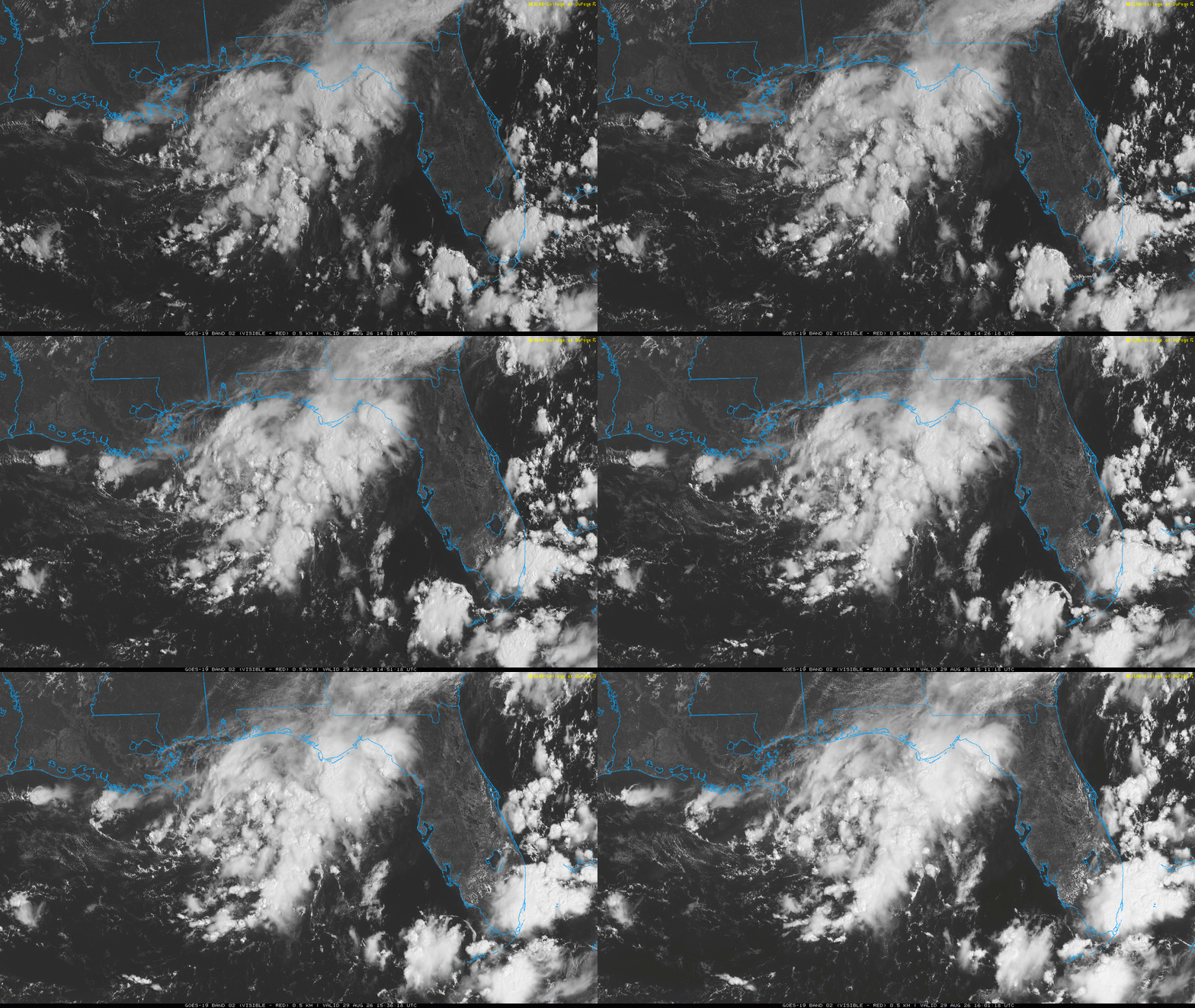
NHC is also monitoring an area of thunderstorm activity in the northeastern Gulf that is showing some signs of developing a bit of organization. This area is currently in a favorable area of upper level support for thunderstorm development, and shear is forecast to diminish with time across the northern Gulf. The models are not very bullish on development, and NHC only puts a 10% chance on something forming out of this area. However, these are the kind of “home brewed” systems that can cause issues even in El Nino years, so we will of course watch it.

In the eastern Pacific, we continue to have tropical storms Lowell and Karina to keep an eye on. Lowell looks as if it will only slowly strengthen as it moves west the next several days, with the models now in pretty good agreement that it will move mainly west to a a position well south of the Big Island in about 7-10 days. Beyond that it should be in that area of weaker steering that I discussed yesterday, and the Google DeepMind AI continues to turn it more northwesterly in the general direction of the western Hawaiian Islands. That is obviously still a long ways out, so again just something to keep an eye on.
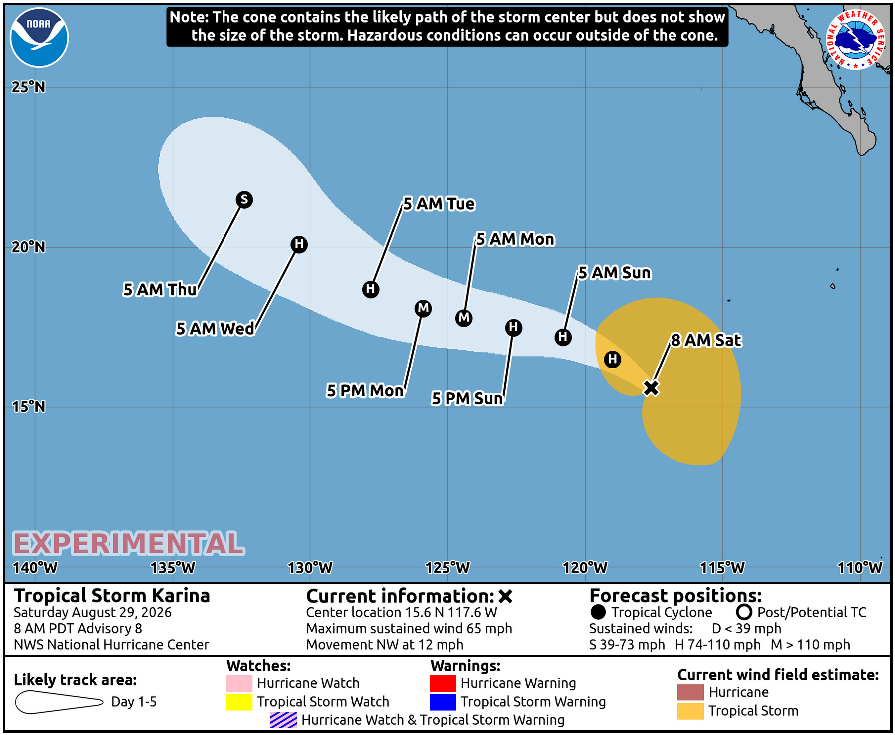
Karina looks as if it will intensify more quickly and significantly, and is likely to become a major hurricane in a few days before weakening. It will be moving west-northwest well away from any land.


Leave a Reply