
NOAA Hurricane Hunter research mission en route to the storm
Sep 02, 2026
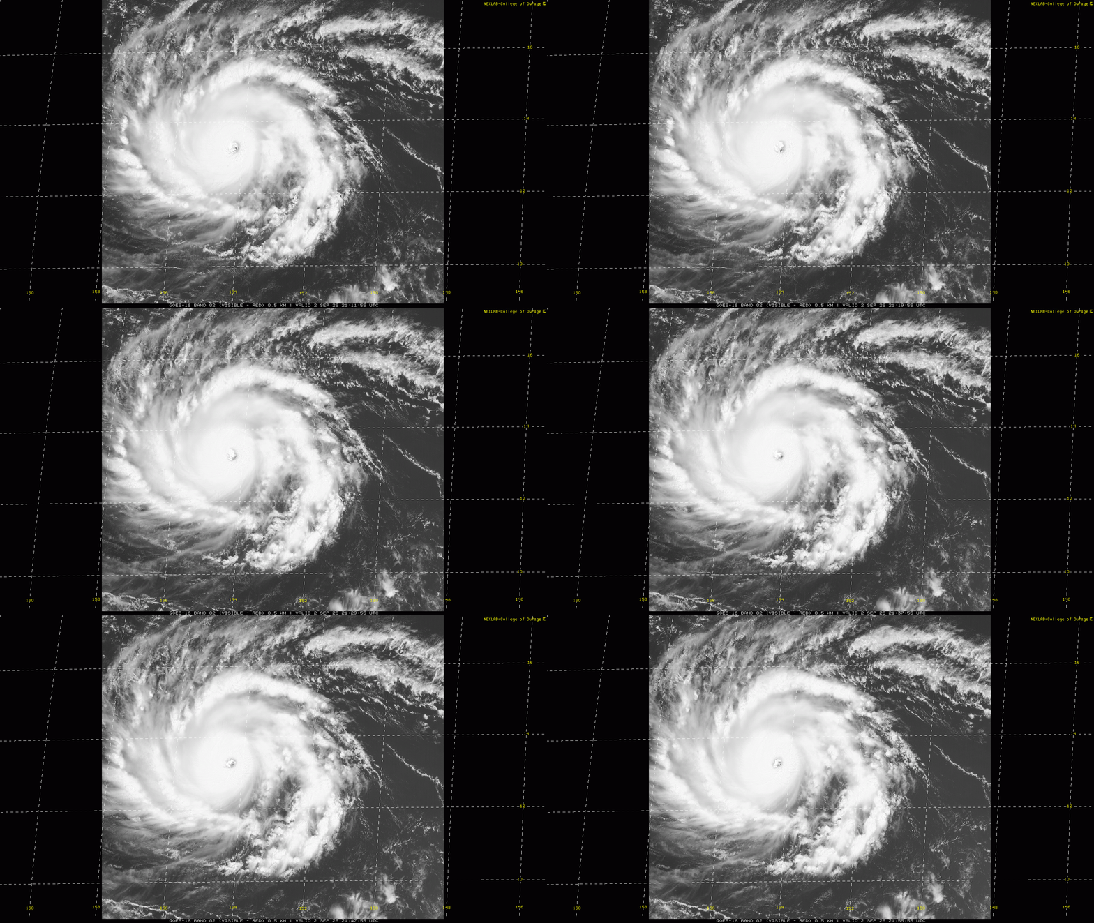
After taking several days to get its act fully together, Lowell has taken off in the last 48 hours, and this afternoon based on satellite estimates the National Hurricane Center designated it as a category 5 hurricane on the Saffir-Simpson Hurricane Wind Scale (SSHWS) with maximum sustained winds of 160 mph. Visible satellite imagery certainly shows an impressive hurricane, with a stadium eye and what appear to be mesovortices rotating within it. A NOAA Hurricane Hunter research mission will be in Lowell this evening and will give us an even better estimate of its intensity.
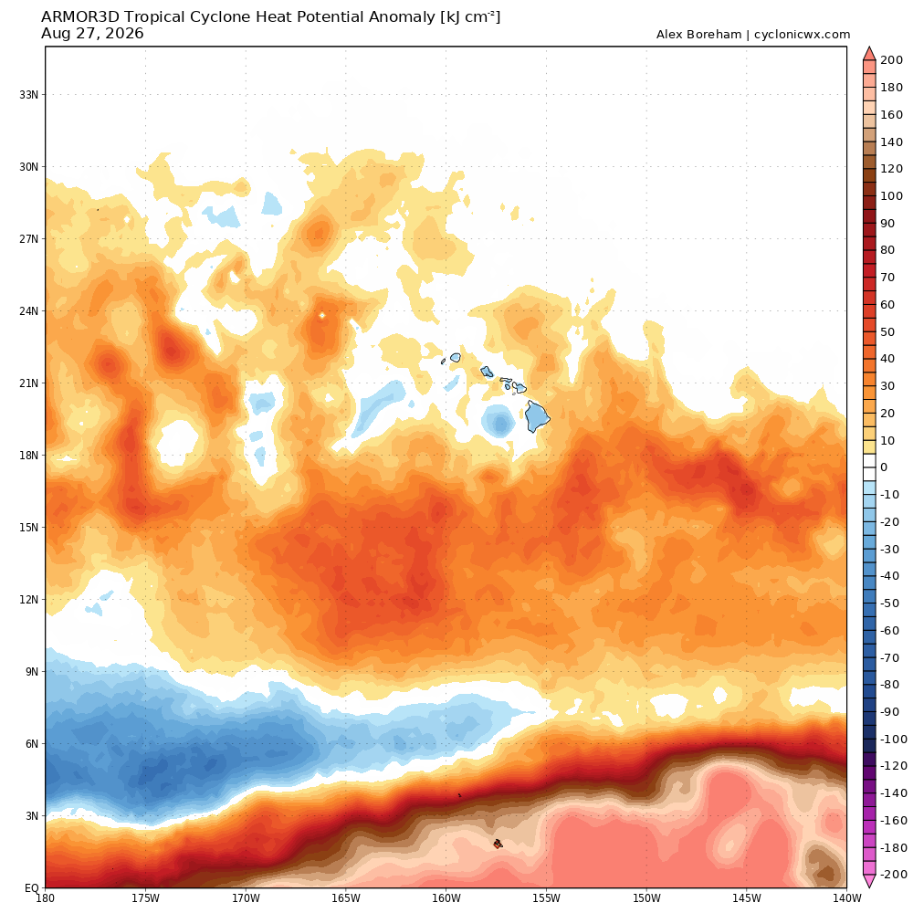
Lowell is moving west at about 10 mph and that motion is expected to continue for the next few days. Oceanic heat content is well above normal in the area south of Hawai’i where Lowell will be moving and shear is expected to be light, so Lowell is expected to remain a major hurricane for the next several days. The intensity will likely fluctuate though due to internal changes that are difficult to forecast such as eyewall replacement cycles.
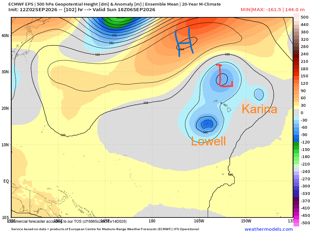
Lowell is currently being steered west by a strong piece of the middle and upper level subtropical ridge to its north. However, the steering pattern near Hawaii is going to change dramatically over the upcoming weekend. That area of high pressure will weaken as whatever is left of Hurricane Karina moves northwest and another upper level low develops to its northwest. This low will be drifting west underneath a strengthening area of of upper level high pressure to its northwest. The mean impact of all of this will be for Lowell to shift from a westerly motion to a northerly motion.
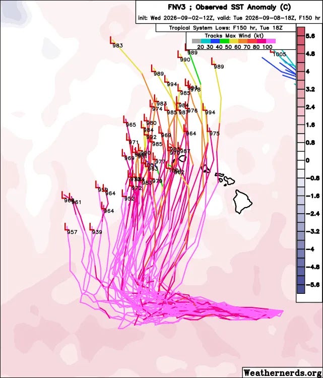
Given all of these different features that will be interacting, this is a very complicated forecast situation and the timing and longitude of Lowell’s turn to the north and how much motion east of north might be imparted on the storm is very uncertain. However, over the last couple of days guidance has overall been shifting east with the track, and the reliable model ensembles are now certainly close enough to Hawai’i for it to be of some concern. For example, the very reliable Google DeepMind AI mean track is now not too far west of Ni’hau — and as shown above, many members now take the system over or close to Kauai and a few as far east as O’ahu or Mau’i.
How strong Lowell will be as it moves north and reaches the latitude of Hawai’i of course is an even bigger question. It will be starting to move north of the most favorable warm ocean conditions — so how intense it is when that turn north occurs and how quickly it moves will be a key. Right now, the mean forecast from the GDM has it as around a category 2.
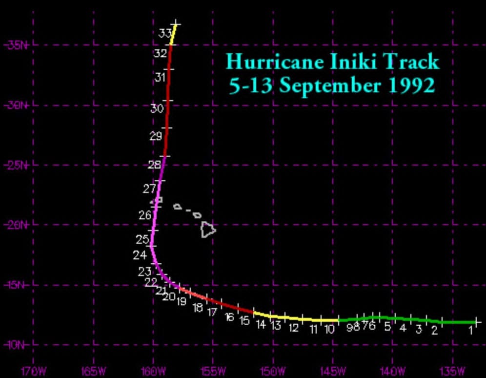
While I am definitively not saying Lowell is going to be a repeat of Hurricane Iniki in 1992, I do want to show the track from that hurricane to remind people that this is the type of general setup that resulted in Iniki causing devastating damage to Kauai. Again, we are a long way from this being an expectation for Lowell — but it shows why we do need to be keeping a close eye on this hurricane for the next several days.
Finally, there has also been a lot of discussion in California about Marie, which is about to become a hurricane to the southwest of Mexico. Rather than going into a lot of detail about that setup, I am sharing this excellent and detailed post from my colleague Dr. Daniel Swain which gives a great overview on Marie and everything else happening on the West Coast over the next several days.


Leave a Reply