
Severe thunderstorms will create issues today in parts of the East
Sep 02, 2026
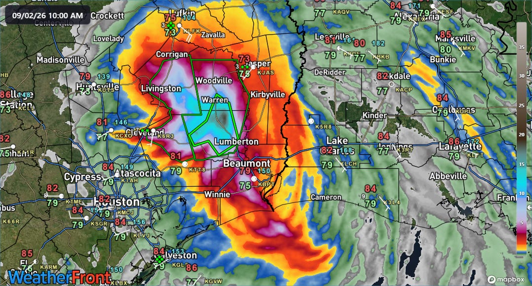
TS Edouard may have been a small tropical cyclone that only made it to strong tropical storm status, but it once again served as a reminder that any landfalling tropical system can cause serious issues. For these weaker systems, heavy rainfall and flash flooding are typically the dominant issue, and that was the case here as well. NSSL Multi-radar Multi-sensor System (MRMS) 24-hour rainfall estimates (above) show an area of 10+” of rain centered over the area of Texas between Beaumont and Lufkin, with a maximum area near 20” just northwest of Lumberton.
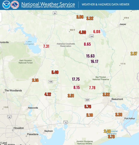
Rain gauge measurements support these estimates, with multiple gauges west and north of Lumberton reporting more than a foot of rain, with a max of 17.75” in western Hardin County.
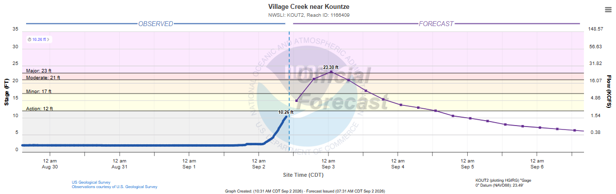
Flash flood emergencies have been issued by the NWS in this area, and numerous roads are closed and some structures have flooded. This area has been dry in recent weeks — East Texas is in moderate drought status per the US Drought Monitor — but even so this rainfall will push several area streams into flood, with Village Creek near Kountze forecast by the NWS to reach major flood stage.
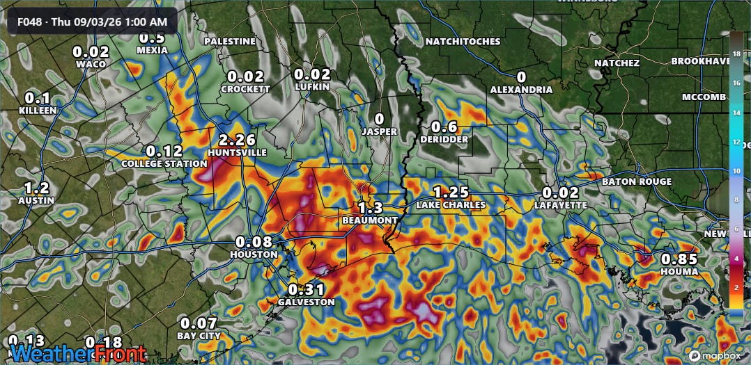
Edouard has definitely been an overachiever with its rainfall as even model forecasts as late as Tuesday’s early morning runs (HRRR 2-day rainfall forecast shown above) were relatively muted in their rainfall forecasts.
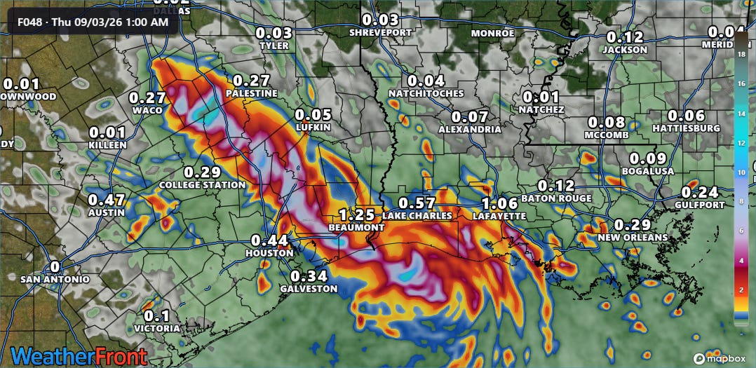
NOAA’s new high resolution model the Rapid Refresh Forecast System (RRFS) did a much better job in showing a corridor of 6-12” of rainfall with isolated higher maxima along the path of Edouard. As the day went on and Edouard showed increased organization and intensity, the model forecasts gradually caught up. Kudos to my colleague Matt Lanza noting in a post on his Substack that I shared yesterday afternoon raising awareness of the trend toward a more serious flood risk.
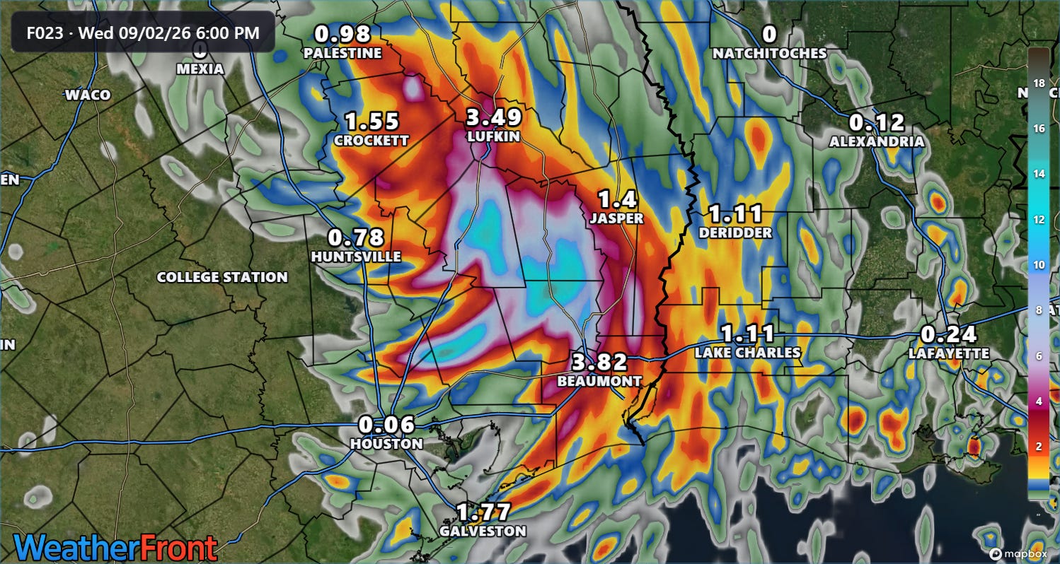
By last evening’s run of the HRRR, it had a much better handle on the rainfall forecast as I shared in my live chat about Edouard’s landfall. Of course, we were much closer to the event by then and the heavy rainfall was ongoing.
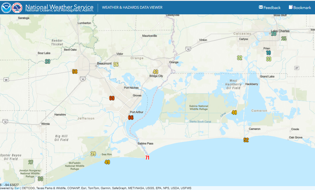
Rainfall was not the only impact with Edouard. While confined to right along the track of the small system, active intense thunderstorms associated with the center of the storm were quite efficient in producing strong winds as the center moved onshore and inland between Sabine Pass and Cameron, LA. The official observing site in Beaumont-Port Arthur reported sustained tropical storm force winds as high as 44 mph as the center moved by with gusts as high as 69 mph. The NOAA National Data Buoy Center observing system as Sabine Pass reported sustained winds of 56 mph and a gust as high as 71 mph as the storm made landfall.
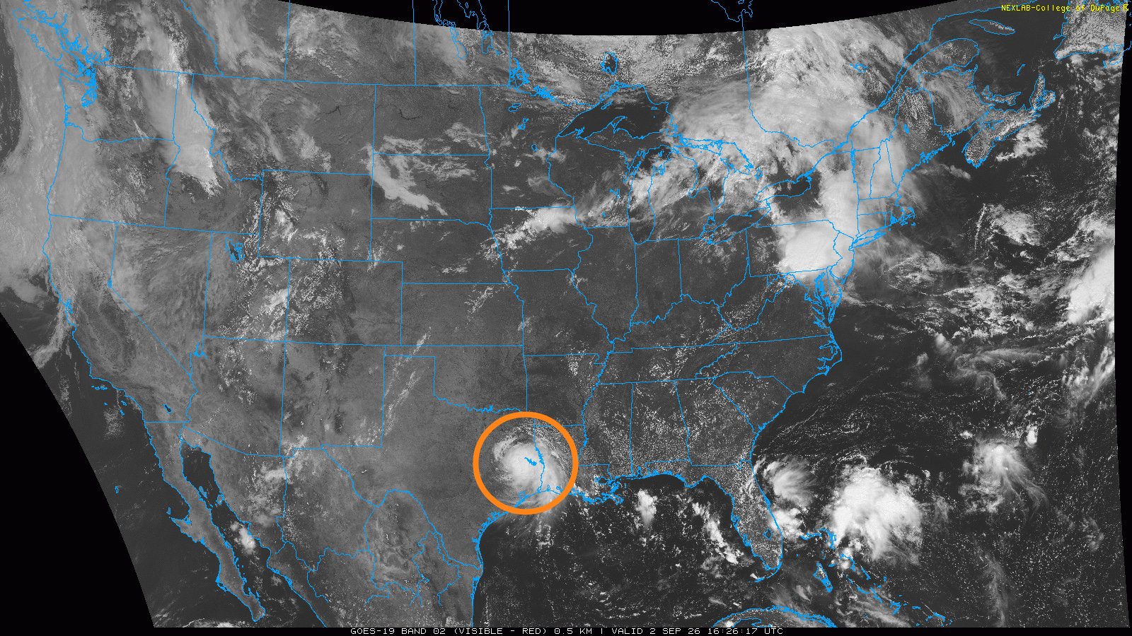
So in addition to the flooding, more than 70,000 customers are without power this morning in east Texas due to wind impacts from Edouard. Edouard is a reminder (including to me!) of the impacts even a small, middling tropical storm — look at how small and isolated it looks in the visible satellite image above — can produce. Luckily for the Houston metro area, Edouard was as we have been discussing a small compact system, and it staying just to their east meant that the metro area was largely spared any issues from the storm.
Edouard is not quite done with Texas — it still has a well defined circulation as it passes just west of Lufkin. Bands of intense showers and storms will continue to rotate around it this afternoon and into tonight as it moves northwest, with additional flash flooding possible.
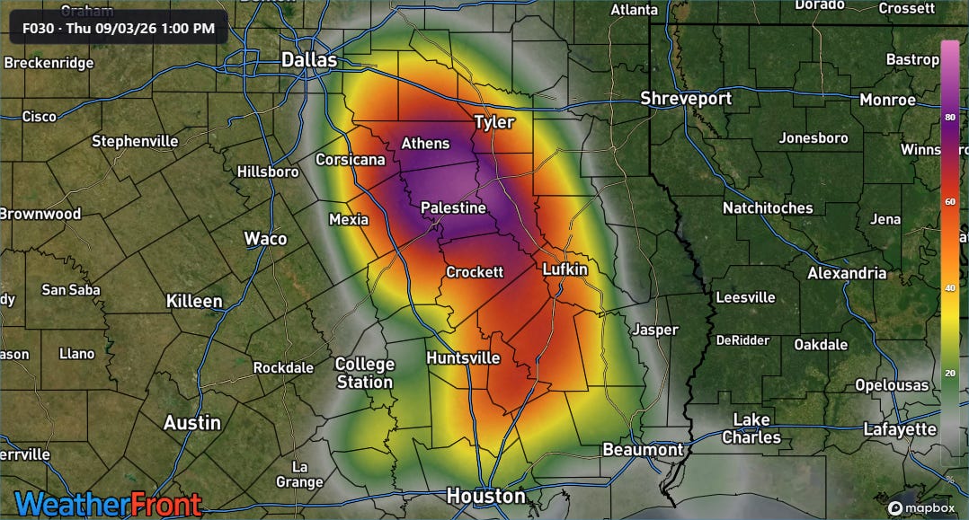
The area along and just east of the Interstate 45 corridor looks to have the greatest risk for additional flooding impacts over the next 24 hours. A tornado or two is also not impossible this afternoon in this region with the strongest of any storms that develop.
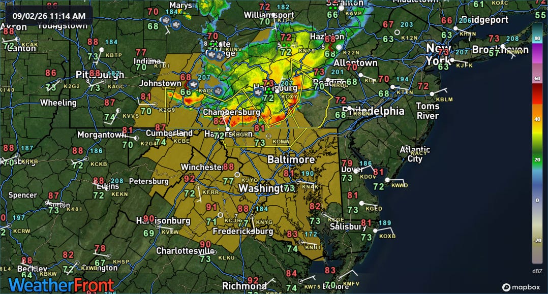
Severe thunderstorms in the eastern US are the other ongoing significant impact weather event today (along with the never ending heat, of course). A complex of severe storms has already been pushing across central Pennsylvania this morning, producing some incidences of damaging winds. These storms are expected to maintain themselves or even intensify somewhat as they move south into the region around Baltimore and DC, and a new severe thunderstorm watch (brown area in map above) has just been issued for this area.
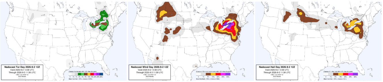
Additional severe thunderstorms are expected this afternoon and evening upstream across the eastern Great Lakes region.
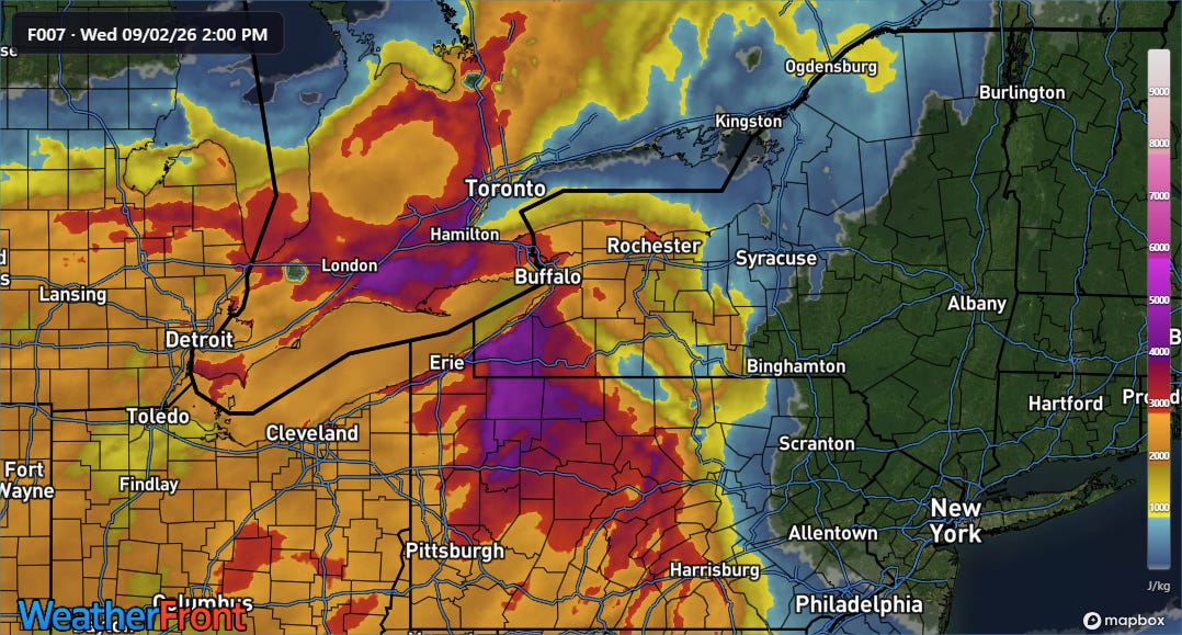
A strong upper level disturbance and associated cold front pushing into a very unstable atmosphere in southwestern Ontario will cause severe thunderstorms to erupt this afternoon and push south and southeast.
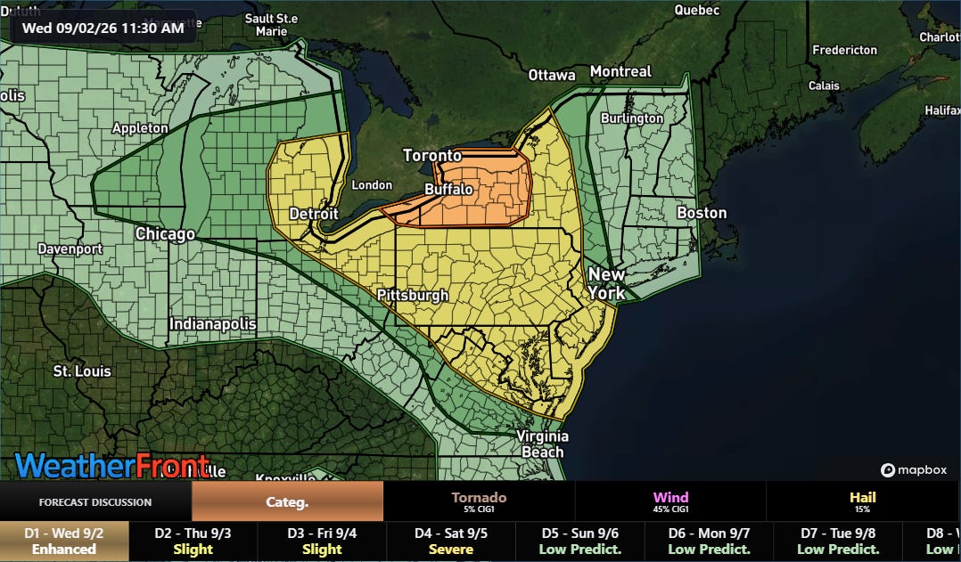
As highlighted in the Nadocast probabilities above, the area from southwest Ontario into western is of particular concern for storms with damaging winds and tornadoes, and SPC recently upgraded the American side of this area to an enhanced (level 3 of 5) risk of severe storms for this afternoon.
This post has already gotten very long, so I am going to stop here — but there are plenty of other weather issues to discuss, including the heat across much of the country east of the Rockies, unusual wet weather coming to the West Coast, and the intense tropical activity in the eastern and central Pacific. I will hopefully have a later video or post about some of this later today. I also will likely be doing another live Substack Chat for paid subscribers about all of the ongoing weather.


Leave a Reply