
The “heat dome” in the central US is not going anywhere, and in fact will build next week. Still keeping an eye on Lowell for Hawai’i.
Sep 04, 2026
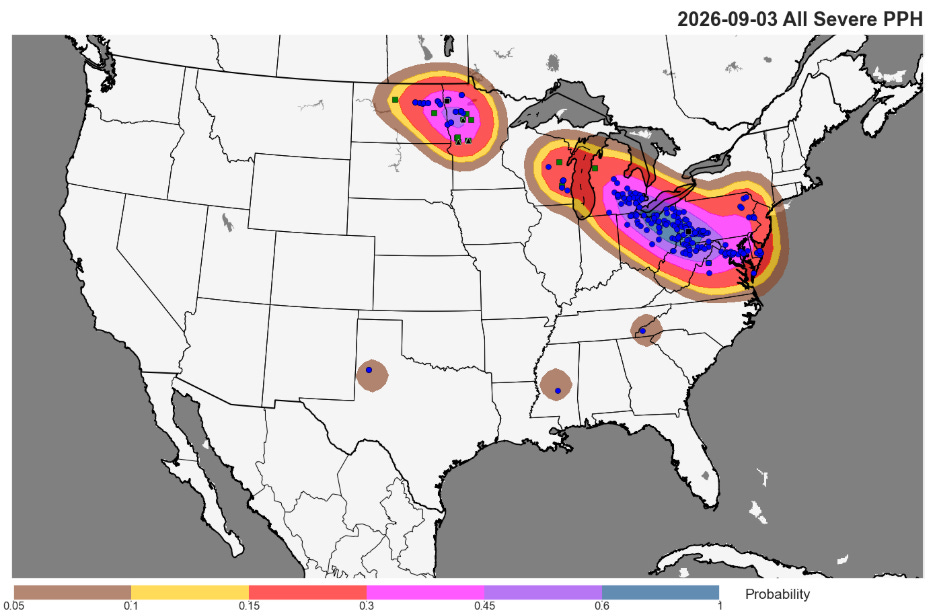
As expected, Thursday was an active day of severe weather from the Upper Midwest into the Great Lakes and Mid-Atlantic, with nearly 400 reports of severe weather. Multiple complexes of severe storms affected this area, but probably the most impactful was the one that started in southern Michigan in the early afternoon and moved southeast across northern Ohio and western Pennsylvania all the way to the DC area by around midnight, where it produced a wind gust of 64 mph at Reagan National Airport.
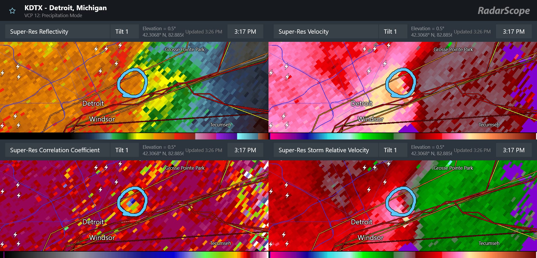
Some of the most impactful weather from this complex of storms occurred early in its lifecycle across southern Michigan, with widespread damaging straight line winds and this tornado with a radar debris signature on the east side of Detroit around 4:15 pm ET (which I was showing live in my Substack Chat at the time).

The tornado appears to have caused quite a bit of damage to homes and buildings in east Detroit before crossing Belle Isle and moving into Windsor, ON. Meteorologists will be surveying the damage on both sides of the border today. Once confirmed, this would officially be the first tornado to hit inside the city limits of Detroit since 1997.
According to PowerOutage.us, about 500,000 customers remain without power late this morning due to these storms, with Michigan (280K) and Pennsylvania (100K) hardest hit.
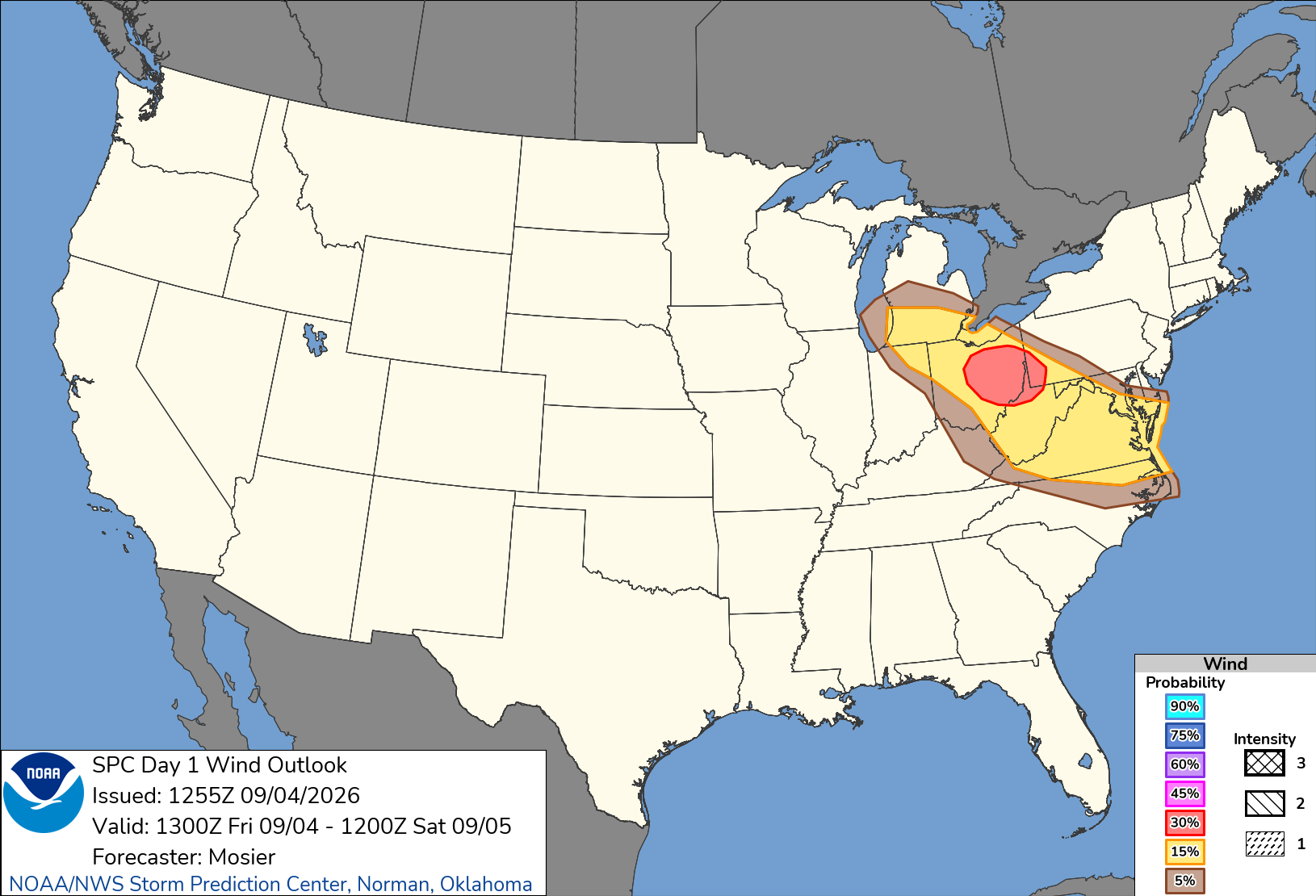
Today does not look quite as active as Thursday, but there should still be southeast moving clusters of strong to severe storms with the potential for damaging straight line winds from southern Michigan into the Mid-Atlantic.
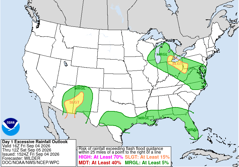
Flash flooding will also be possible with these storms, particularly from southeast Michigan into northern West Virginia where 2-4” of rain has fallen over the last couple of days in many areas, making conditions more prone for flooding. Monsoonal moisture will also support strong storms with potential for gusty winds and localized flash flooding over parts of Arizona and New Mexico.
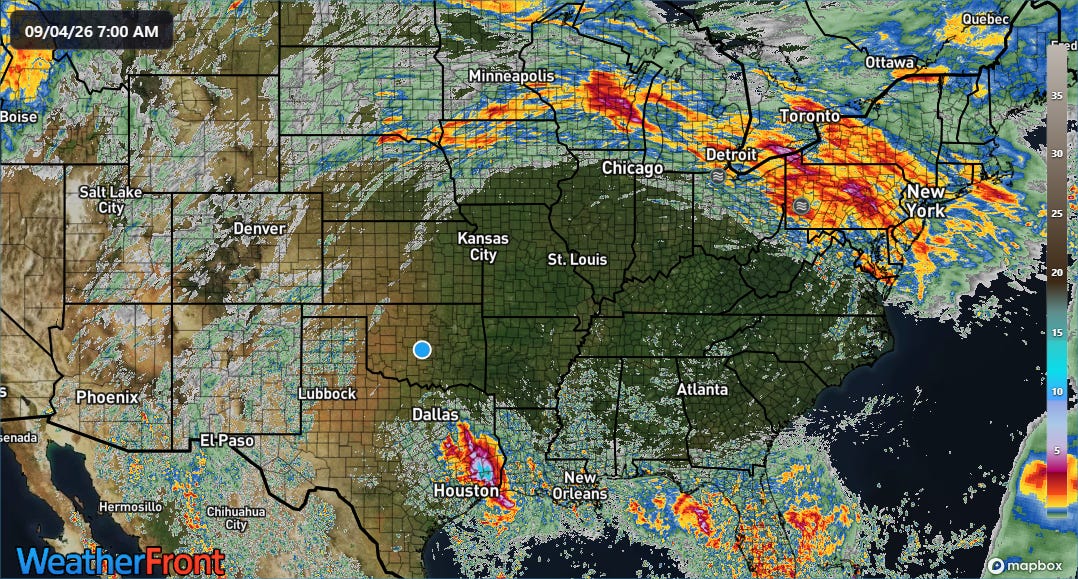
All of this thunderstorm activity is occurring around the periphery of a large area of middle and upper level high pressure across the central United States. You can see pretty clearly in this map of 3 day rainfall that the high has been centered around St. Louis, with the “ring of fire” surrounding it (can also see the extremely heavy rainfall from TS Edouard over eastern Texas).
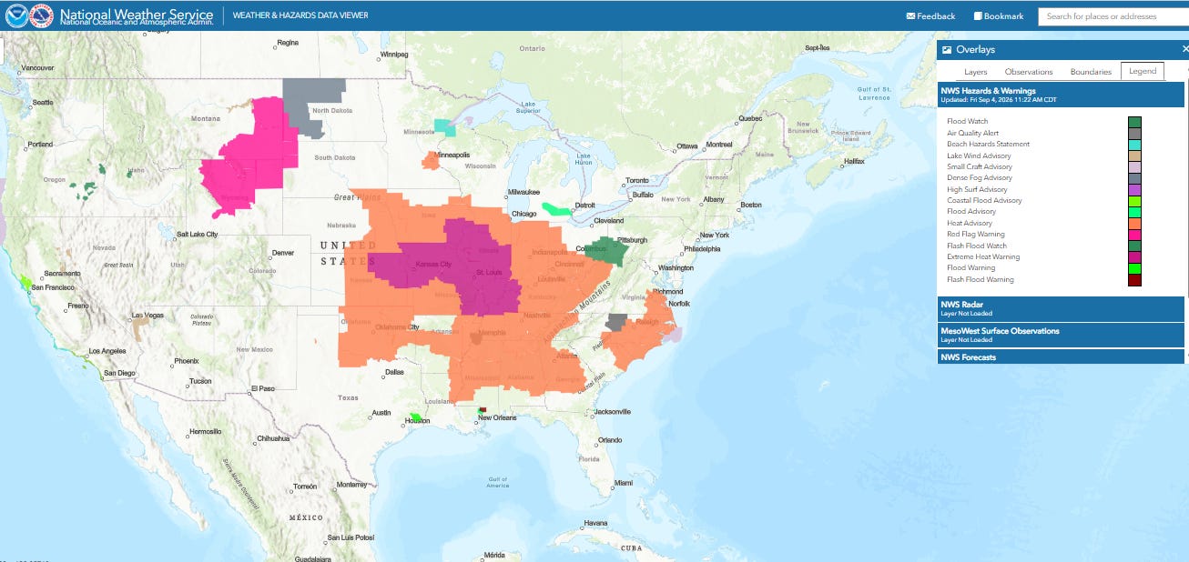
This “heat dome” has brought an unusual combination of heat and humidity for so late in the season, and heat advisories (orange) and extreme heat warnings (purple) remain in effect for many areas today. Several record high temperatures have been set in recent days, but with the humidity in play in many areas record warm minimums have been more numerous. This included 82F in St. Louis both yesterday and Wednesday. These readings set daily records and tied for the second warmest monthly minimums on record, trailing only 83F on 6 September 1899. Chicago has set daily record warm minimum temperatures the last three morning, and the 78F on Wednesday tied for the warmest September minimum on record.
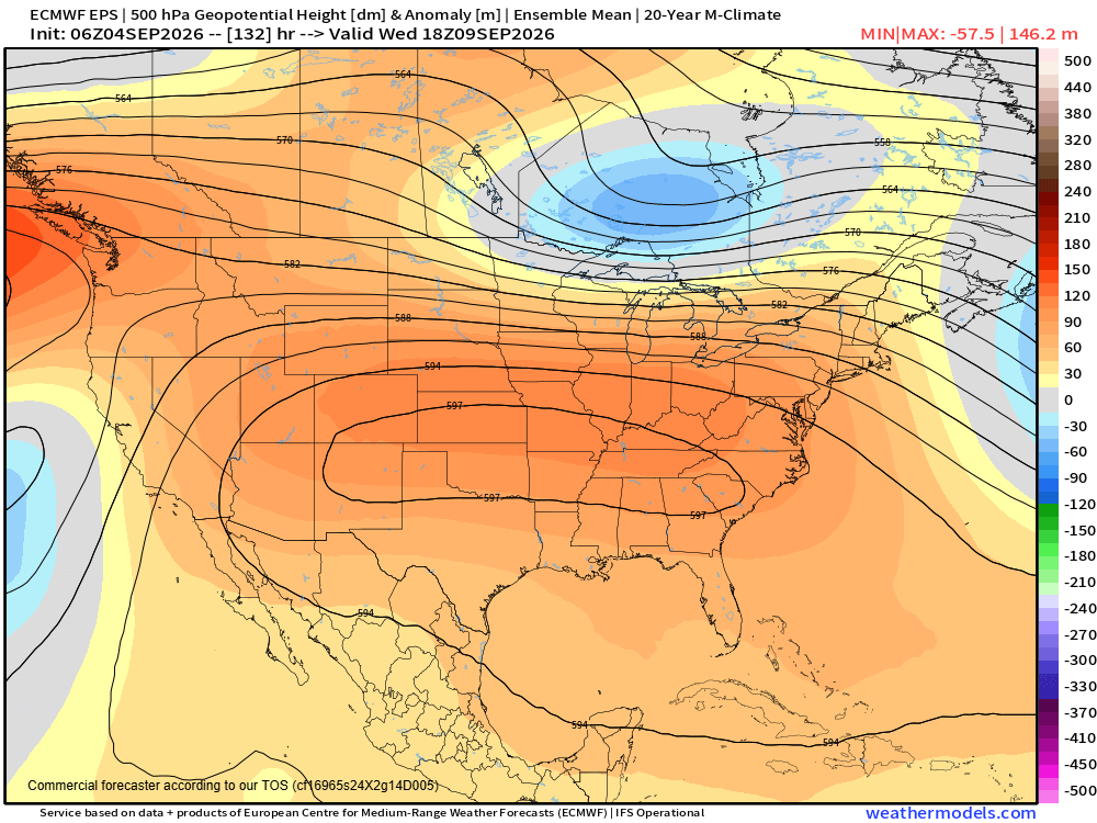
Troughs of upper level low pressure on both coasts will erode the high pressure area along its edges this weekend, but by the middle of next week it will rebuild. By the middle of the week, models forecast a potentially near record strong 500 millibar high for the time of year (with heights near the infamous 6000m values I have talked about) extending from the southern Rockies to the southeast US coast.
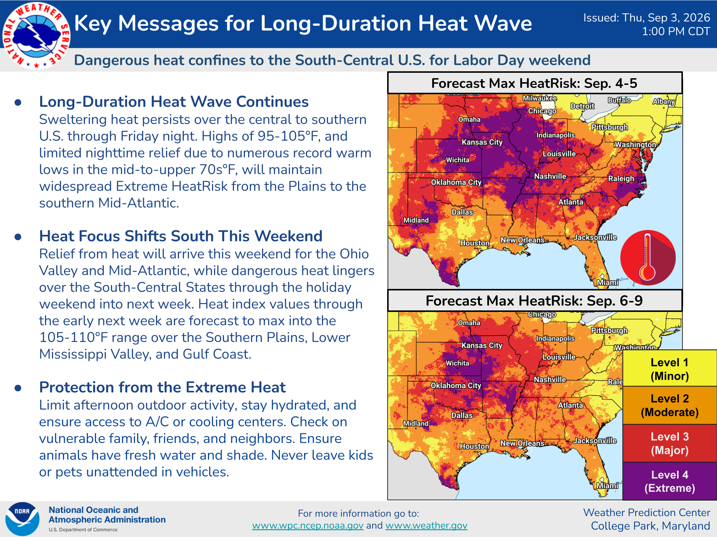
This will mean unusual heat will persist across the center of the country into next week.
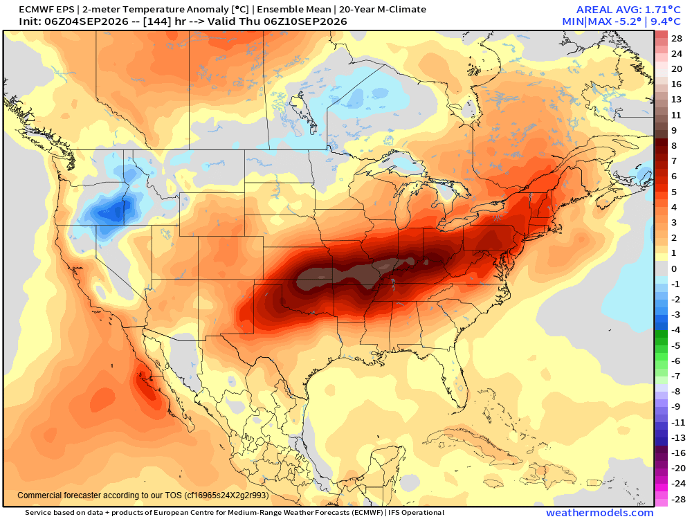
And by the middle to latter part of next week, warmer temperatures will also return to the Mid-Atlantic and Northeast.
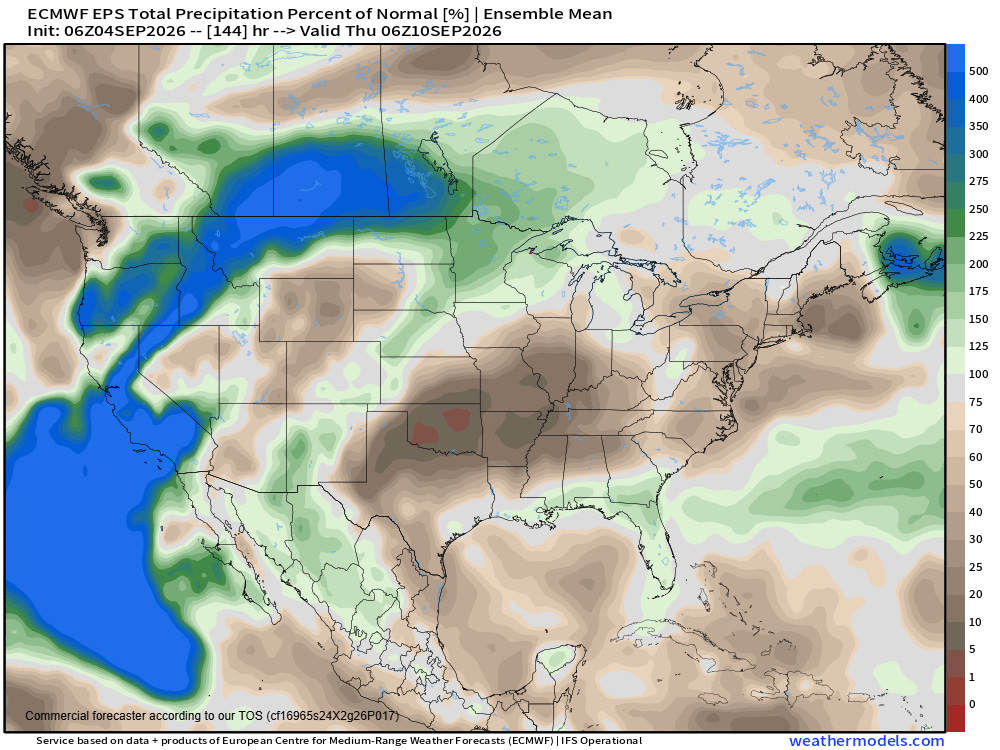
It also means another week of dryness for much of Texas, Oklahoma, southern Kansas and the Mid-South where widespread severe to exceptional drought continues to worsen.
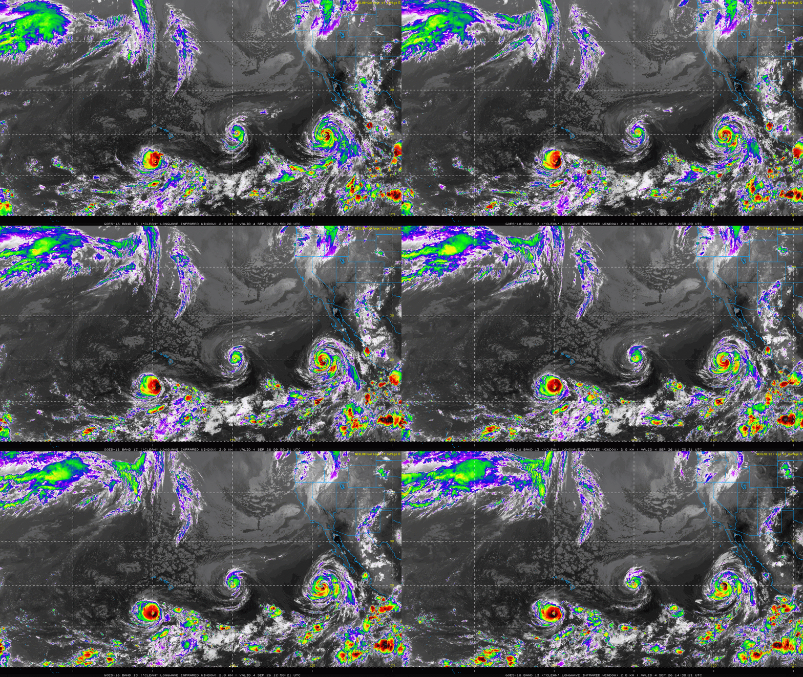
With the demise of Edouard, the focus in the tropics is now completely on the central and eastern Pacific, where we continue to have three hurricanes spinning: Lowell (major hurricane south of Hawai’i), Karina (east of Hawai’i), and Marie (southwest of Baja California). As can be seen in the rainfall image above, it still looks as if the trough of upper level low pressure will bring some moisture from Marie north to enhance rainfall chances, particularly over areas of the southern Rockies and desert Southwest — but the hurricane itself is still expected to remain well out to sea and should eventually weaken.
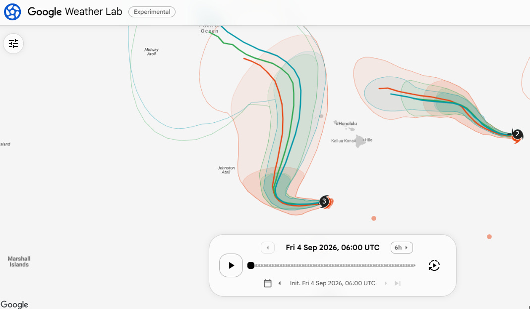
Lowell remains the primary concern in the Pacific as it will turn north over the weekend. As we have been discussing, the models continue to waffle around given the relatively complex steering pattern expected to evolve over the central Pacific; however, in general they have shifted a bit west with the track of the hurricane in the direction of Hawai’i. Having said that, a number of operational and ensemble members still bring Lowell close enough to have a rather significant impact on Kauai, and there remains plenty of time for things to shift either east or west. Given the size and strength of Lowell, interests in Hawai’i, and particularly Kauai, should continue to monitor it closely. At a minimum, swells, large surf and rip currents should be a significant issue for all of the islands by early next week.
Balanced Weather is made possible by the generous support of paid subscribers, who as thanks get access to live Balanced Weather chats and videos as well as the ability to post comments and ask questions on posts. To become a paid subscriber or a free subscriber (also very much appreciated and you will automatically receive new posts in your email), please click below.


Leave a Reply