
More heat for the US headed into next week, and the latest on Lowell
Sep 05, 2026
Happy weekend! Busy day today with my son in town visiting — but a few quick things to share and update about.
Heat continues to be a huge story not just in the US but globally. The insane summer of 2026 seems neverending for western Europe. France as a whole had its warmest summer on record in 2026 by nearly a full degree C, an incredible margin for a region of that size averaged out over a 3 month period.
And the summer just keeps rolling on into September, as France set a new national September record hot temperature with 105.4F on Friday. Today, Marseilles, with records back to 1868, set a new September record by 6.5F when it reached 99.3F — just an incredible margin for a monthly temperature record at such a long term climate site. Spain, Portugal and other parts of western Europe have also been seeing extreme record heat.
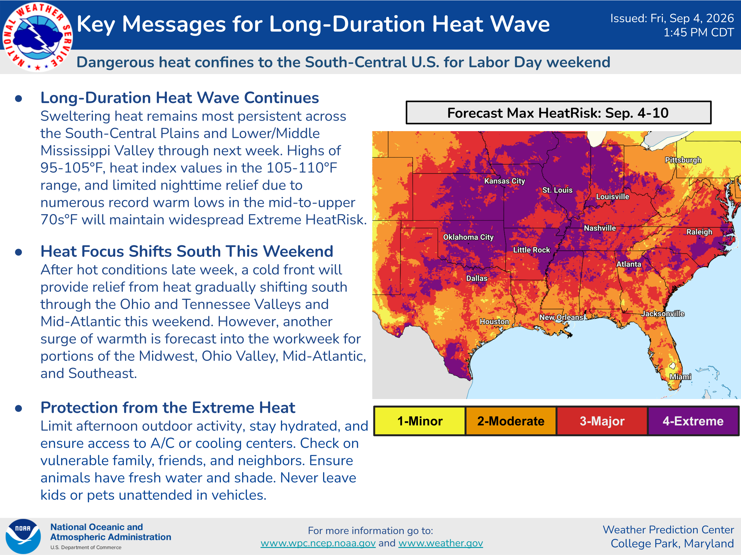
The heat will also continue unabated for the southern US headed into next week. While parts of the Midwest and East will see a break this weekend, hotter temperatures will build back into these regions by midweek as the upper level area of high pressure reintensifies.
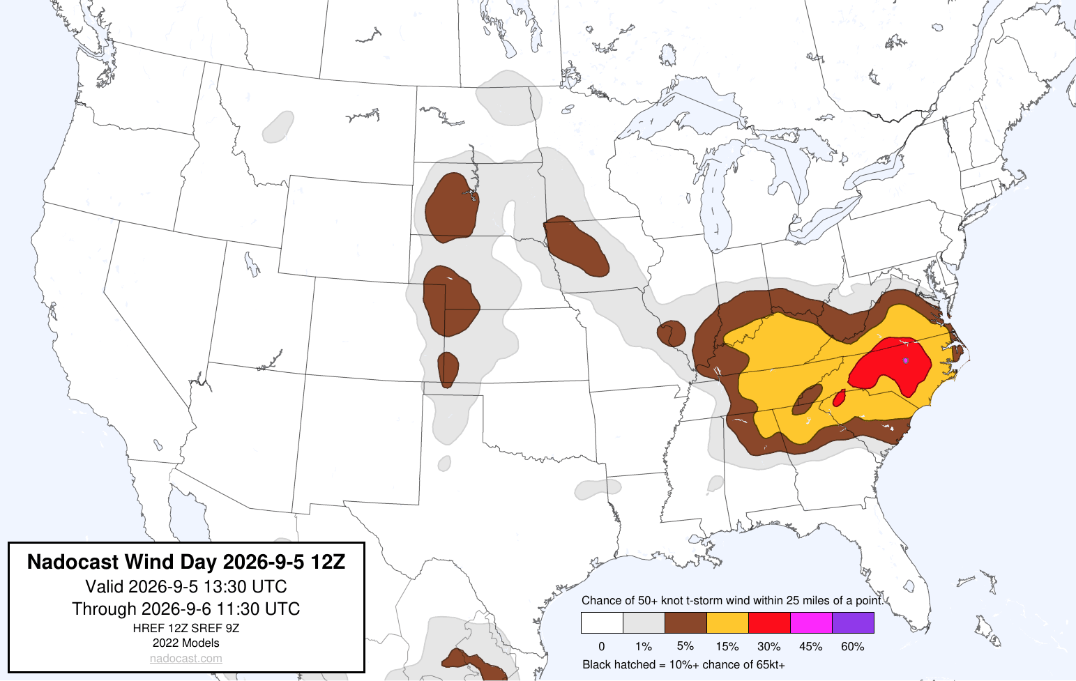
Severe weather will be a concern again today in parts of the eastern US as the cold front that will bring that heat relief moves slowly south. Clusters of storms with damaging wind gusts are expected.
![[Key Messages]](https://substackcdn.com/image/fetch/$s_!W9Db!,f_auto,q_auto:good,fl_progressive:steep/https%3A%2F%2Fsubstack-post-media.s3.amazonaws.com%2Fpublic%2Fimages%2F2639910d-9b6c-4dfc-b0b9-9bcd0ebdef47_897x736.png "[Key Messages]")
The model consensus continues to take the center of Lowell — which reached category 5 intensity again last night and is now a high end category 4 with 150 mph sustained winds — about 100-200 miles west of Kauai County at the western end of the main Hawaiian Islands. While Lowell should be weakening as it turns north, it will be a large and still powerful hurricane as it makes it closest approach to the islands. At a minimum, large surf, swell, rip currents and some localized heavy rainfall and flash flooding are expected over all the islands, with the potential for more direct impacts in the western part of the state if the hurricane were to track more to the east. We will be watching the trends closely this weekend as Lowell actually makes the turn to the north and starts heading in the general direction of Hawai’i.
Thanks to the Bluesky accounts of Don Sutherland and M. Herrera for their excellent climatology coverage.


Leave a Reply