
Center looks to pass just west of Niihau, and cause strong winds, heavy rain and squalls on Kauai.
Sep 07, 2026
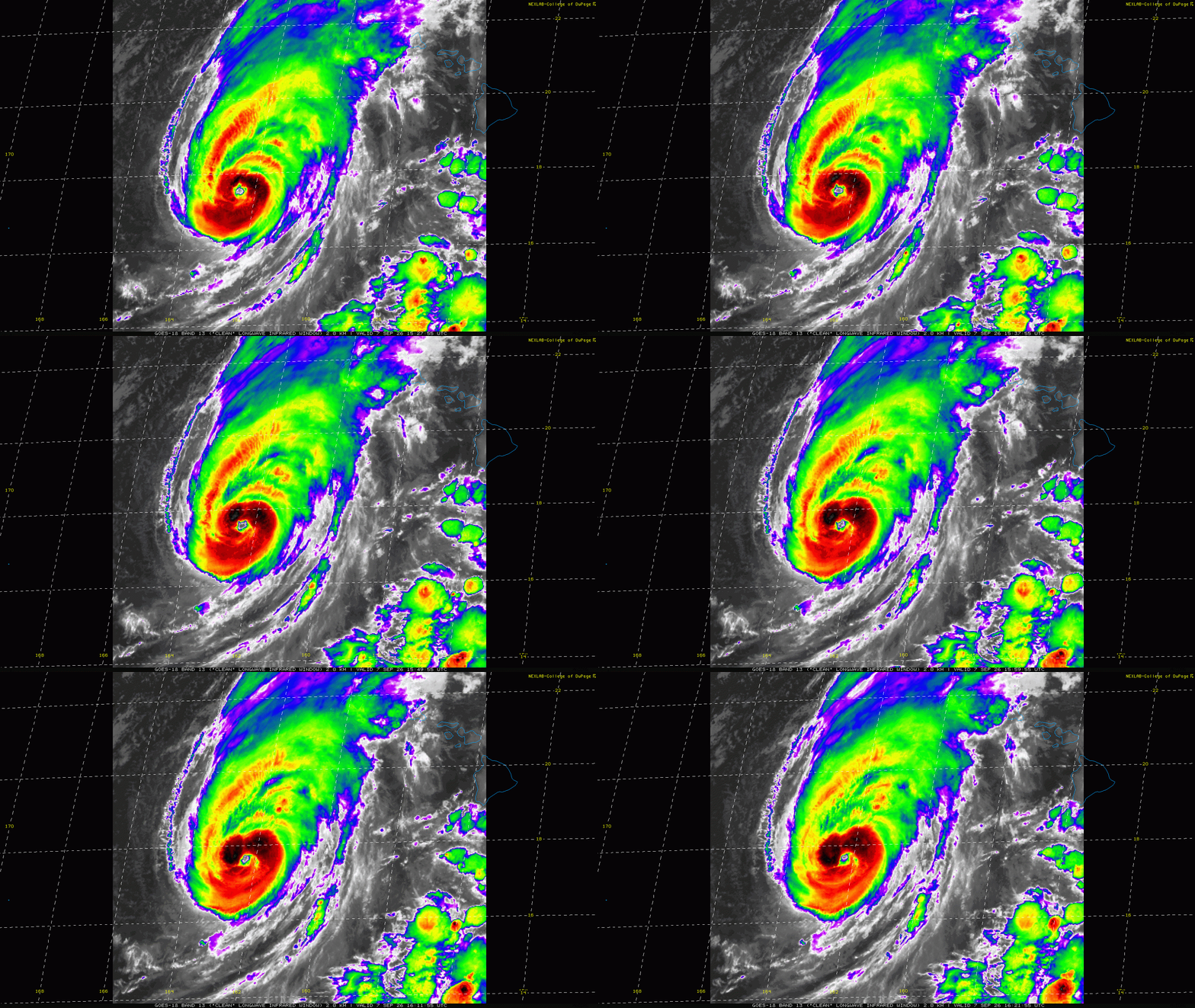
The many days of watching major Hurricane Lowell and its potential to cause impacts in parts of Hawai’i will finally reach a resolution in the next 24 to 36 hours. Lowell is still a well organized major hurricane this morning with maximum sustained winds of 115 mph. Infrared satellite imagery over the last few hours has showed a new surge of intense, cold topped convection developing in the northern semicircle of the hurricane and wrapping around the eye. A USAF reconnaissance aircraft will be investigating Lowell into this afternoon (US time), giving us an excellent idea of Lowell’s evolving intensity and structure.
You can see in the infrared satellite loop of Lowell how high cloudiness is streaming off to the north-northeast in the general direction of Kauai (the westernmost large island west of O’ahu), which gives us a good idea of how the middle and upper level steering flow is currently oriented. This is expected to keep Lowell moving north-northeast at about 15 mph for the next day or two. This increase in upper level winds is also expected to start imparting some shear to the hurricane which should begin a gradual weakening — although it is still expected be a large category 2 hurricane as it makes its closest approach to the Hawaiian Islands.
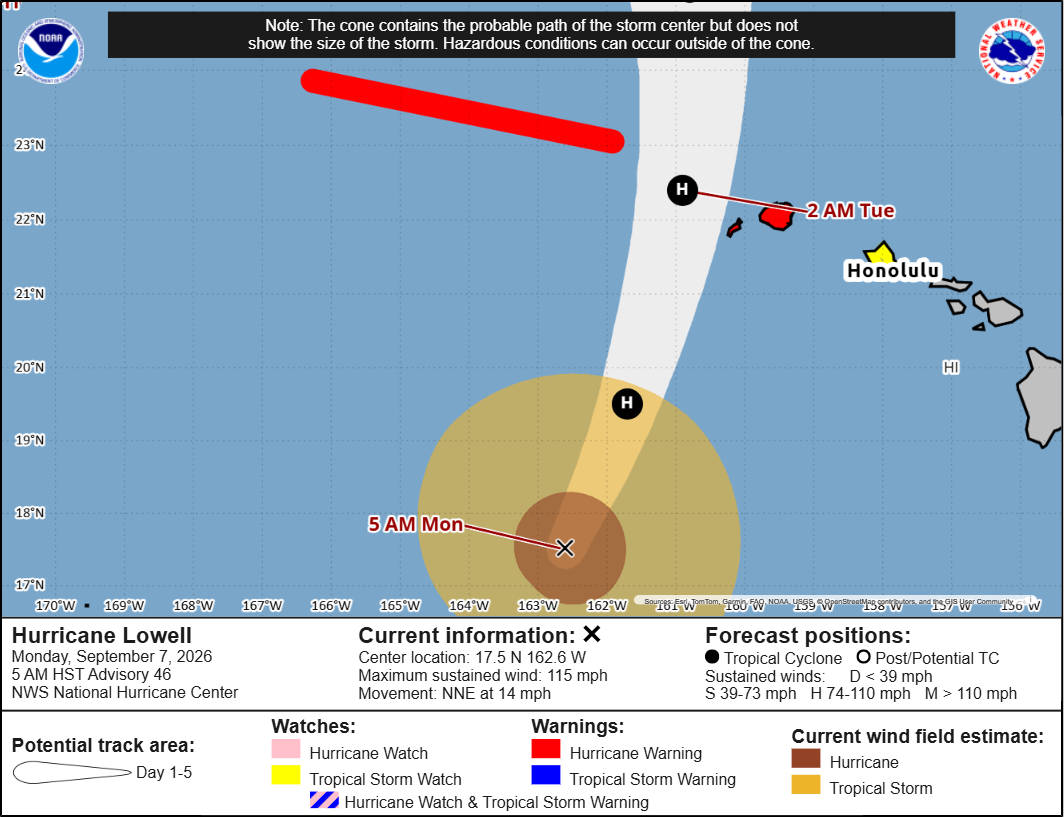
While it is still anticipated that the eye of Lowell should remain west of Kauai and Niihau (the small island to west of Kauai that is populated by several hundred people), the track has shifted far enough to the east that significant wind and rain impacts are now expected on the islands given the large size of Lowell. A Hurricane Warning is now in effect for Kauai and Niihau, and a tropical storm watch is in effect for O’ahu.
This loop of forecast sea level pressure and surface wind gusts for tonight into early Tuesday from the most recent NOAA HAFS-B hurricane model shows how even with the eye staying west of the islands, gusts of hurricane force overspread Kauai with gusts in excess of 100 mph shown over Niihau.
The forecast radar loop from the model shows that the eastern eyewall could potentially impact Niihau, while bands of intense squalls should impact Kauai.
![[Image of U.S. rainfall potential]](https://substackcdn.com/image/fetch/$s_!g8m_!,f_auto,q_auto:good,fl_progressive:steep/https%3A%2F%2Fsubstack-post-media.s3.amazonaws.com%2Fpublic%2Fimages%2Ff1396643-4abb-4abc-b0d4-350ae7c184f3_3300x2550.gif "[Image of U.S. rainfall potential]")
These intense squalls on Kauai will produce torrential rainfall with totals in excess of a foot possible, which could result in life threatening flash floods and mudslides — especially in more typically dry areas on the usual leeward side of the island. Tornadoes and particularly intense wind gusts will also be possible with these squalls. Even on the other islands, rainbands and squalls will produce heavy rainfall with potential flash flooding and gusty winds. Very high surf, rip currents and coastal flooding are also expected.
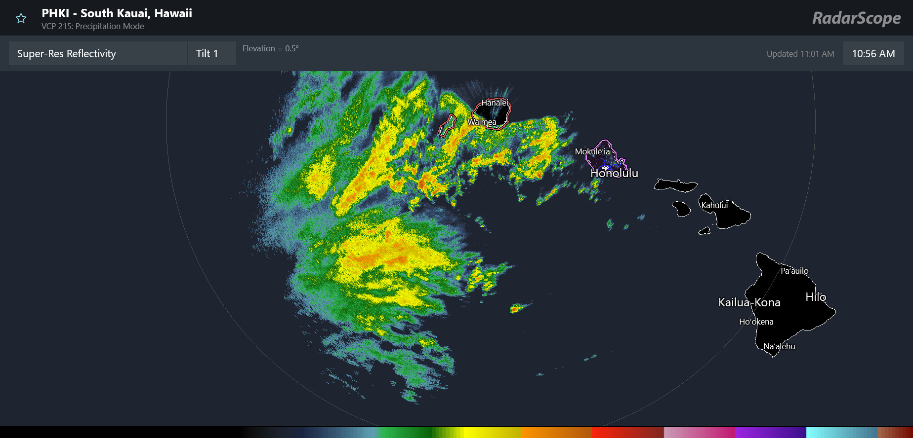
The NEXRAD Doppler weather radar on Kauai was out of service for a number of hours, but just came back online and showing squalls overspreading Niihau and Kauai. Hopefully the radar will stay up and allow us to monitor the evolving threats and NWS meteorologists to issue their critical forecasts and warnings.
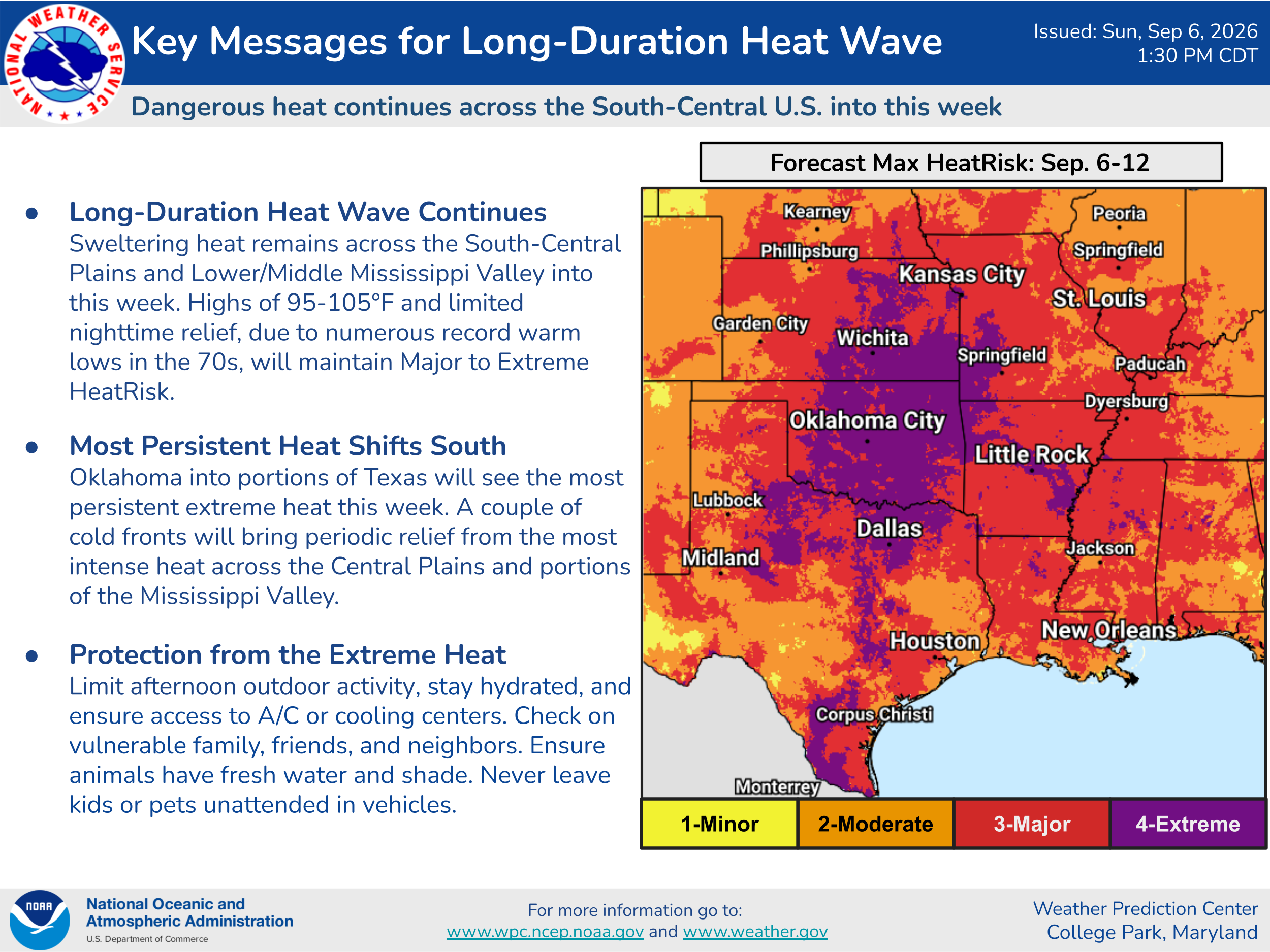
In the CONUS, the ongoing heatwave will continue to be the major story this week. While the south-central US will remain the center of the most persistent and intense heat, warmer and humid conditions will also be temporarily spreading back toward the Northeast and Mid-Atlantic again as the week goes on.
I will be traveling today but will also have opportunities to monitor Lowell, and will provide some updates via Substack Notes and Chat (paid subscriber benefit) and social media as I can.


Leave a Reply