
And a weird late September Nor’easter to keep an eye on
Sep 21, 2026
Two newsletters today! Let’s catch up on the tropics.
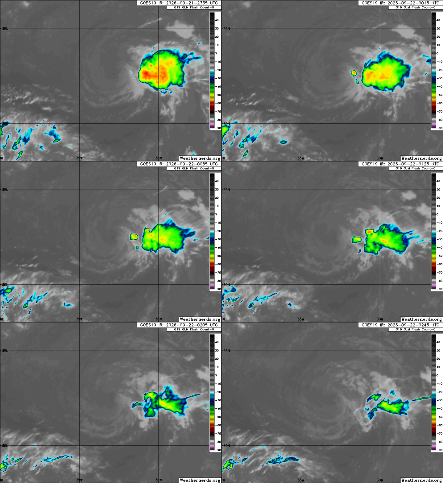
Last evening was indeed the high point for Tropical Storm Fay. The anticipated high wind shear and dry air started battering it early this morning, and it is now a shell of itself with all of the limited shower activity located well east of a naked low level circulation. NHC is estimating it as a 40 mph tropical storm, and it is forecast to continue weakening up until becoming a remnant low in about 24 hours and dissipating later this week.
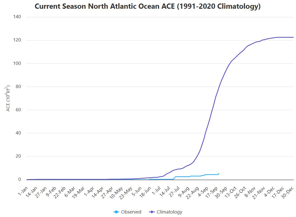
Fay was the strongest storm so far this season as it briefly peaked just below hurricane intensity 24 hours ago, but it still provided just a blip of total Accumulated Cyclone Energy (ACE). Total ACE in the Atlantic (per Colorado State University above) for 2026 is running just a bit above 5% of what we should normally see at this point in the hurricane season — and of course we have still yet to see a hurricane.
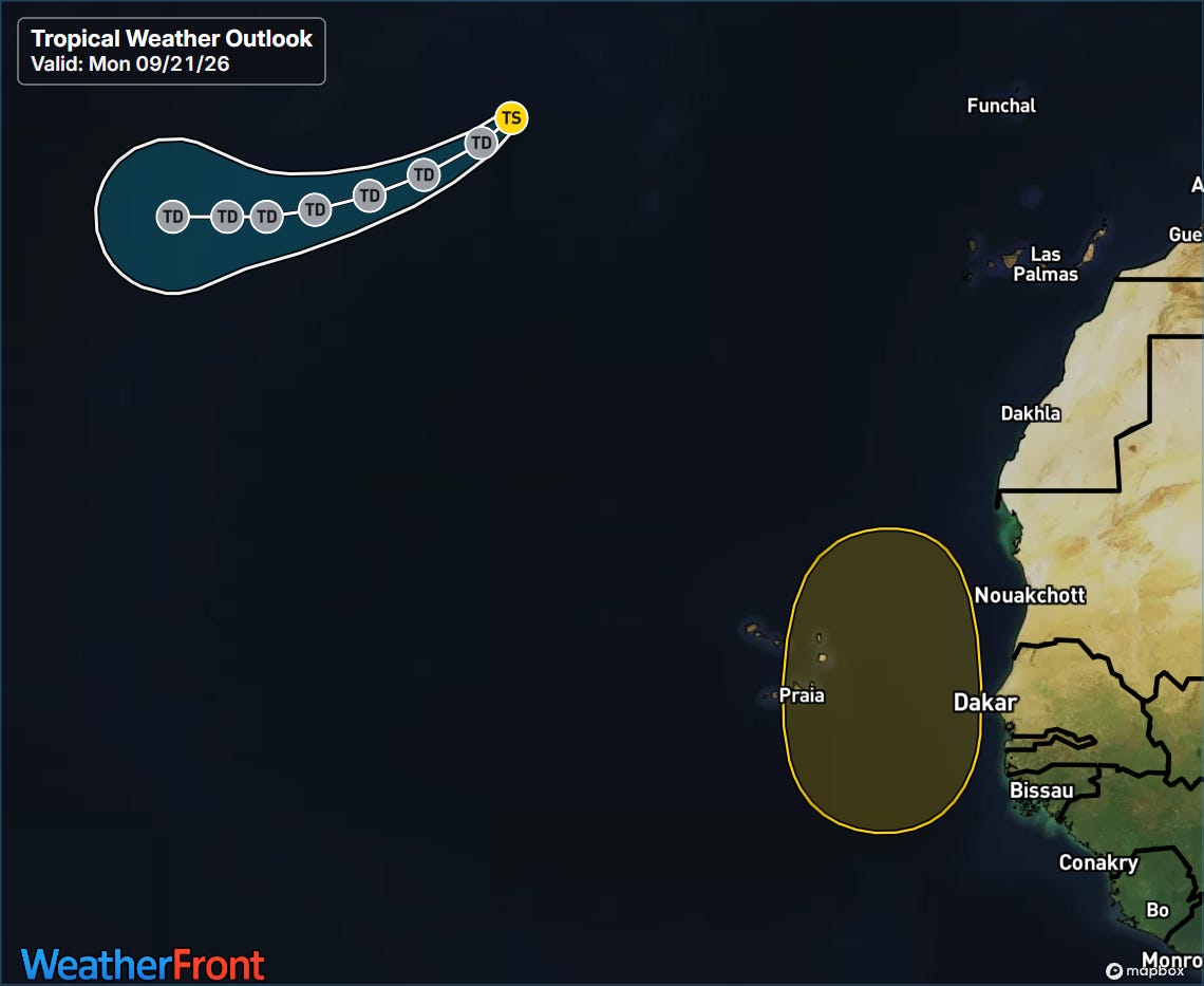
The only other system that NHC is actively monitoring this week is a tropical wave that will be emerging off the west coast of Africa, and which some of the models are showing becoming a potential tropical storm near the Cabo Verde Islands late this week. Even if this were to happen, it looks as if it would be on a north-northwest track and would only be an issue for that immediate area.
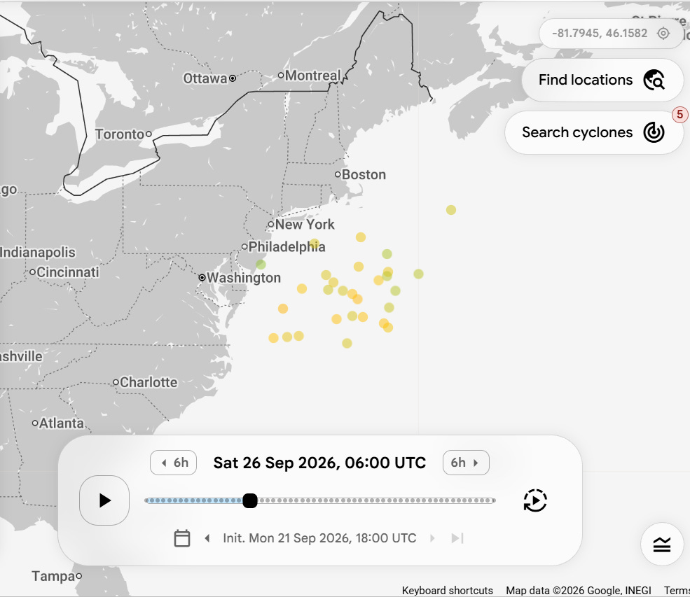
One other thing to keep an eye on this week is a non-tropical Nor’easter storm system which is forecast to develop off the Mid-Atlantic coast later this week. Some of the models are suggesting that this system will become somewhat trapped and could gain tropical or subtropical characteristics this weekend. Regardless of whether this happens, wind, rain and coastal flood impacts are anticipated for parts of the East Coast. My colleague Matt Lanza had a good summary of some of the questions surrounding this system in his Substack this morning, and I will of course have more as the week goes on.
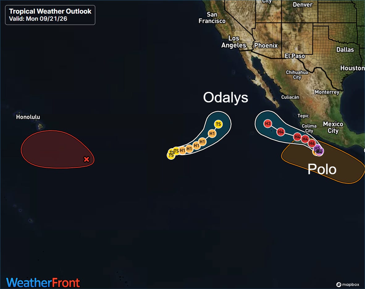
The Pacific continues to be where all the real tropical action is. Polo was just classified as a tropical depression Sunday afternoon and in just a little over 24 hours has rapidly intensified to a 110 mph high end category 2 hurricane. In their evening forecast discussion, NHC talks about the incredibly favorable conditions for intensification that Polo finds itself in, including very light wind shear and anomalously warm sea surface temperatures. As a result, they are forecasting Polo to continue to rapidly intensify and attain category 5 intensity tomorrow.
![[Key Messages]](https://substackcdn.com/image/fetch/$s_!58B1!,f_auto,q_auto:good,fl_progressive:steep/https%3A%2F%2Fsubstack-post-media.s3.amazonaws.com%2Fpublic%2Fimages%2Ff1132a28-36c5-4a7e-a375-24bb1e21304b_897x736.png "[Key Messages]")
While the core of the hurricane is expected to stay offshore, it will pass close enough to the southwest coast of Mexico to cause potential flash flooding and strong winds.
Tropical Storm Odalys is the system to the west of Polo. Odalys is expected to move southwest the next several days and modestly strengthen to a category 1 hurricane, remaining well out to sea.
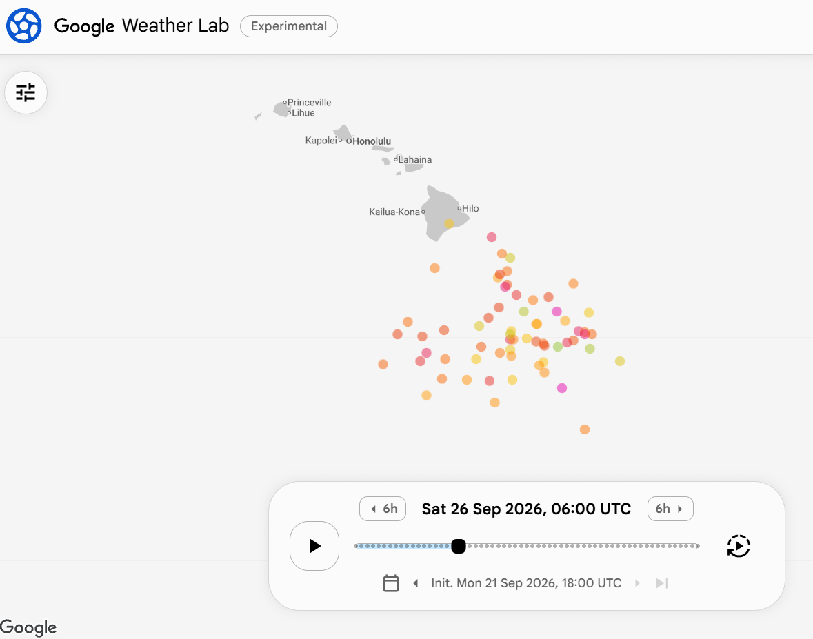
NHC is also monitoring a tropical disturbance to the east-southeast of Hawaii (red X on the outlook map above), and projects it to have a high chance of becoming a tropical cyclone this week. Amazingly enough, this is yet another system that could potentially pose some risk to Hawai’i as conditions look quite favorable for development, and the latest Google DeepMind forecast above shows a rather high likelihood of a significant hurricane to the south-southeast of the Big Island by late this week.
Beyond this time, the model forecast becomes quite dispersive with some ensemble members taking the system to the west and south of the islands, while other solutions have a track more northwest and impacting the state. Of course, by this time we are talking a week or more from now, and given we do not even have a defined system yet anything we can say would be little more than conjecture. We will obviously keep an eye on this system as we go through the week.
 Balanced Weather
Leave a comment