
Hawai’i also monitoring another tropical system. In CONUS, strong Nor’easter expected as New Mexico deals with serious flash flood threat.
Sep 22, 2026
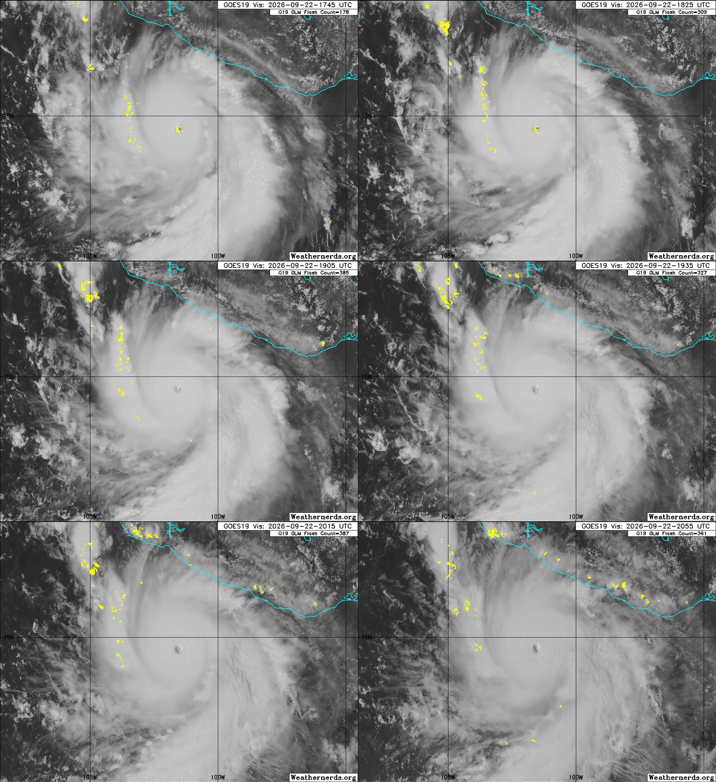
All of the models suggested for days that conditions would be very favorable in the eastern Pacific for the system that became Polo to intensify rapidly. None of them could capture the extreme intensity or the rapidity with which it would strengthen.
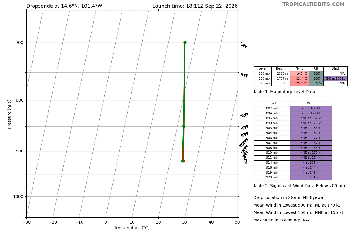
A NOAA reconnaissance aircraft has been investigating the hurricane this afternoon and in two separate eye penetrations measured a central pressure of 892 mb, or 26.34”. This extremely low pressure makes Polo the second most intense hurricane on record in the eastern Pacific measured by central pressure, behind only Hurricane Patricia’s 872 mb in 2015. A dropsonde instrument in the northeast eyewall (plot above) measured an average wind in the lowest 500m of 196 mph. NHC estimates the maximum sustained winds of the hurricane to be 180 mph currently, which is the third strongest on record in the eastern Pacific. As a reminder, Polo was a newly formed 35 mph tropical depression Sunday afternoon — it has intensified nearly 150 mph in 48 hours.
![[Key Messages]](https://substackcdn.com/image/fetch/$s_!Grqd!,f_auto,q_auto:good,fl_progressive:steep/https%3A%2F%2Fsubstack-post-media.s3.amazonaws.com%2Fpublic%2Fimages%2F327b7c4a-d347-4472-905e-31facf114a82_897x736.png "[Key Messages]")
Polo has been moving very little this afternoon, essentially exhibiting trochoidal wobbles typical of a very intense tropical cyclone. Luckily, the core of the hurricane is expected to remain well offshore as the system should begin to move slowly west-northwest parallel to the coast of Mexico over the next few days. Polo is forecast to remain a category 5 hurricane for the next couple of days with intensity fluctuations due to eyewall replacement cycles. Eventually is should weaken a bit but is still expected to remain a major hurricane for the next several days.
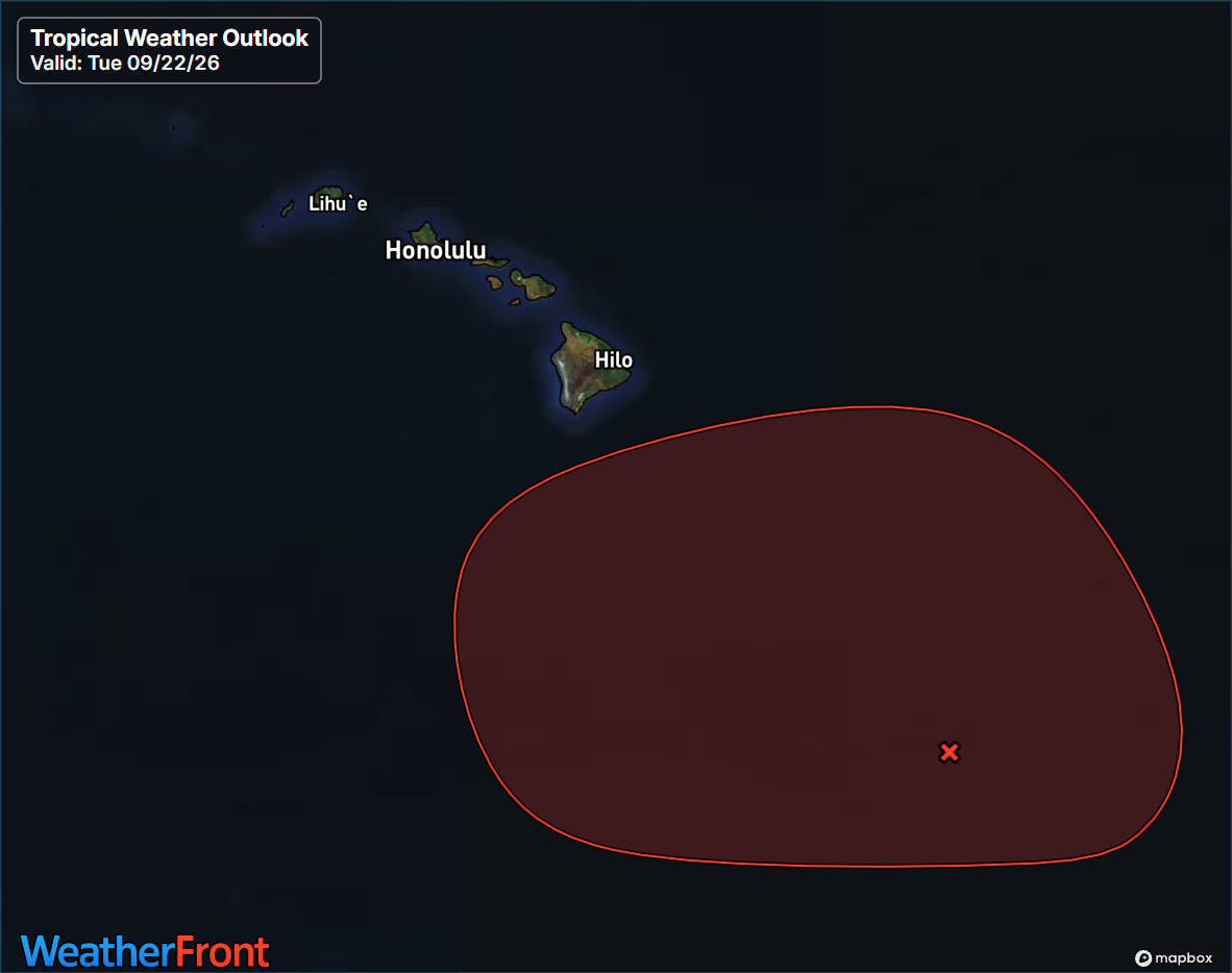
NHC is continuing to monitor a fairly well organized tropical disturbance — which is actually the remnants of Tropical Depression 15E — as it moves slowly northwest to the southeast of Hawai’i. Conditions appear quite favorable for development, and this system is like to become a tropical cyclone again in the next day or two.
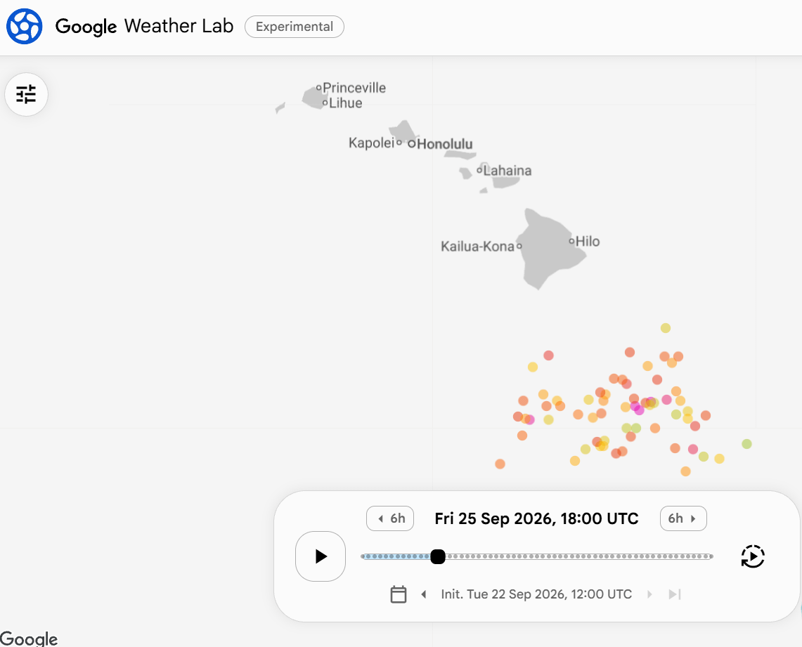
Models continue to suggest that this system is fairly likely to become a hurricane — potentially a significant one — to the south or south-southeast of the Big Island by the end of this week. Beyond this period, the models are still more uncertain, but generally suggest a track toward the west-northwest or northwest, with some impacts again possible for Hawai’i. NHC is urging interests in Hawai’i to monitor this system closely; heavy rainfall associated with it could start impacting the southeast portions of the island chain in the next 24 to 48 hours.
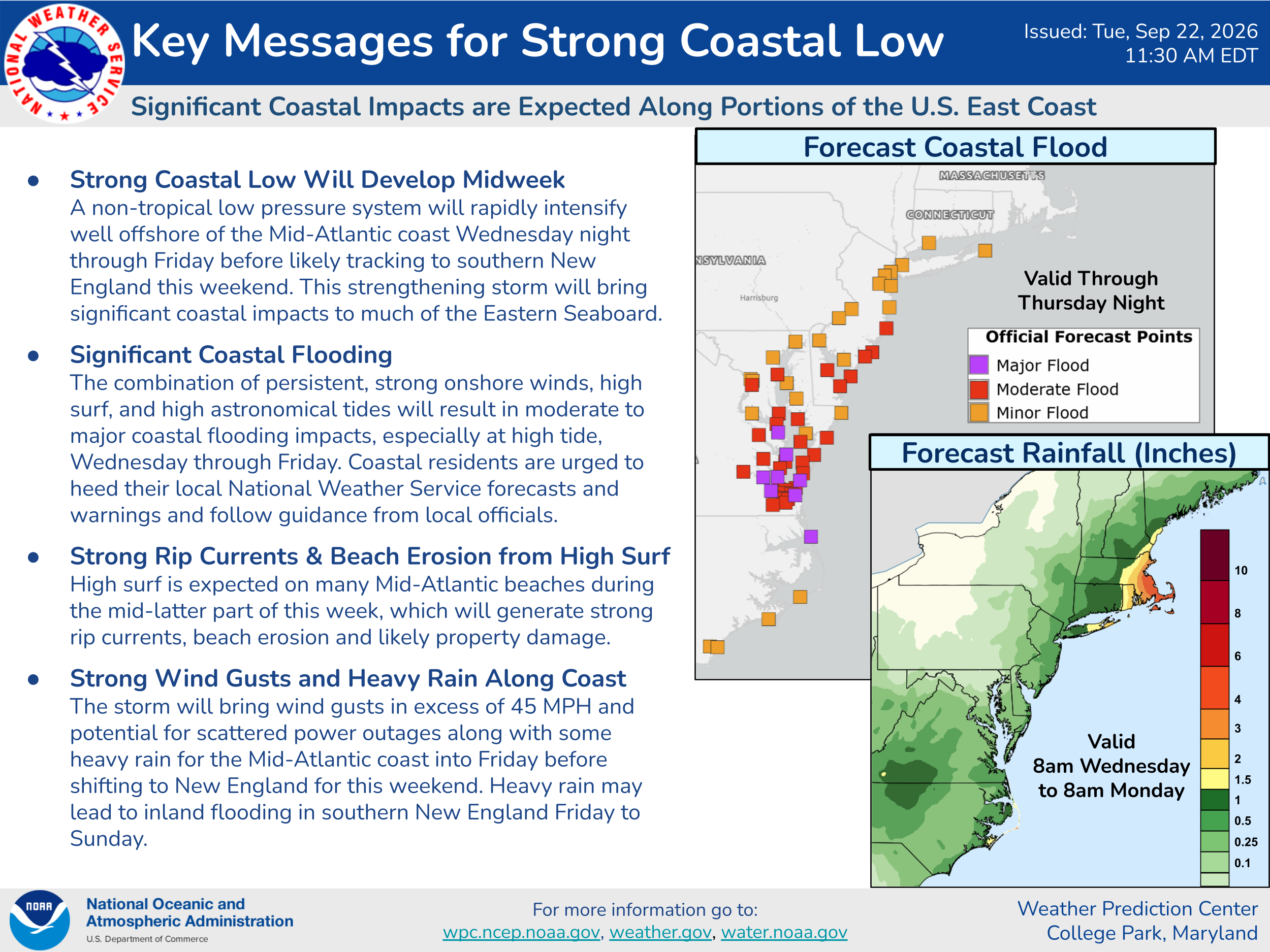
Meanwhile, there is plenty of weather going on in the mainland US as well. We continue to expect a strong non-tropical Nor’easter storm system to develop off the Mid-Atlantic coast late Wednesday through Friday. This system will bring significant impacts to the region, including moderate to major coastal flooding, beach erosion, and strong winds along the coast.
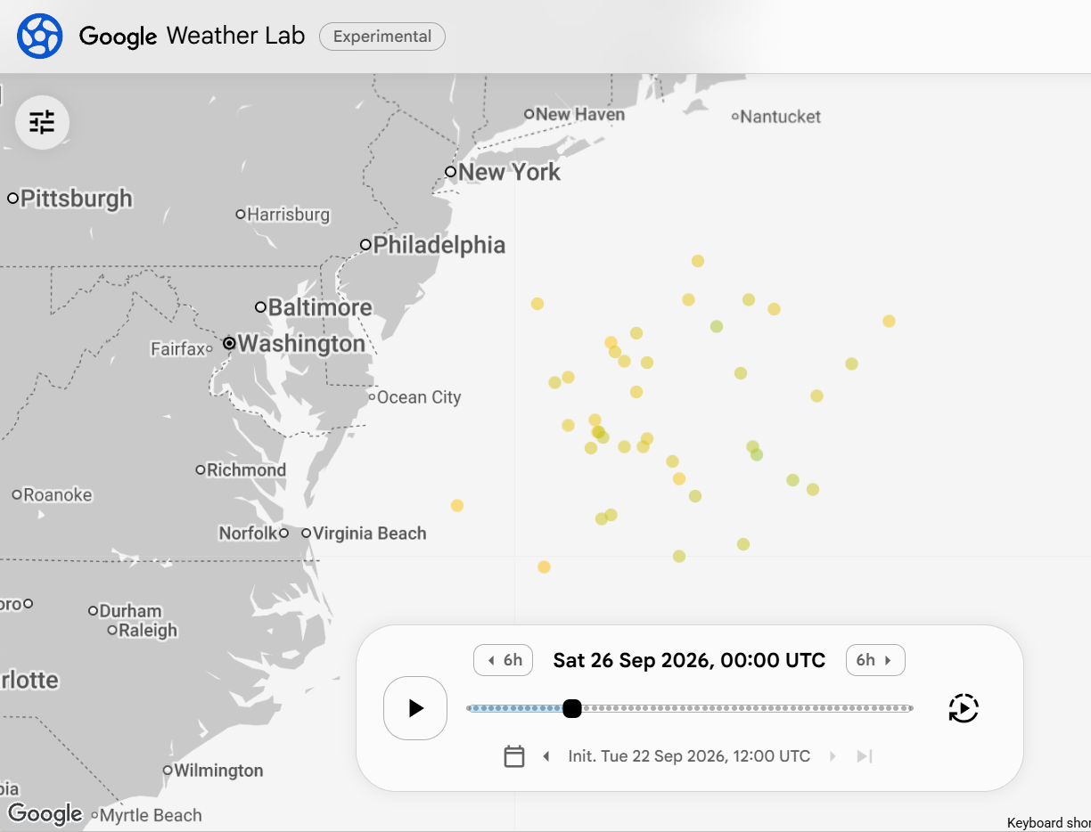
While NHC is not currently mentioning this system in their outlooks, some of the models suggest that the system will obtain some subtropical or tropical characteristics toward the end of the week as it meanders over very warm waters east of the Delmarva. The Google DeepMind ensemble shows the system, indicating that the model expects it to have some tropical characteristics. The overall impacts should not be different even if it does gain some tropical nature, and as the system continues to move north this weekend toward southern New England it will be moving over cooler (though still anomalously warmer than normal) waters less conducive to further tropical development. Significant rain, wind and coastal flooding impacts will be possible in southern New England from the storm this weekend.
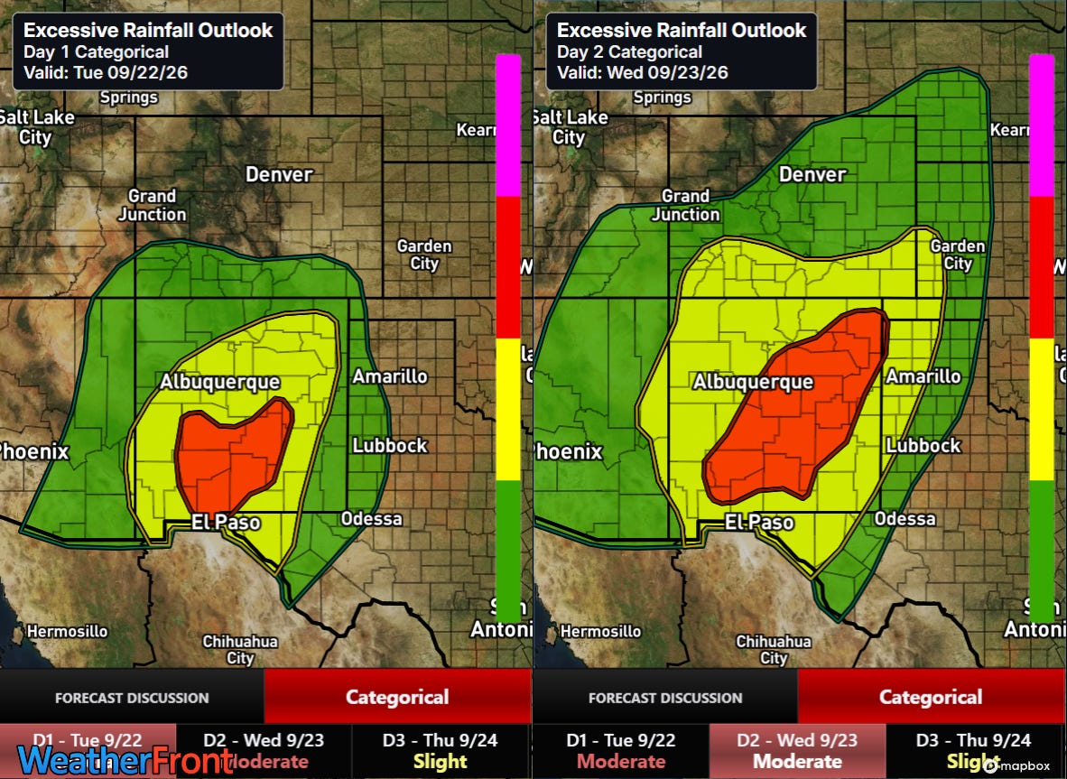
Another region of serious weather impact focus is New Mexico, where persistent extreme levels of monsoonal moisture have been flowing into the state, supporting waves of thunderstorms with heavy rainfall. This pattern is expected to continue for the next 48 hours, and given the preceding wet period, the Weather Prediction Center has rather large moderate (level 3 of 4) risks of flash flooding across the state through Wednesday night.

Clusters of thunderstorms across central New Mexico this afternoon have already been producing heavy rainfall with pockets of 3-hourly amounts of 2-4” per radar estimates. Numerous flash flood warnings are already in effect.
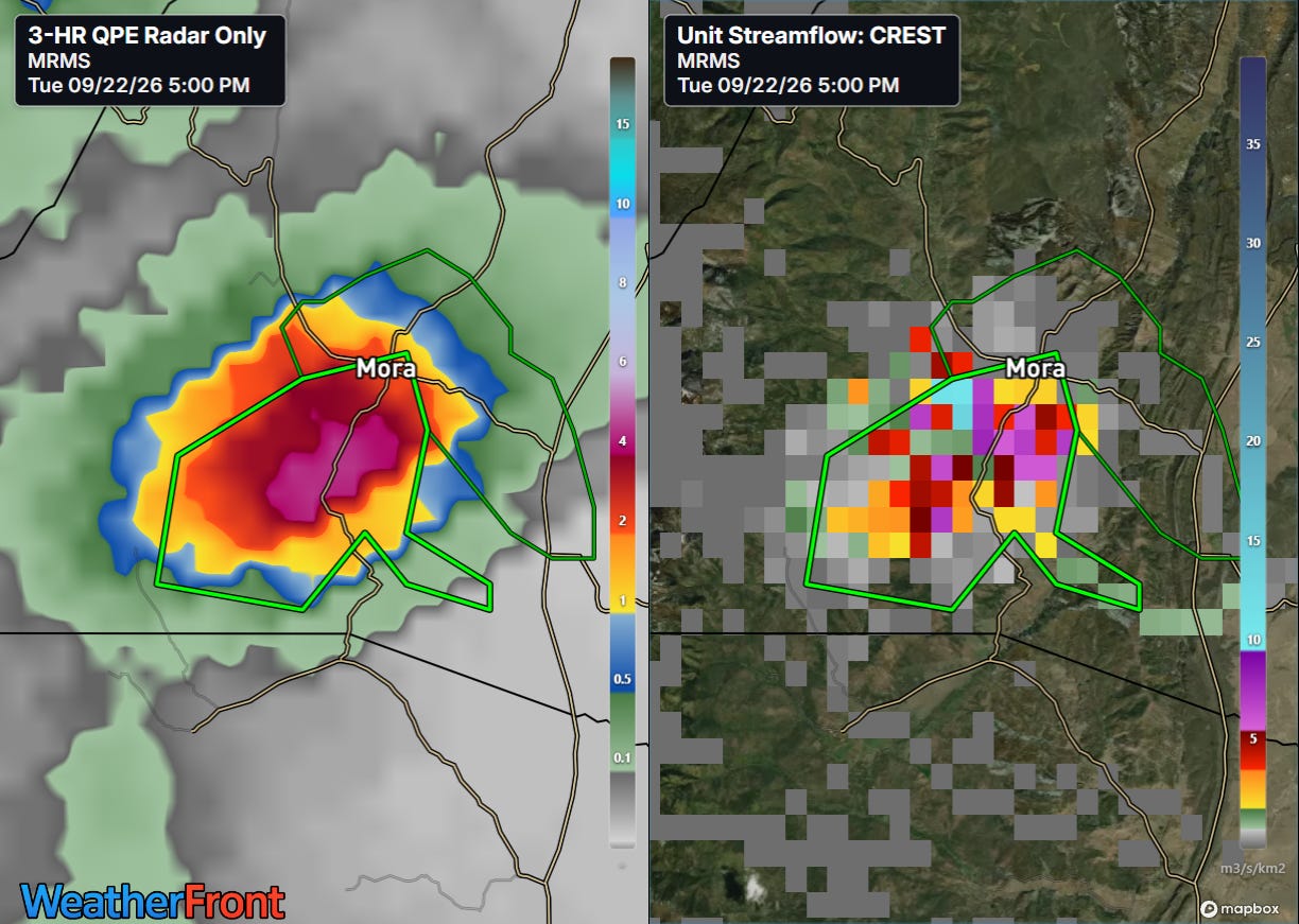
An area that appears to have been particularly hard hit this afternoon is around Mora, NM, where MRMS 3-hourly rainfall estimates of 3-5” have occurred and CREST unit streamflow inundation values are very high, indicative of potentially significant flash flooding. A flash flood emergency is in effect for the community of Mora and points to the south where the heaviest rainfall appears to have fallen.


Leave a comment