
Nolo should impact at least the Big Island with heavy rainfall, and other impacts possible depending on how close track gets. Polo looks to recurve into Baja California.
3 minutes ago
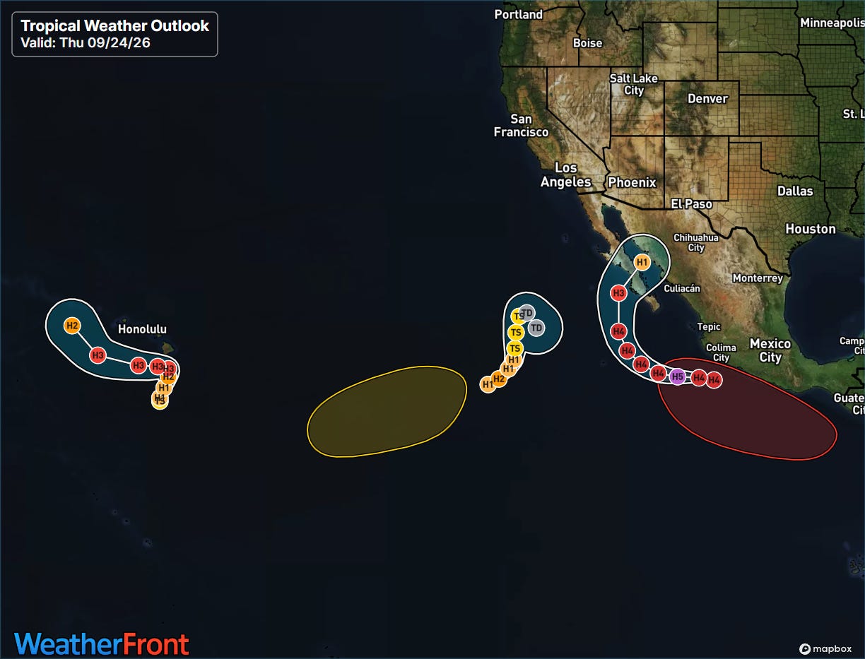
Busy day for me today, but lots of weather going so I want to get a quick update out about the various impact events — starting with the hyperactive eastern and central Pacific tropics. We have three active systems, left to right: Tropical Storm Nolo, Hurricane Odalys, and category 4 Hurricane Polo. There are also two systems being monitored for development by NHC, including one that is likely to develop into a new tropical cyclone along the southwest Mexican coast behind Polo — but we will focus on the active systems.
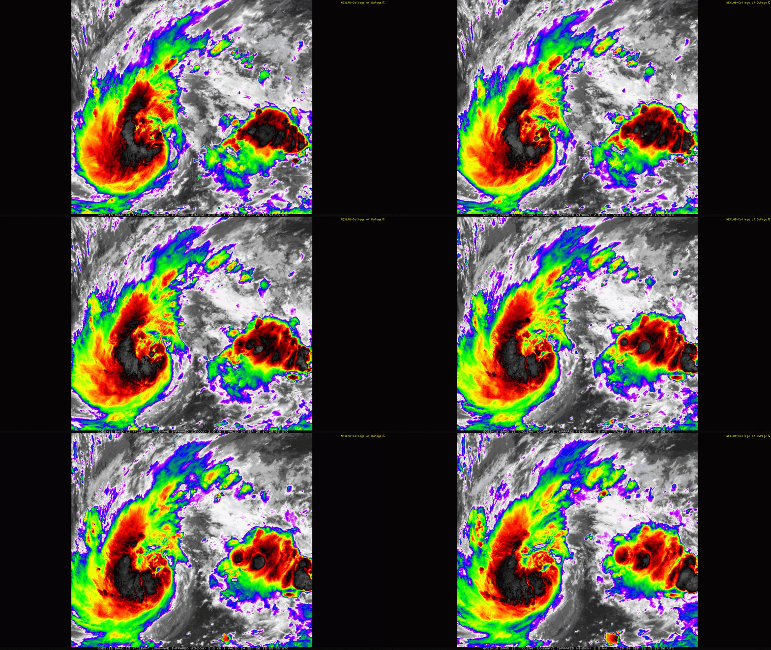
Satellite imagery shows that Nolo is becoming better organized. NHC is estimating it as a 60 mph tropical storm, and it is likely to become a hurricane in the next 24 hours. In their morning forecast discussion, NHC noted that conditions appear to be favorable for rapid intensification, and Nolo is likely to become a major hurricane as it start to move north-northeast in the general direction of the Big Island of Hawai’i.
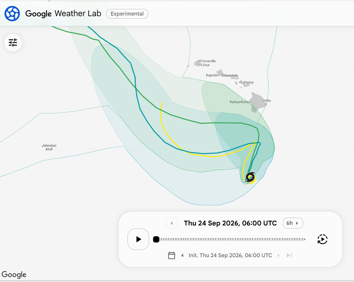
Steering currents are expected to be evolving over the weekend with a new ridge of high pressure developing north of Nolo, which should force a turn in the storm back to the west. Where and when exactly that happens will be critical in the impacts to Hawai’i — and there is still a lot of uncertainty in the model solutions on that turn. My sense is overall the models have shifted a bit to the south from 24 hours ago, as shown by the most recent operational European (yellow line) and Google DeepMind (GDM) ensemble (blue line) above.
To give an idea of the spread and uncertainty, the newest experimental version of the GDM (greenish line) is significantly farther north and closer to the Big Island before that turn occurs. The experimental GDM performed very well with Hurricane Lowell when it impacted Kaua’i earlier this season — so it will be interesting to watch the forecast evolution in the coming days.
![[Key Messages]](https://substackcdn.com/image/fetch/$s_!S4VE!,f_auto,q_auto:good,fl_progressive:steep/https%3A%2F%2Fsubstack-post-media.s3.amazonaws.com%2Fpublic%2Fimages%2F4e5bf6f0-3de6-442e-a35b-5cd71c7f71af_897x736.png "[Key Messages]")
As far as impacts are concerned, heavy rainfall and flash flooding will be likely on the Big Island and potentially Mau’i regardless of how the track of Nolo evolves. However, the magnitude of the rainfall/flood event will worsen the closer the track gets to the island — a track more along the southern edge of potential forecasts would mean a “typical” heavy rain/flood risk, while a track along the northern edge closer to the Big Island would potentially mean a more catastrophic event. Other impacts such as damaging wind and surge, surf, etc. will also increase the farther north the track ends up being.
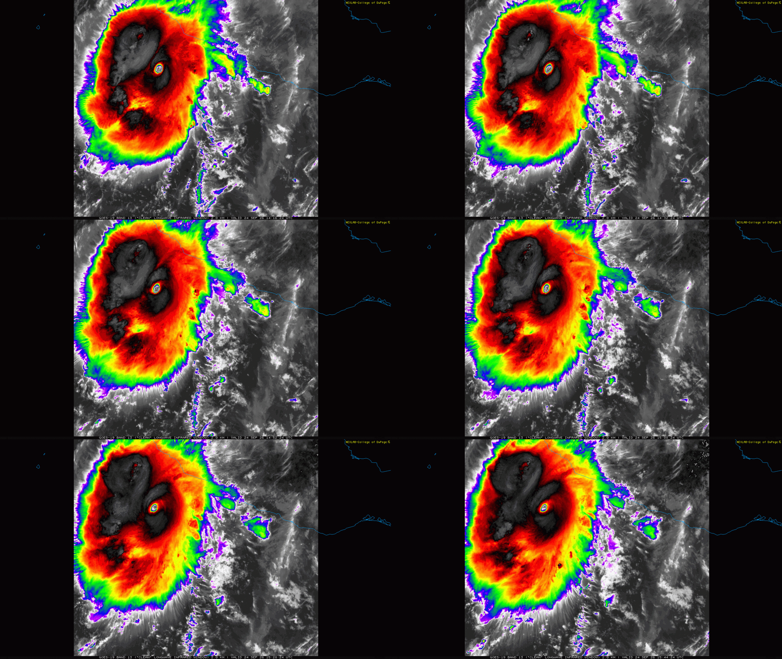
Polo has completed a second period as a category 5 hurricane, and is now going through another internal reorganization process and has “weakened” to a category 4. Polo has started to move more definitively to the west, and will continue to move west-northwest the next few days before recurving to the north-northeast and moving toward Baja California. Models are now in pretty good agreement that Polo will make landfall as a weaker but likely still major hurricane along the west coast of Baja California to the north of Cabo San Lucas.
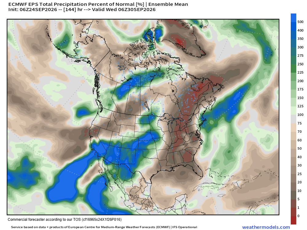
Moisture from both Odalys and Polo will eventually work northeast into the Southwest US this weekend and early next week, bringing an increase in rainfall chances. Right now, it appears as though an upper level trough digging into the region will be too “shallow” and quick moving to fully pick either system up and bring more significant heavy rainfall impacts to the region — but obviously we will keep an eye on it. Of course, significant wind, surge and rainfall impacts are expected in Baja California Sur from the direct passage of the storm, and also in the Gulf of California and northwest Mexico.
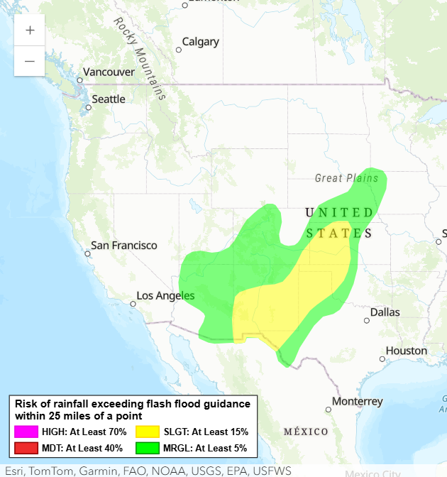
In the shorter term, monsoonal moisture moving into New Mexico and points northeast will continue to support thunderstorms with heavy rainfall and potential flash flooding today into tonight.
In the Atlantic, Fay had an unexpected resurgence and has become a tropical storm again but is expected to remain well out to sea and weaken again in a the next couple of days. The system we have mentioned off the west coast of Africa now has a high chance of developing into a short lived tropical depression or storm per NHC and could bring some gusty winds and heavy rainfall to Cabo Verde, but is expected to dissipate in a few days as it moves north into hostile conditions.
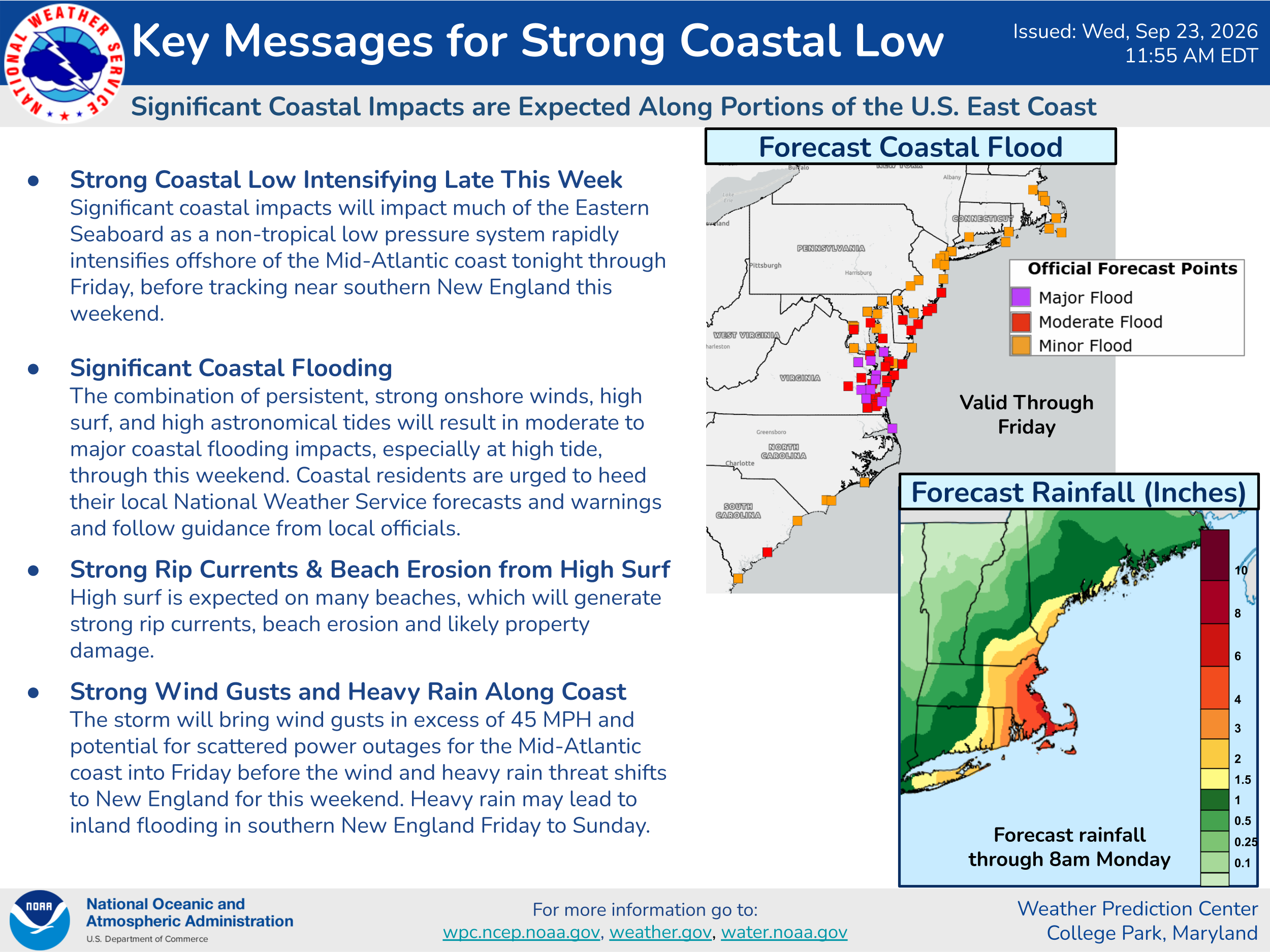
The strong low pressure system off the Mid-Atlantic is starting to take shape — and there continue to be hints in the model forecasts that this system could obtain some tropical or subtropical characteristics. Regardless, impacts will be similar and are summarized in the Weather Prediction Center graphic above. While the impacts will be similar, the combination of extratropical and tropical processes going on with this system seem to be causing more model uncertainty than normal, so overall forecast confidence is lower than normal as well. My colleague Matt Lanza has been doing a great job of talking through this at his Substack, The Eyewall — I encourage you to check it out.
I am also hoping to have a chance to dive more into the Nor’easter, and share updates on it as well as the other systems through Substack Chat (paid subscriber benefit), Substack Notes and social media.


Leave a comment